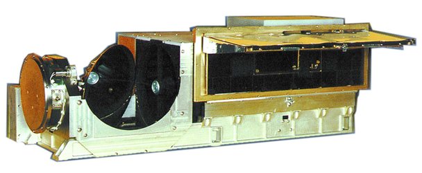
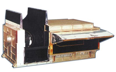
Instrument overview
The MetOp satellites carry a set of seven 'heritage' instruments provided by the United States’ National Oceanic and Atmospheric Administration (NOAA) and the French Space Agency (CNES) and a new generation of five European instruments offering improved sensing capabilities to both meteorologists and climatologists.
Several of the instruments measure similar aspects of the atmosphere, namely temperature and humidity, but use a variety of measuring techniques to acquire their data. This approach is crucial for numerical weather prediction, which not only requires high-quality observations but also needs huge amounts of data from different sources to feed into the models.
With its sophisticated array of instruments and diverse measuring techniques MetOp can provide outstanding data sets to advance the field of meteorology, which ultimately improve the accuracy of weather forecasting and our understanding of climate change.

Access the video
European instruments
Infrared Atmospheric Sounding Interferometer (IASI)
IASI is one of the most advanced onboard instruments measuring infrared radiation emitted from the surface of the Earth to derive data of unprecedented accuracy and resolution on humidity and atmospheric temperature profiles in the troposphere and lower stratosphere, as well as some of the chemical components playing a key role in climate monitoring, global change and atmospheric chemistry.
The Microwave Humidity Sounder (MHS)
MHS acquires measurements at various altitudes of atmospheric humidity, including rain, snow, hail and sleet, and temperature by measuring microwave radiation emitted from the surface of the Earth.
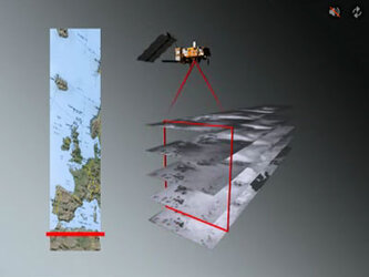
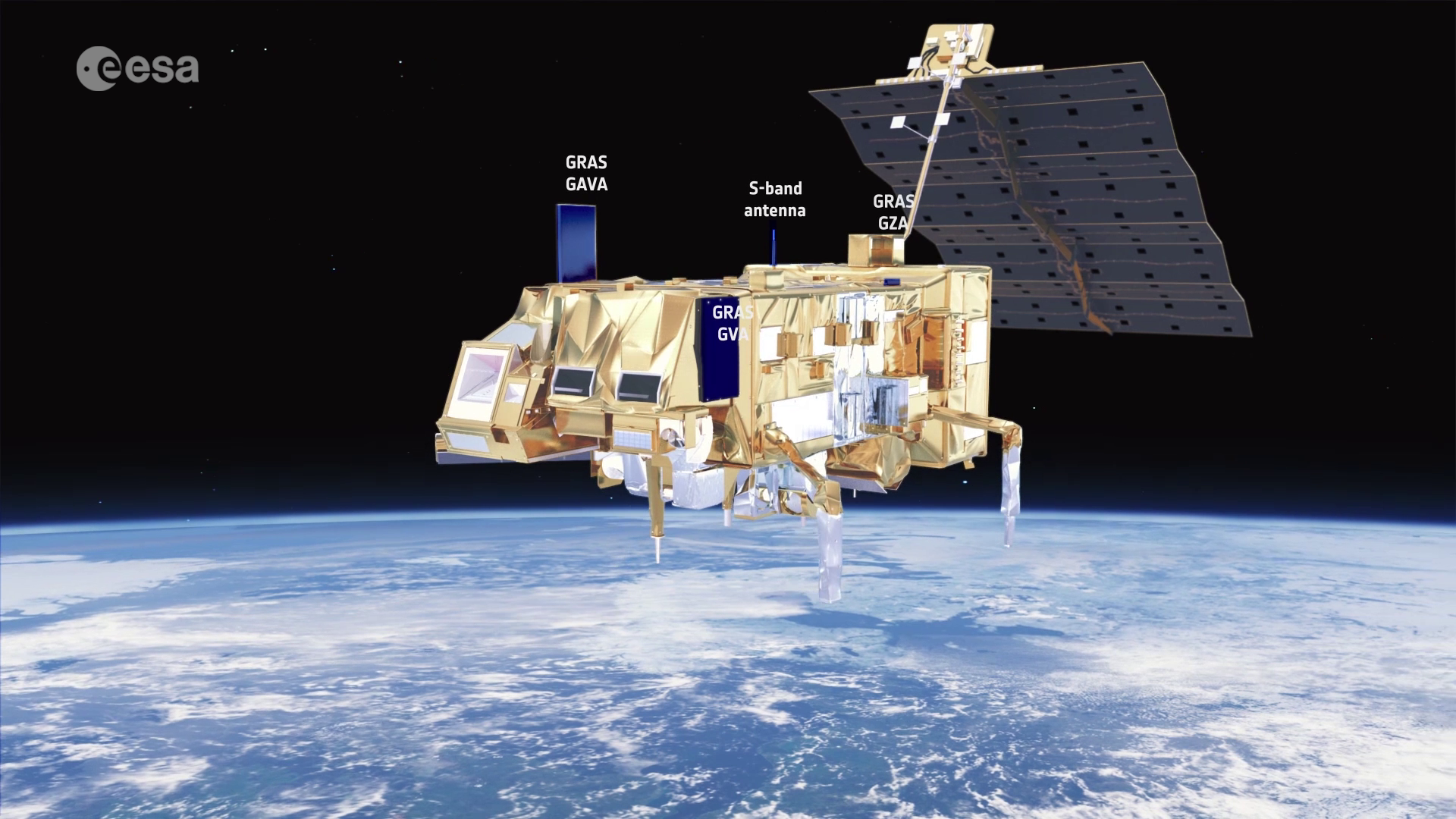
The Global Navigation Satellite System Receiver for Atmospheric Sounding (GRAS)
GRAS is a Global Positioning Satellite (GPS) receiver that operates as an atmospheric-sounding instrument, providing a minimum of 500 atmospheric profiles per day through a process of GPS radio occultation. GRAS will supply atmospheric soundings of the temperature and humidity of the Earth’s atmosphere.
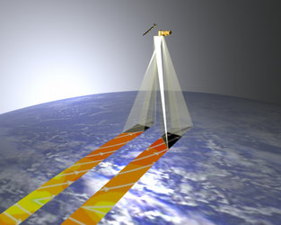
Advanced Scatterometer (ASCAT)
ASCAT, an enhanced follow-on instrument to the highly successful scatterometers flown on ESA's ERS-1 and ERS-2 satellites, measures wind speed and direction over the ocean. Its six antennas allow for simultaneous coverage of two swaths on either side of the satellite ground track, providing twice the information of the earlier instruments. ASCAT also contributes to activities in areas as diverse as land and sea ice monitoring, soil moisture, snow properties and soil thawing.
Global Ozone Monitoring Experiment-2 (GOME-2)
GOME-2 is a spectrometer that collects light arriving from the Sun-illuminated Earth's atmosphere or a direct view to the Sun and decomposes it into its spectral components. The recorded spectra are used to derive a detailed picture of the atmospheric content and profile of ozone, nitrogen dioxide, water vapour, oxygen, bromine oxide and other gases.
Heritage instruments
(common to both MetOp and NOAA satellite payloads)
Meteorological instruments
Advanced Microwave Sounding Units (AMSU-A1 and AMSU-A2)
The AMSU instruments measure scene radiance in the microwave spectrum. The data from these instruments are used in conjunction with the High-resolution Infrared Sounder (HIRS) instrument to calculate the global atmospheric temperature and humidity profiles from the Earth's surface to the upper stratosphere. The data are also used to provide precipitation and surface measurements including snow cover, sea ice concentration and soil moisture.
High-resolution Infrared Radiation Sounder (HIRS/4)
HIRS/4 is a 20-channel radiometric sounder measuring radiance in the infrared (IR) spectrum. Data from HIRS/4 are used in conjunction with data from the AMSU instruments to calculate the atmosphere's vertical temperature profile and pressure from the Earth's surface to about 40 km altitude. HIRS/4 data are also used to determine ocean surface temperatures, total atmospheric ozone levels, precipitable water, cloud height and coverage and surface radiance.
Advanced Very High Resolution Radiometer (AVHRR/3)
AVHRR/3 provides day and night imaging of land, water and clouds and measures sea surface temperature, ice, snow and vegetation cover by scanning the Earth’s surface in six spectral bands in the range 0.58 - 12.5 microns.
Data collection instrument
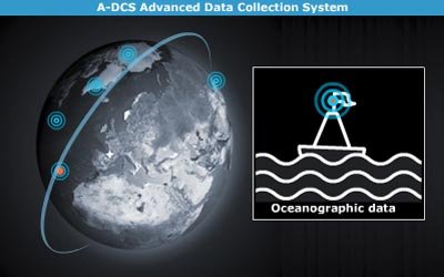
Advanced Data Collection System (A-DCS)
A-DCS, provided by CNES, will provide worldwide in-situ environmental data collection and Doppler-derived location services with the basic objective of studying and protecting the Earth’s environment. A-DCS, also known as Argos, is an advanced version of the system presently operated jointly by NOAA and CNES.
Space weather instrument
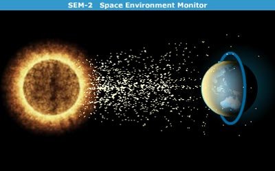
Space Environment Monitor (SEM-2)
SEM-2, provided by NOAA, is a spectrometer that provides measurements to determine the intensity of the Earth's radiation belts and the flux of charged particles at the satellite altitude. It also supplies knowledge of solar terrestrial phenomena and warnings of solar wind occurrences that may impair long-range communication, high-altitude operations, damage to satellite circuits and solar panels, or cause changes in drag and magnetic torque on satellites.
Search and rescue instruments
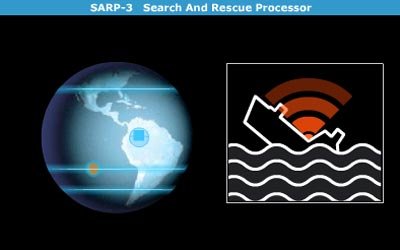
Search And Rescue Processor (SARP-3)
SARP-3, provided by CNES, receives and processes emergency signals from aircraft and ships in distress and determines the name, frequency and time of the signal. These pre-processed data are then fed into the Search And Rescue Repeater (SARR) instrument for immediate transmission to Search and Rescue Satellite (SARSAT) distress terminals on the ground.
Search And Rescue Repeater (SARR)
SARR, provided by the Canadian Department of Defence through NOAA, receives and down-links emergency signals from aircraft and ships in distress and provides a down-link for data received by the Search and Rescue Processor (SARP-3). SARR receives distress beacon signals on three separate frequencies, translates them and retransmits them to Local User Terminals (LUTs) on the ground. These terminals process the signals, determine the location of the beacons and forward the information to a rescue mission control centre.