

Optimising forest production with space technology
Space and robotics technology have been combined to develop an advanced Precision Forestry Positioning System, which allows more efficient forest planning and harvesting.
Invented by researchers at the Institute of Man-Machine-Interaction at the RWTH Aachen University in Germany, the system has helped catalogue 240 million single trees in the German region of North Rhine-Westphalia.
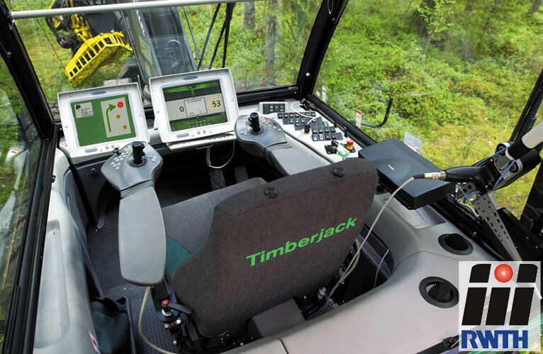
The system combines remote sensing maps from airplanes with satellite navigation data to map each tree in a forest. This information is then used to plan which trees are to be cut, and when. Finally, the plan is used on harvesters to identify which trees to cut. This helps make the harvesting more efficient, optimises overall wood production and reduces costs.
International prize winner
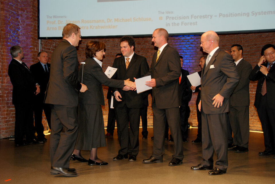
The system won the North Rhine-Westphalia Region’s 2008 European Satellite Navigation Competition, which was supported by ESA’s Technology Transfer Programme Office.
"We already have one harvester in operation with our system onboard. As the prototype works well, we are fairly close to the stage where we can go into production. Another 6 to 12 months, and we should be there," said Prof. Dr Jürgen Rossmann from RWTH Aachen University, who developed the system together with Petra Krahwinkler, Arno Bücken and Dr Michael Schluse.
Precision foresting by space and robotics technology
The objective of the Precision Forestry Positioning System is to automate and optimise all the work involved in foresting, from the early planning of the forest to the final cutting of single trees, in order to be competitive on the worldwide market, and to overcome efficiency problems related to the forest ownership structure of the region.
"Precision farming is important in today’s agriculture, where farmers can save money with the use of satellite navigation systems," explained Arno Bücken. "However, the accuracy of the GPS navigation system, which is of 20 to 30 m, is not enough to identify single trees in a forest. Much higher accuracy is needed".

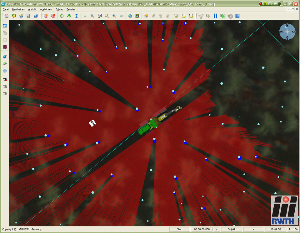
"We found a solution to this problem, which increases the accuracy to 50 cm, by using GPS as the initial reference position, and then taking remote sensing data to identify the single trees in the forest."
The remote sensing data are taken from aircraft and combined with data from conventional maps, so that each tree can be identified.
"Galileo will most likely improve the initial position estimates, and thereby decrease the uncertainty involved. Also, smaller local maps will be sufficient to achieve the same precision, which could result in smaller and lighter scanners. This will eventually lead to a system that can be carried around by a forest worker," Bücken continued.
Virtual forest for efficient growth planning

To help the planning, a virtual computer-based forest has been developed with all trees being identified by their location, based on the GPS and remote sensing data. In addition, a fourth dimension, 'time', has been added, and is of the utmost importance for this system.
"All trees are not only known by their geo-coordinates, but they are also time-stamped, and all measurement data are archived. This makes it possible to see 'how trees grow', as well as look back to learn from the past," said Rossmann.
The virtual forest is being developed as an intelligent planning and decision support tool for forest growth management. It is now possible to decide, prior to any machinery or workers entering the forest, which path to follow and which trees to cut, reducing time and optimising output.
"Before the invention of this system, forest workers made their decisions based on visual inspections of the forest, a much slower and less efficient method requiring higher skilled workers on a full-time basis. Equipped with precise sensors and positioning systems, our solution helps locate and coordinate forest machinery and workers," explained Rossman.
The system is able to remember where a tree was cut and who owns it. Knowing this information is very important for the North Rhine-Westphalia region, as two thirds of the privately owned forest consists of small parcels of 0.5 to 1.5 hectares. The ability to identify felled trees and assign them to the right owner by using geo-tags is extremely useful. Different owners can harvest together, reducing costs.
ESA's Technology Transfer Programme Office (TTPO)
The main mission of the TTPO is to facilitate the use of space technology and space systems for non-space applications and to demonstrate the benefit of the European space programme to European citizens. The office is responsible for defining the overall approach and strategy for the transfer of space technologies including the incubation of start-up companies and their funding. For more information, please contact:
ESA’s Technology Transfer Programme Office
European Space Agency ESA
Keplerlaan 1, 2200 AG, Noordwijk ZH
The Netherlands
Phone: +31 (0) 71 565 6208
Email: ttp @ esa.int
Website: http://www.esa.int/ttp
(*) Note for editors:
RWTH Aachen University is located in Aachen, Germany. RWTH stands for Rheinisch-Westfälische Technische Hochschule, which translates into 'Rhenish-Westphalian Technical University'.

