Calling on satellites in alpine rescues
Emergency services rescued 1780 people in the Austrian Alps last year. They can now count on satellites to access maps, send messages, give warnings and stay in contact.
TeleConsult Austria, with the support of ESA, has developed and tested an Internet-based system that combines satellites and hybrid technologies.
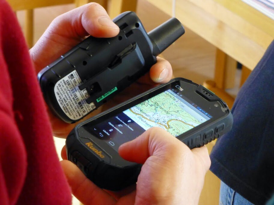
It can replace traditional FM radio, which is sometimes unreliable in mountainous regions, with a smartphone carrying the Sarontar app and a satellite modem.
Back at mission control, a team coordinates the operation and directs the crew on the way to the accident. This involves tracking, instructing, monitoring and recording the progress.
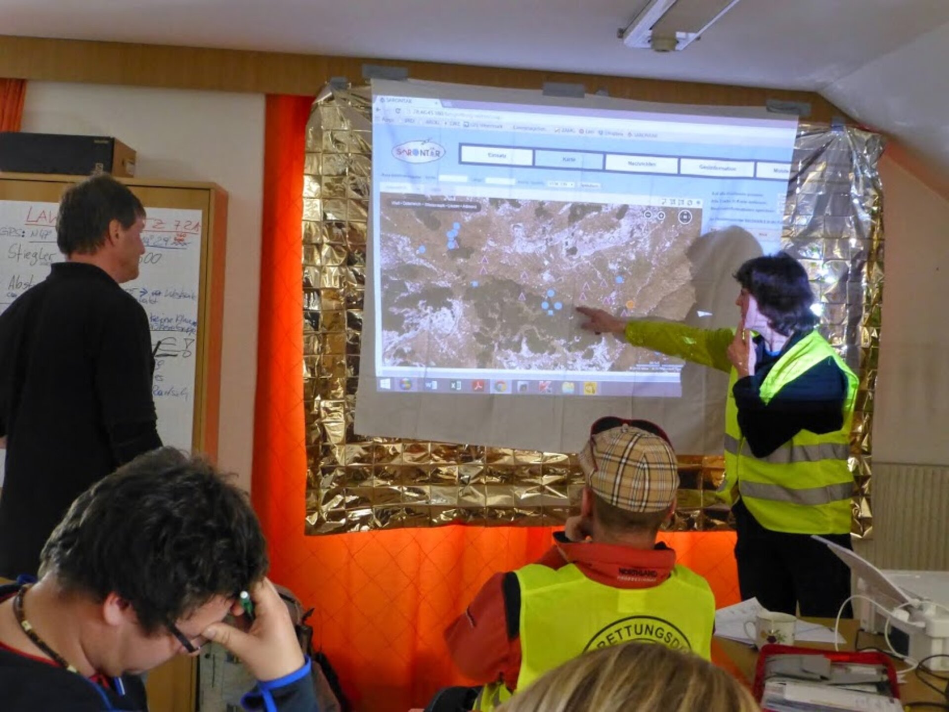
The Sarontar application makes their job easier, too. Sarontar: Situational Awareness and Command & Control of Rescue Forces in Alpine Regions uses backend software to record the whole operation, create a visual of all regular GPS positioning data that also comes with timestamps, shows messages and warnings from the teams on the mountain, and displays the information graphically on a map.
Mission coordination and documentation are all in one place and can be used to report on the mission.
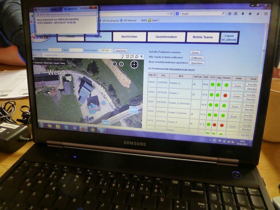
There’s no need to plot GPS coordinates previously radioed in from the rescue crew – it’s all automated. They can also redirect incoming messages to the smartphones of other team members on the mountain.
All the data collected during the rescue operation are stored and fully accessible during and after the event.
Satnav enables realtime tracking of the search and rescue teams operating in the mountain, Earth observation imagery provides up-to-date maps and telecom satellites ensure this information is delivered when terrestrial networks are unavailable.
The new system was put to the test recently in the Styrian region of Austria in an exercise requiring crew to attend two simulated emergencies at different areas on the mountain near Admont.

It involved mountain rescue services from six local areas who respond to emergencies in a 930 sq km area of the Alps.
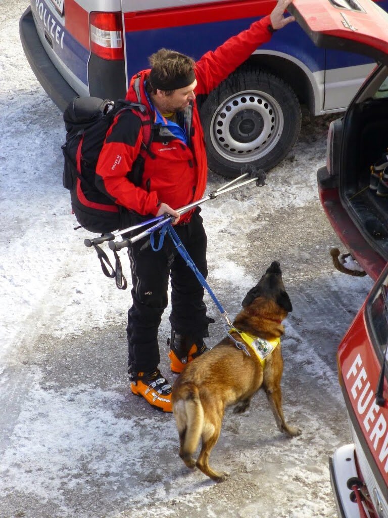
The exercise involved around 50 volunteers, the rescue dog brigade, Alpine police and the local fire brigade.
Apart from a successful rescue, teams reported that the smartphone app is easy to use.
The mission coordination team quickly preferred using Sarontar rather than their traditional mapping tool.
The National Alerting and Warning Centre, which answers emergency calls, now has direct access to the Sarontar mission control centre and can insert initial mission information for the local unit responsible for the area of the emergency.
“ESA’s Integrated Applications Promotions programme helped us to meet user needs, to strengthen contact with user groups and to give them the opportunity to intensively test and use the system through the pilot stage,” said Claudia Fösleitner at TeleConsult Austria.
ESA’s Francesco Feliciani, who was at the event in Admont, commented: “Sarontar guarantees contact between mission control and rescue crew by integrating terrestrial wireless and satcom.
“Simple messaging and automatic tracking provides excellent support in particular for coordinating teams in search operations.”