How satellite navigation works
Navigation beacons must be as visible as possible. So 20th century radio navigation towers guiding aircraft stood hundreds of metres tall, while the lighthouses warning mariners of treacherous waters reach dozens of metres in height or cling to high ground. In essence navigation satellites are the same, except they are built on the ultimate high ground of space, making them visible from anywhere on Earth.
Turning time into distance
The signal emitted from each satellite is a microwave radio wave containing the time it was transmitted and the satellite’s current orbital position.
As signals travel at the speed of light then (if your time-keeping is accurate enough) by calculating the time difference between the satellite signal and your receiver, you can derive the precise distance the signal has travelled from the satellite to reach your receiver.
Ultra-precise satellite navigation relies on the same basic principle as counting the seconds after a lightning flash before the accompanying thunder is heard, in order to estimate a storm’s remoteness: a time value is converted into a reckoning of distance.
Finding your place

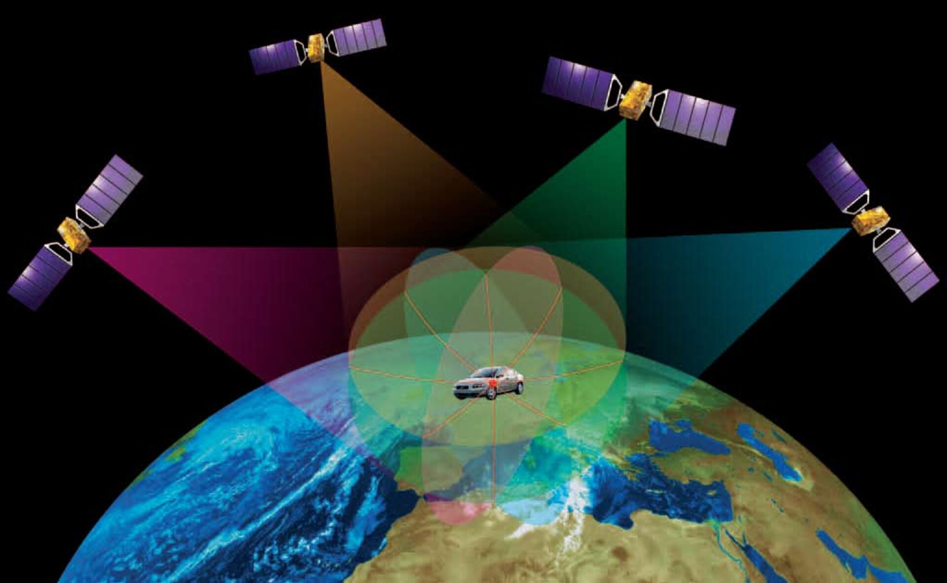
Combine inputs from multiple satellite signals simultaneously – like viewing multiple lighthouses at once –and your location is pinpointed.
Locking on to more signals yields greater accuracy but a four is the absolute minimum required. Three are used to ‘trilateralise’ (the three-dimensional equivalent of triangulation) the user’s longitude, latitude and altitude and a fourth to determine the time offset between the (precise) satellite clock and the (less precise) clock embedded within the receiver.
Space and ground segments
Design trade-offs have led to a medium-Earth orbit as the optimal altitude for navigation satellite constellations, commencing with the US GPS and Russian Glonass. There are solid practical reasons for this: medium-Earth orbits are relatively stable and the satellites move across the sky relatively slowly. Lower orbits would require more satellites to maintain the same coverage while higher orbits would reduce coverage extent.
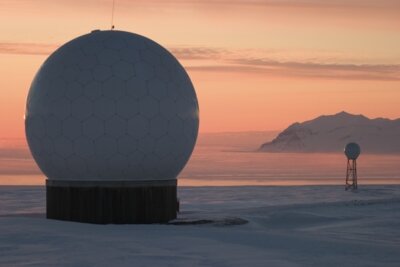
In addition an extensive ground infrastructure distributed worldwide is required to uplink the navigation signals, keep the different clocks of the constellation synchronised and correct any onboard timing or positioning deviation.
User receivers

Satellite navigation receivers also do a great deal of work, containing ‘ephemerides’ or electronic almanacs recording the expected locations of the constellation, to reduce the time taken to acquire signal locks from minutes to a matter of seconds.
The satellite navigation signals are very faint, equivalent to car headlights shone from one end of Europe to another. The signals are based around pseudo-random number codes that identify each satellite in a constellation. The receiver has records of each of these complex codes, so a full-power replica can be generated within the receiver from the faint signal received and used for the calculations deriving the final navigational data displayed to the user.
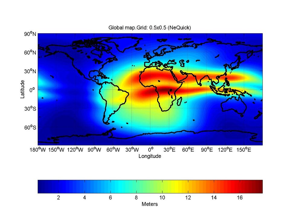
Interference can be a problem: the ionosphere, the uppermost electrically-charged layers of Earth’s atmosphere can cause signal delay equivalent to several metres in the worst case. Signals reflecting off local surroundings, known as ‘multipath’ can cause spurious signal locks and decrease the overall accuracy.
Larger dual-frequency receivers can remove most ‘iono-interference’ while smaller receivers of the type fitted into phones or car dashboards rely only on single frequency signals, but employ software models to remove up to half the error.