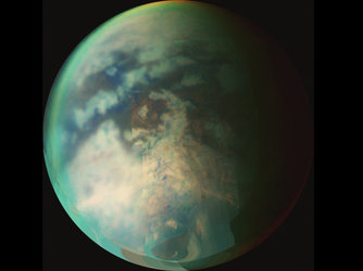
Revealing Titan’s rugged surface
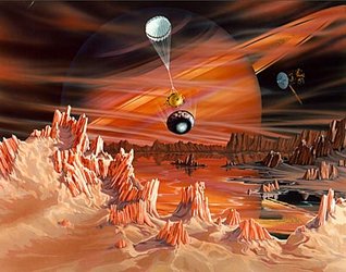
During its two and a half hour descent, the cameras on Huygens showed eager scientists on Earth spectacular regions of bright highlands with river drainages and canyons, bounded by dark plains on Titan. New information about the composition of the landing region is now ready for the public.
Since the mission, planetary scientists have been using the Radar System and the Visible and Infrared Mapping Spectrometer (VIMS), on board the orbiting Cassini spacecraft to investigate the composition of the region Huygens flew over.
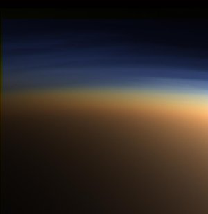
Before Huygens, Titan’s surface was a total mystery. The reason was simple: it was covered by a very opaque haze. As the probe penetrated the layer of haze within the atmosphere, “Huygens revealed a previously invisible world,” says Jean-Pierre Lebreton, ESA’s Huygens Project Scientist.
Laurence Soderblom, US Geological Survey, has been trying to make sense out of what Huygens saw. Surprisingly, one of the things that proved unexpectedly difficult was locating the Huygens landing site on the images from Cassini. “When we looked at the SAR images (Synthetic Aperture Radar) and compared them to the VIMS data, we saw little correlation,” reveals Soderblom.
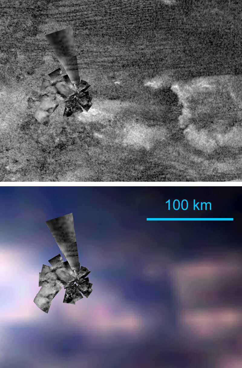
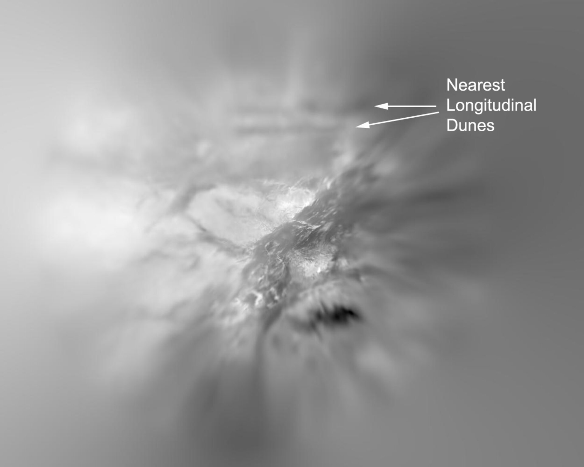
The boundary between the bright highlands and dark plains that Huygens drifted over simply did not show up in the radar images. Finally, the clue came in the form of two isolated dark sands dunes about 30 kilometres north of the landing site visible in both SAR and Huygens’ images. They are probably composed of sugar-size hydrocarbon grains between 100 and 300 microns in diameter.
Most of Titan’s dunes are giants, each one stretching for up to 100 kilometres in length across the dark plains and separated by 10 kilometres. Most importantly, two dunes that showed up in both the radar and optical images gave the scientists the clue they needed to get to work. “We started to piece together a model of the way we think the surface behaves,” says Soderblom.
In this model, the area around the Huygens landing site is a huge plain of dirty water ice over which lie blankets of organic (carbon-bearing) deposits that make up the bright highlands and dark dunes. The bright layers are invisible to radar waves, so Cassini SAR images see through to the lower, dirty water ice layer that is rugged in some places and smooth in others.
The deposits form when solar ultraviolet radiation and charged particles react at high altitudes with Titan’s abundant methane to produce carbon- and hydrogen-bearing (hydrocarbon) molecules like ethane and acetylene, and more complex nitrogen-bearing molecules generally called tholins. These products drift down to the surface as aerosols much in the same way smog particles on Earth form and coat surfaces. On Titan however these deposits may accumulate to thicknesses of hundreds of metres deep.
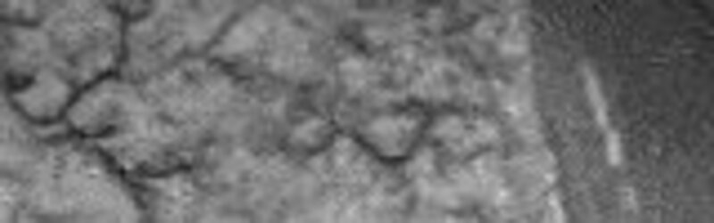
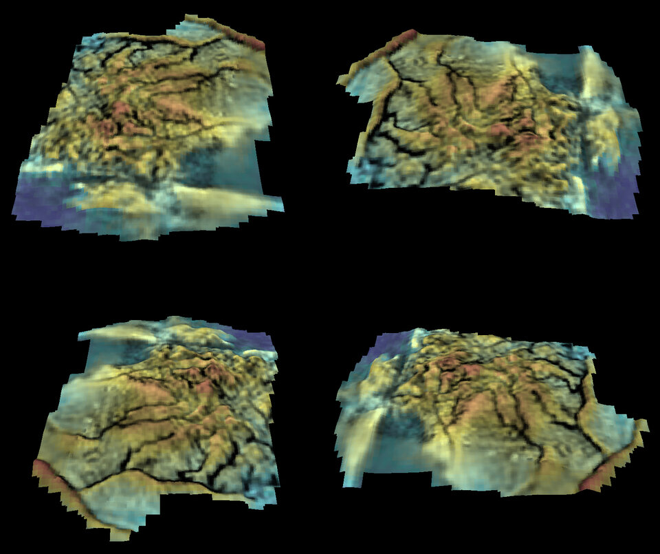
The dunes are composed of sand-sized material that agglomerated, either during its descent or when reworked by geological processes on the surface. The ice and organic landforms are as different from one another as they are spectacular. To the north of Huygens’ landing site are the bright highlands, displaying channels in a very ramified pattern, branching four or five times as they climb into the hills.
Stereoscopic images from the Descent Imager/Spectral Radiometer (DISR) camera on Huygens have now been analysed and show that some of the ridges between the channels rise to 150 - 200 metres in height, with slopes of thirty degrees. “This is extremely rugged terrain,” says Soderblom. The shape suggests that they are drainage channels, cut by liquid methane falling as rain.

Close - by are stubby canyons with only a few branches. They have probably been formed by ‘spring sapping’, whereby methane flows through the subsurface before emerging as a spring near the base of a hill. The spring erodes the hillside, causing it to collapse and form a cliff face.
The third area is the flat dark plain. This is mostly water ice mixed with tholin grit. “Titan’s river channels, canyons, and flood plains rival the variety seen on Earth,” says Soderblom. The dark plains show markings that suggest the region occasionally experiences flash flooding, but not from the highland drainage channels. Instead large quantities of liquid methane appear to flow from east to west.
Planetary scientists can now begin to piece together the sequence of events that led to the formation of this exotic landscape. “Huygens and Cassini have taken giant steps forward in our understanding of Titan,” says Soderblom.
For more images of the surface of Titan click here.
Note for editors
This article is based on two papers that will appear in a special issue of the Planetary and Space Science magazine dedicated to Huygens results: ‘Correlation between Cassini VIMS spectra and Radar SRA images: implications for Titan’s surface composition and the character of the Huygens probe landing site’, and ‘Topography and geomorphology of the Huygens landing site on Titan’, by L. Soderblom et al.
Cassini-Huygens is a joint mission between NASA, ESA and the Italian Space Agency (ASI).
For more information
L. Soderblom, U.S. Geological Survey, Flagstaff, Arizona, USA
Email: Lsoderblom @ usgs.gov
Jean-Pierre Lebreton, ESA Huygens Project Scientist
Email : Jean-Pierre.Lebreton @ esa.int