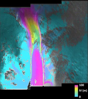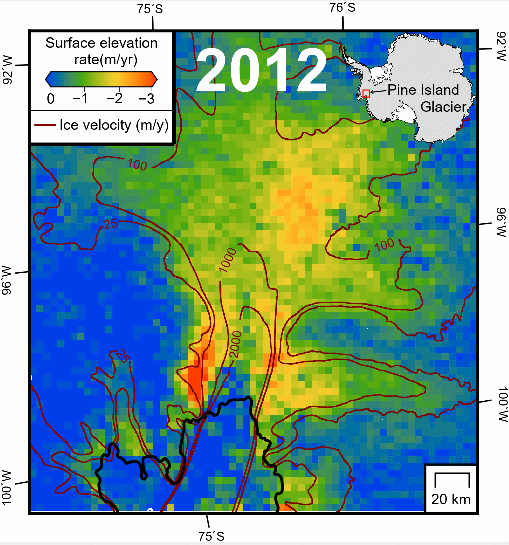
Applications
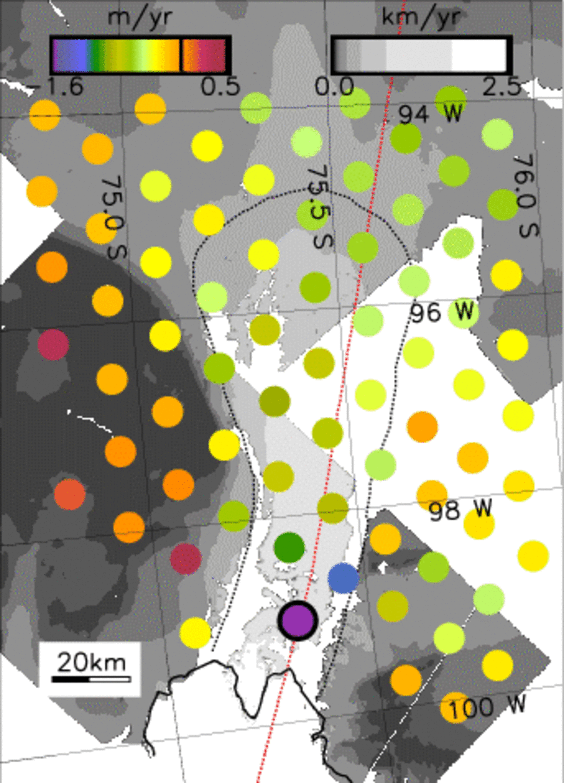
Rate of elevation change of the lower 200 km of the Pine Island Glacier
The rate of elevation change of the lower 200 km of the Pine Island Glacier between 1992 and 1999 (colored dots) registered with a map of the ice surface speed (gray scale). The dots are located at crossing points of the ERS orbit ground-tracks, and have an area equal to the radar altimeter footprint.