Applications
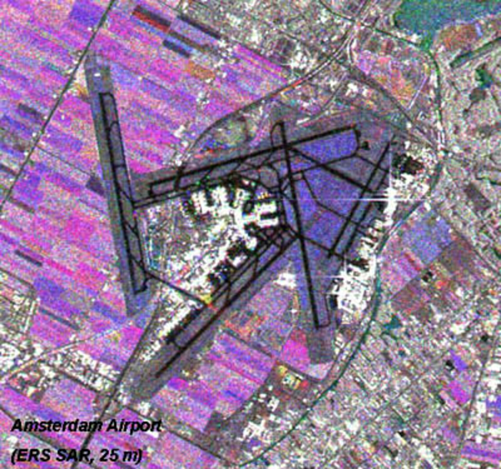
Satellite image showing agricultural fields surronding the Schipol airport
This is an example of an image map derived from spatially and temporally filtered ERS SAR images acquired over the same site (Schipol Airport, NL) and assembled in the form of a colour composite. Bright areas generally correspond to man-made features such as the Amsterdam airport infrastructure and urban and peri-urban infrastructures. Coloured areas in purple and blue correspond the agricultural fields for which the radar backscatter temporal signatures primarily depend on crop stage, agricultural practices and rain events. This product extract has been designed and processed by BAE Systems (UK).