Applications
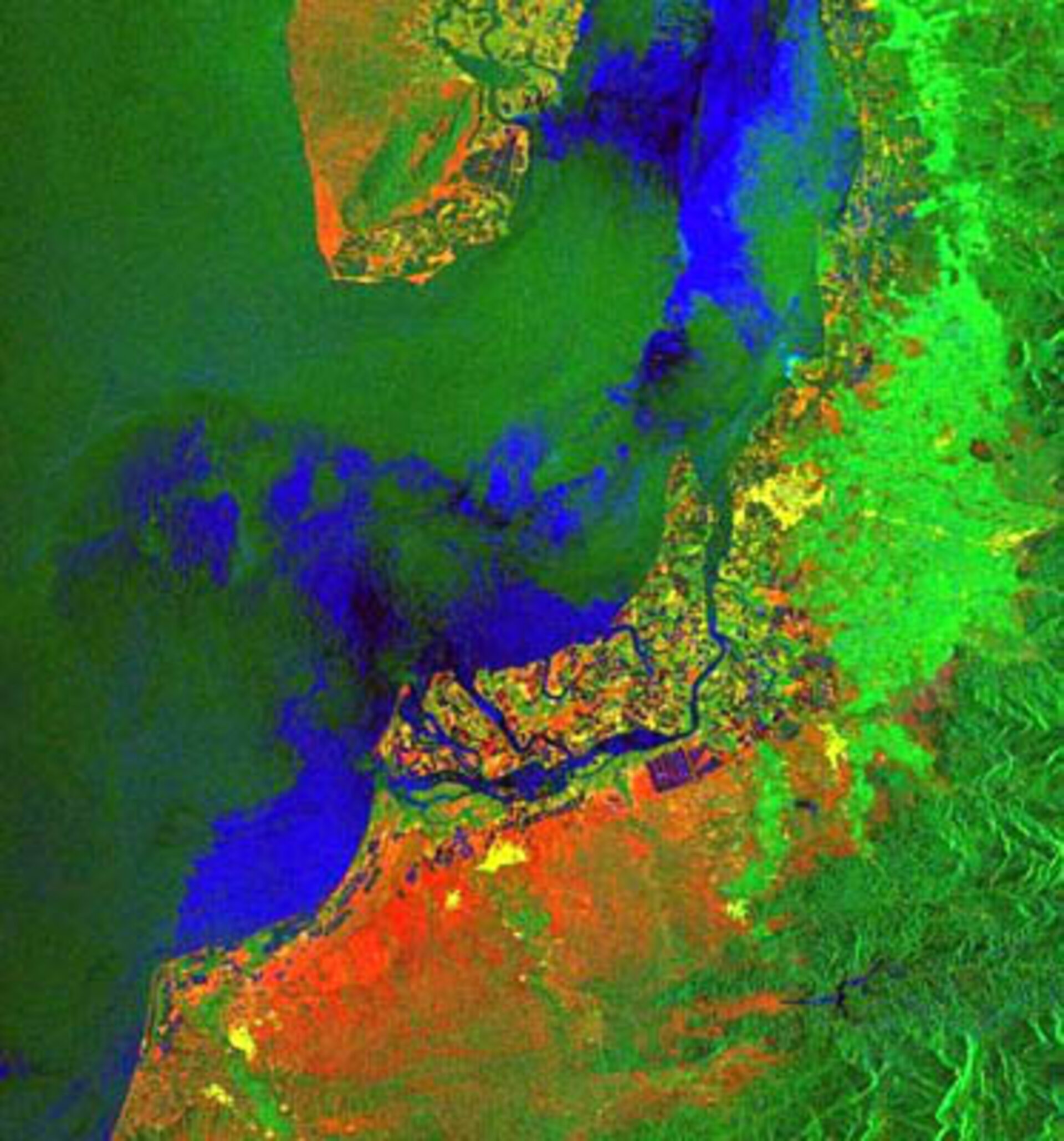
Satellite image showing mangrove regions at the Peru Ecuador border
This image is an example of an interferometric colour composite based on the ERS Tandem archives. This was derived by combining radar backscatter (shown in Green), backscatter changes (in Blue) together with interferometric correlation (Red layer) between two ERS images. The centre of the image shows the complex patterns typical of mangrove areas in tropical regions at the Peru - Ecuador border on the Pacific coastline. The bright green region in the East of the image shows areas with a certain vegetation density whereas the large portion in red tones in the South shows an area with more dry land. This image has been processed from data collected when the ERS-1 and ERS-2 satellites were flying in