Agency
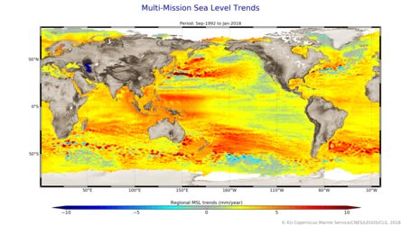
Sea level trends
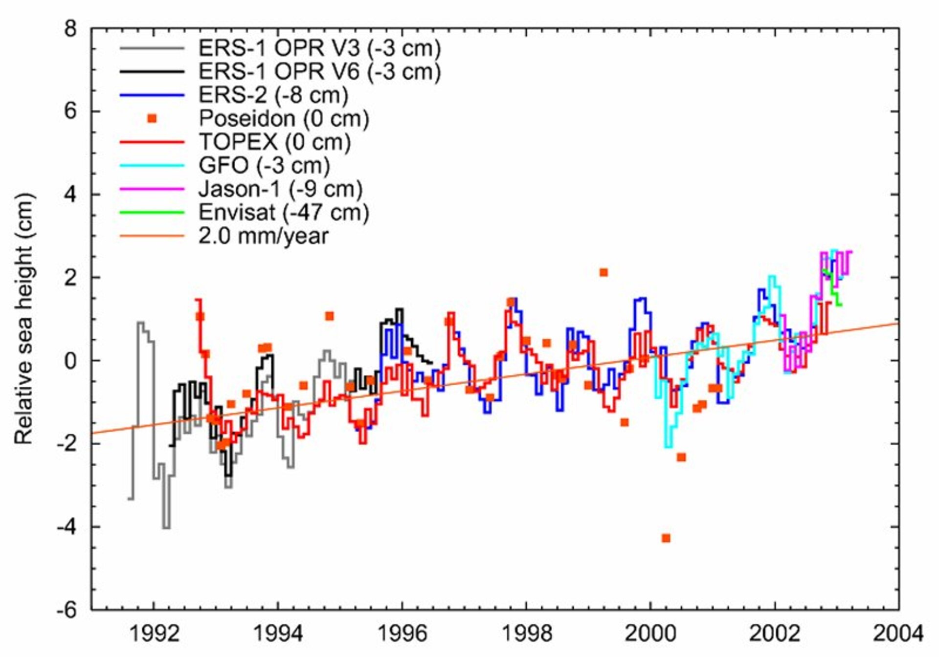
The graph uses data from the various altimeter-equipped spacecraft - ERS-1, ERS-2, TOPEX-Poseidon, GFO, Jason-1 and Envisat - to show annual global sea level during the last decade. The merged results show a general rise of 2 mm per year.