Agency
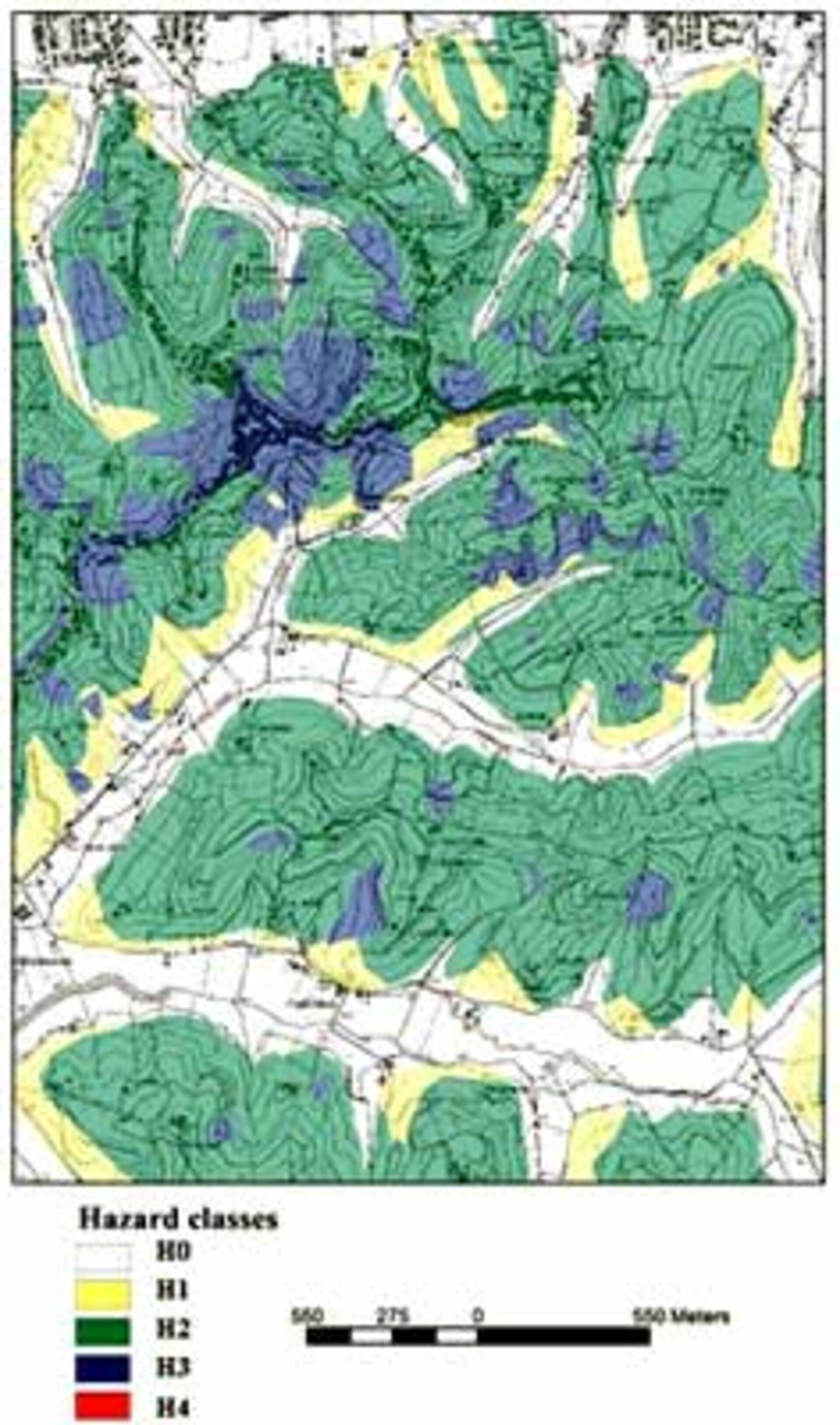
Landslide Hazard Mapping Product for Arno Basin, Italy
Sample SLAM Landslide Hazard Mapping Product for part of the Arno Basin in Italy. Landslide Hazard Maps merge Landslide Motion Survey data with Landslide Displacement Monitor data plus associated ground and geology data to identify areas most at risk. The Hazard Classes in the key go from H0 - meaning unsusceptible - to H1 - areas with a thousand year landslide return period - and H2 - a hundred years - H3 - ten years - to finally H4 - which is areas where landslides are currently active or with a two year return period.