Applications
Flood change detection
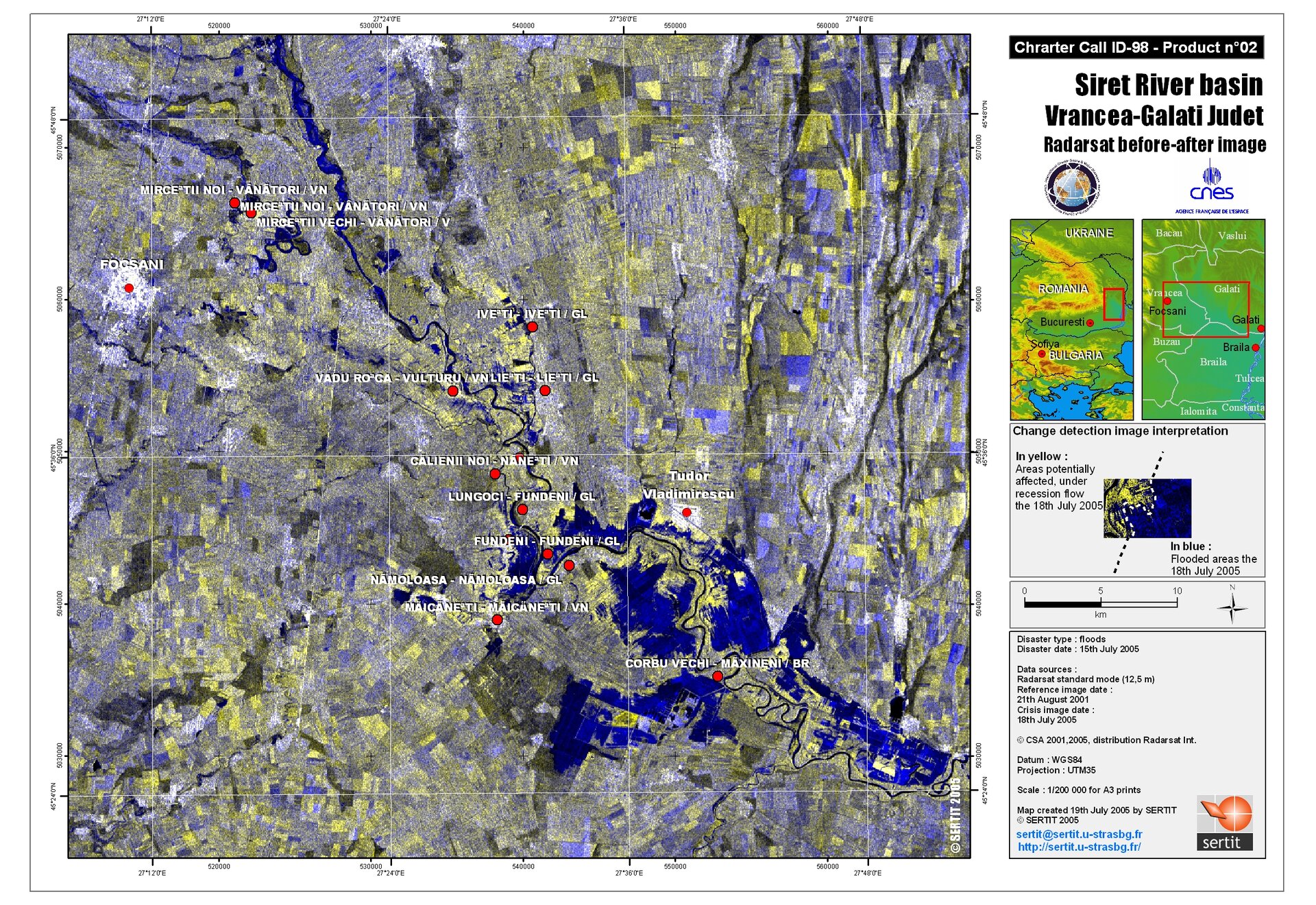
This before-after image of the Siret River Basin, Vrancea-Galati Judet, is a Radarsat crisis product, with a resolution of resolution 12.5 metres. Blue demarcates flooded areas, with yellow indicating areas potentially affected.