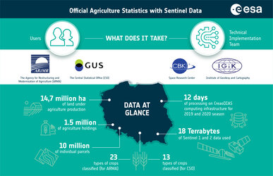
Agency
Detecting environmental cover
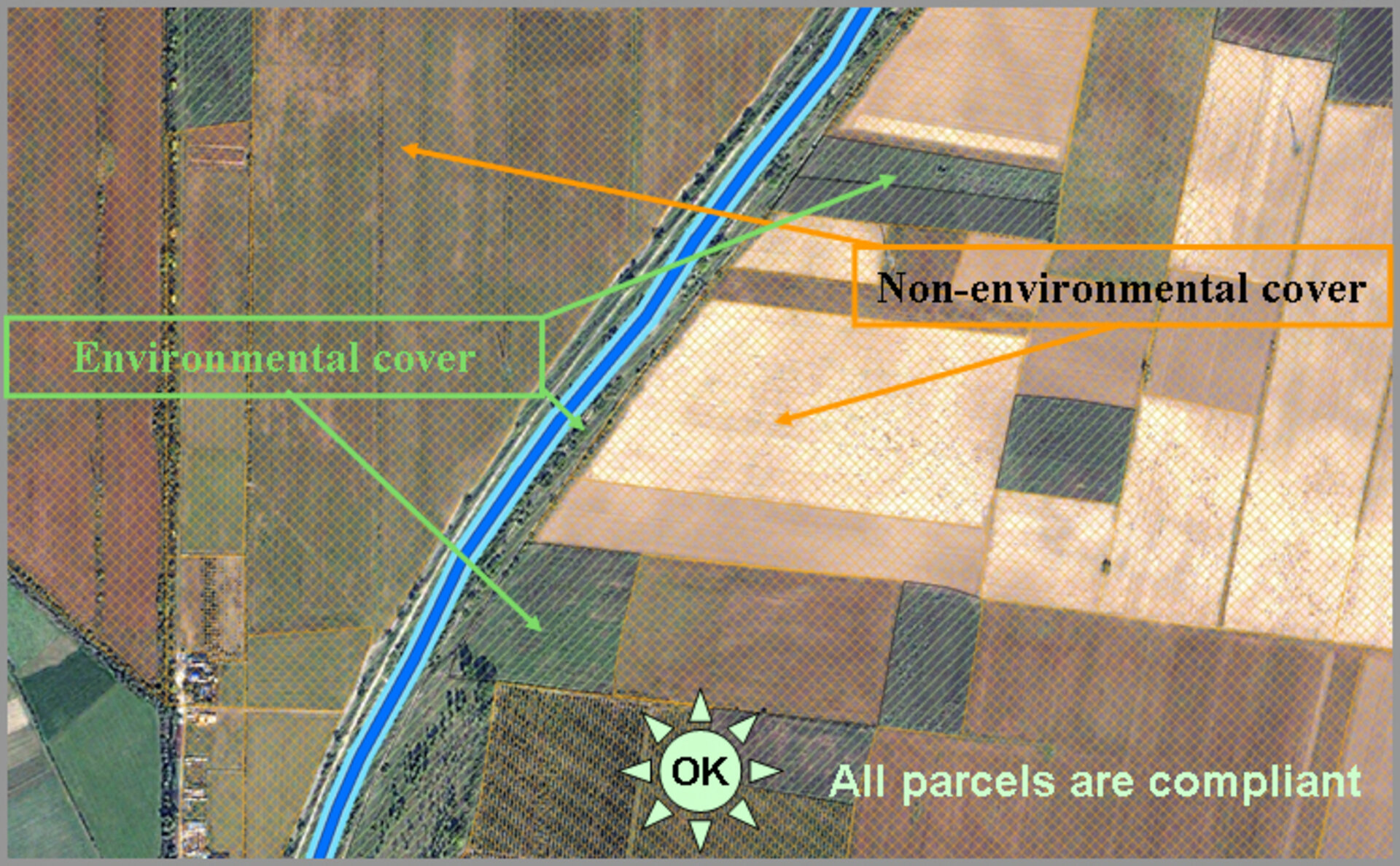
To protect soils against erosion risks and improve soil structure, the Good Agricultural and Environmental Condition (GAEC) states farmers must establish an 'environmental cover’ for a buffer width around waterways on all parcels adjacent to waterways to restrict diffuse pollution in waters and soils. Because satellite images allow for the interpretation of agricultural parcels, compliancy can be easily detected.