Agency
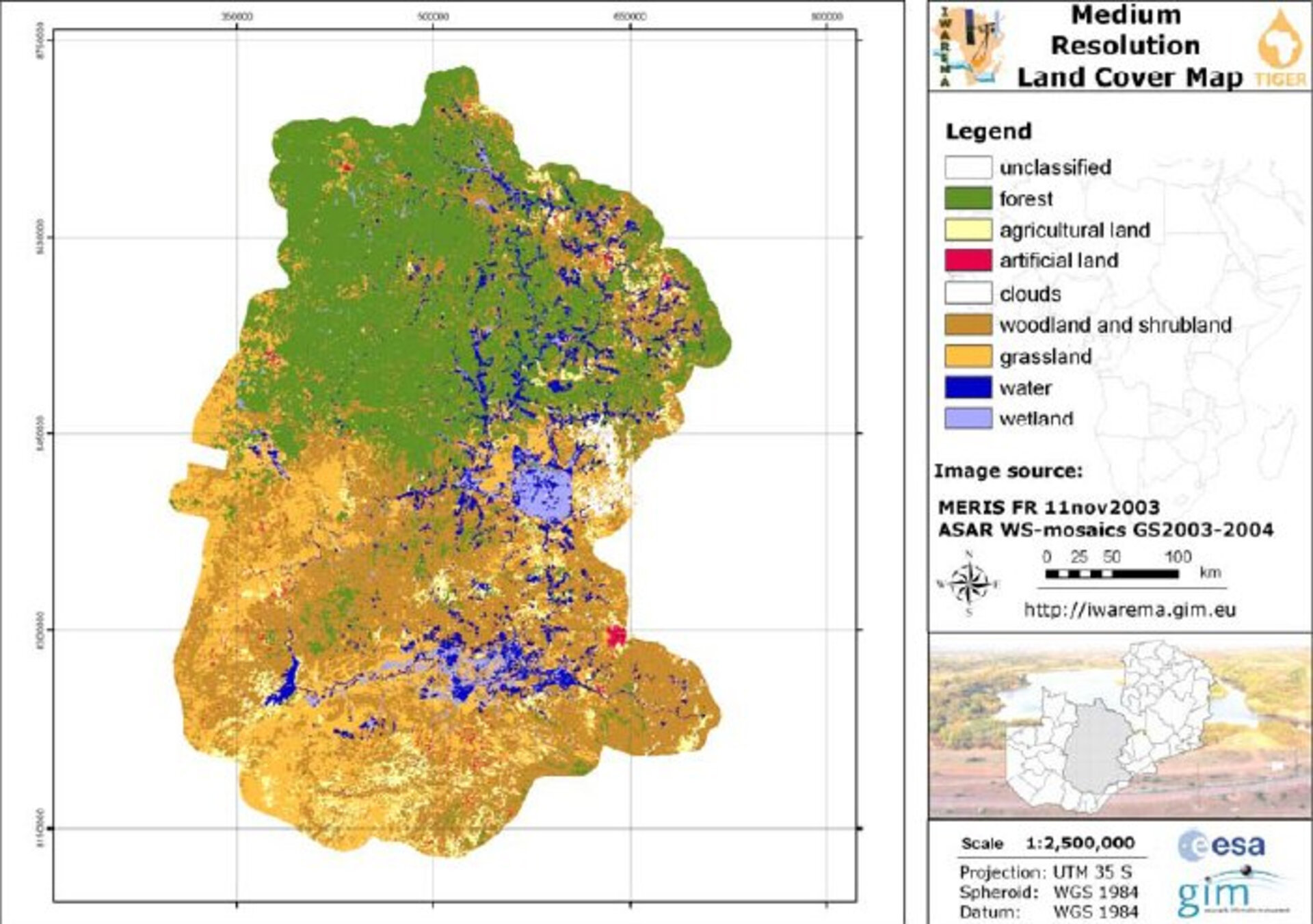
Land cover map of Zambia
Land cover map of Zambia created as part of the IWAREMA (Integrated Water Resource management for Zambia) project. The land cover change maps will help the government look at past trends in terms of deforestation, reclaimed land and new settlement areas to determine the long term affect and implement corrective measures.