Agency
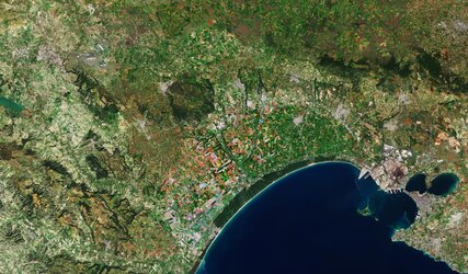
Natural colour image, Albaln Hills (Italy)
An example of a coloured satellite image: a natural colour (also called true colour) composition. The image has been taken by Landsat in the 3 bands corresponding to the visible part of the electromagnetic spectrum; so the red band is displayed in red, the green band in green and the blue band in blue. The result is an image with colours similar to those that would be seen by the naked eye.