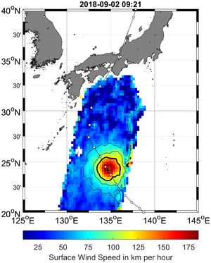
Agency
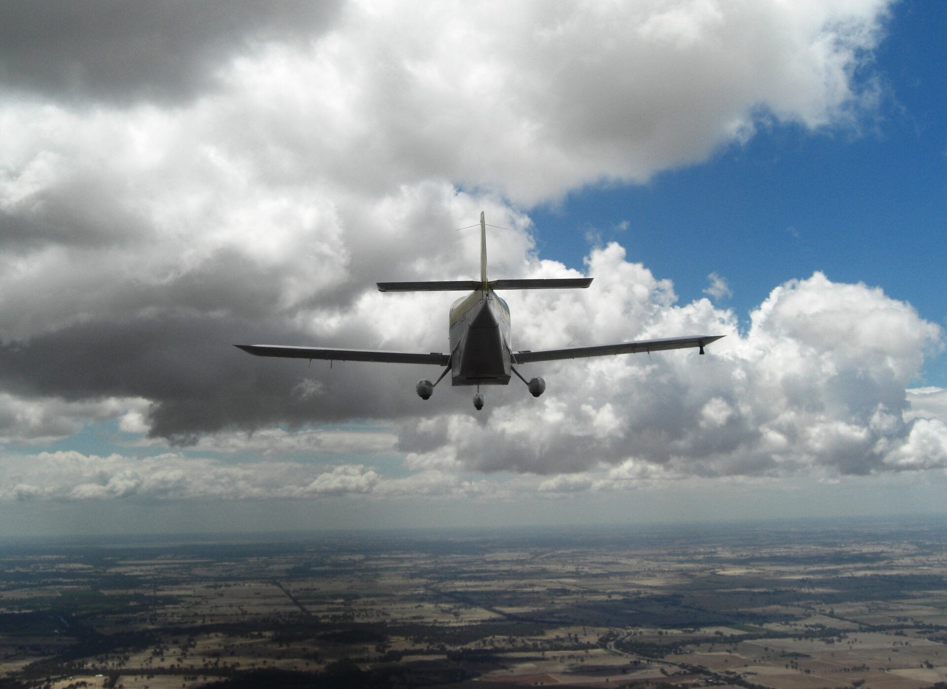
Aircraft mapping microwave emissions
Aircraft mapping L-band microwave emissions from Earth's surface. The aircraft took measurements over the Murrumbidgee Catchment in southeast Australia as part of the validation campaign to support the SMOS mission. The aircraft carried a Polarimetric L-band Multibeam Radiometer (PLMR) and a thermal imager.