Applications
Emergency management
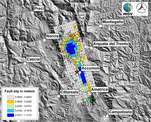
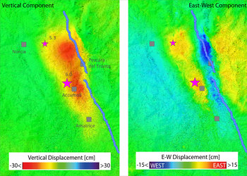
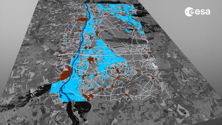
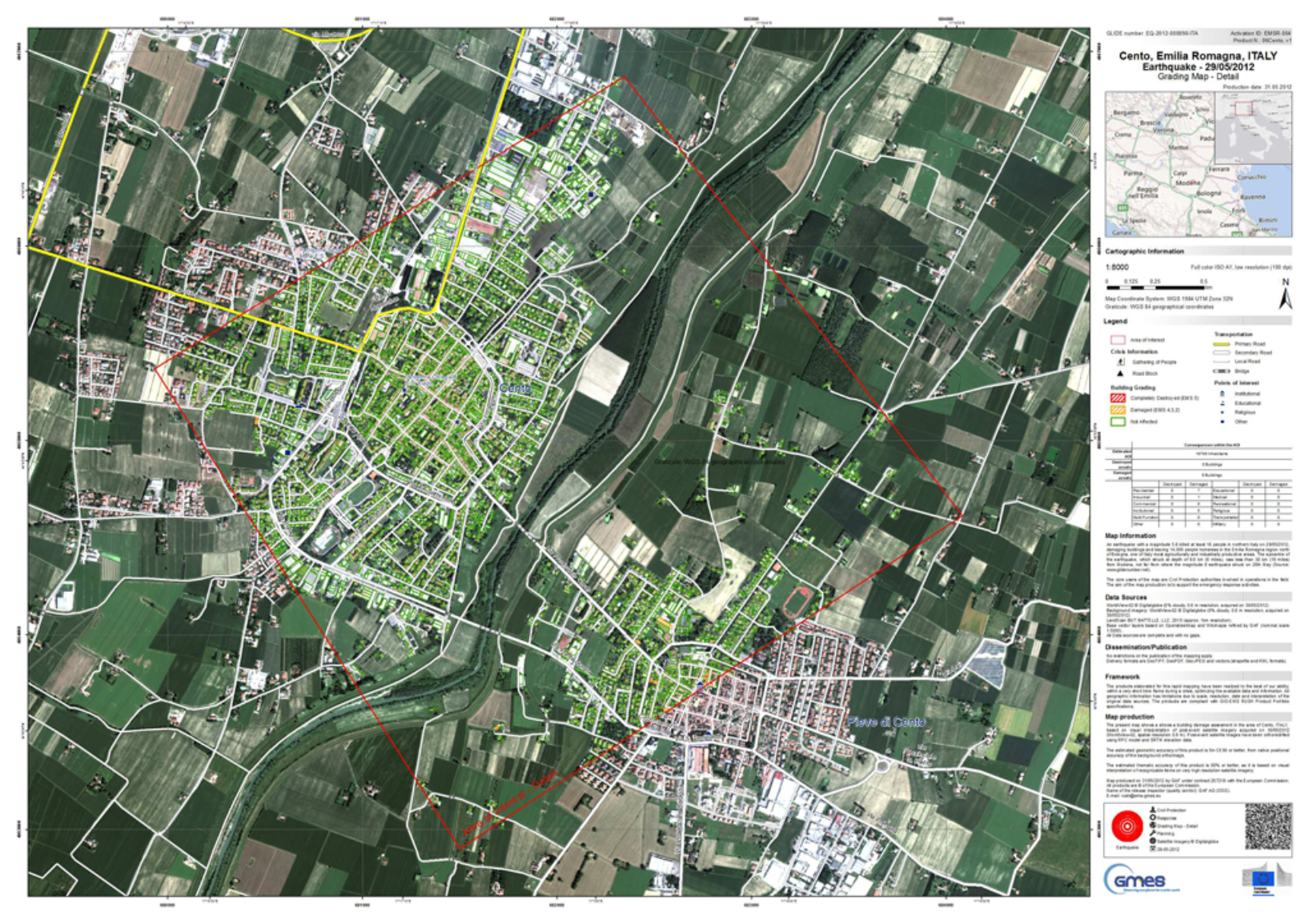
In May 2012, two earthquakes struck Italy’s Emilia-Romagna region, claiming at least 27 lives and causing widespread damage. GMES emergency services responded by produced damage assessment maps derived from satellite data. Within hours of the tremors, these maps were uploaded on the Italian Civil Protection web platform and made accessible to all actors involved in the emergency management activities.