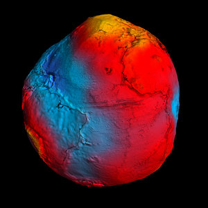
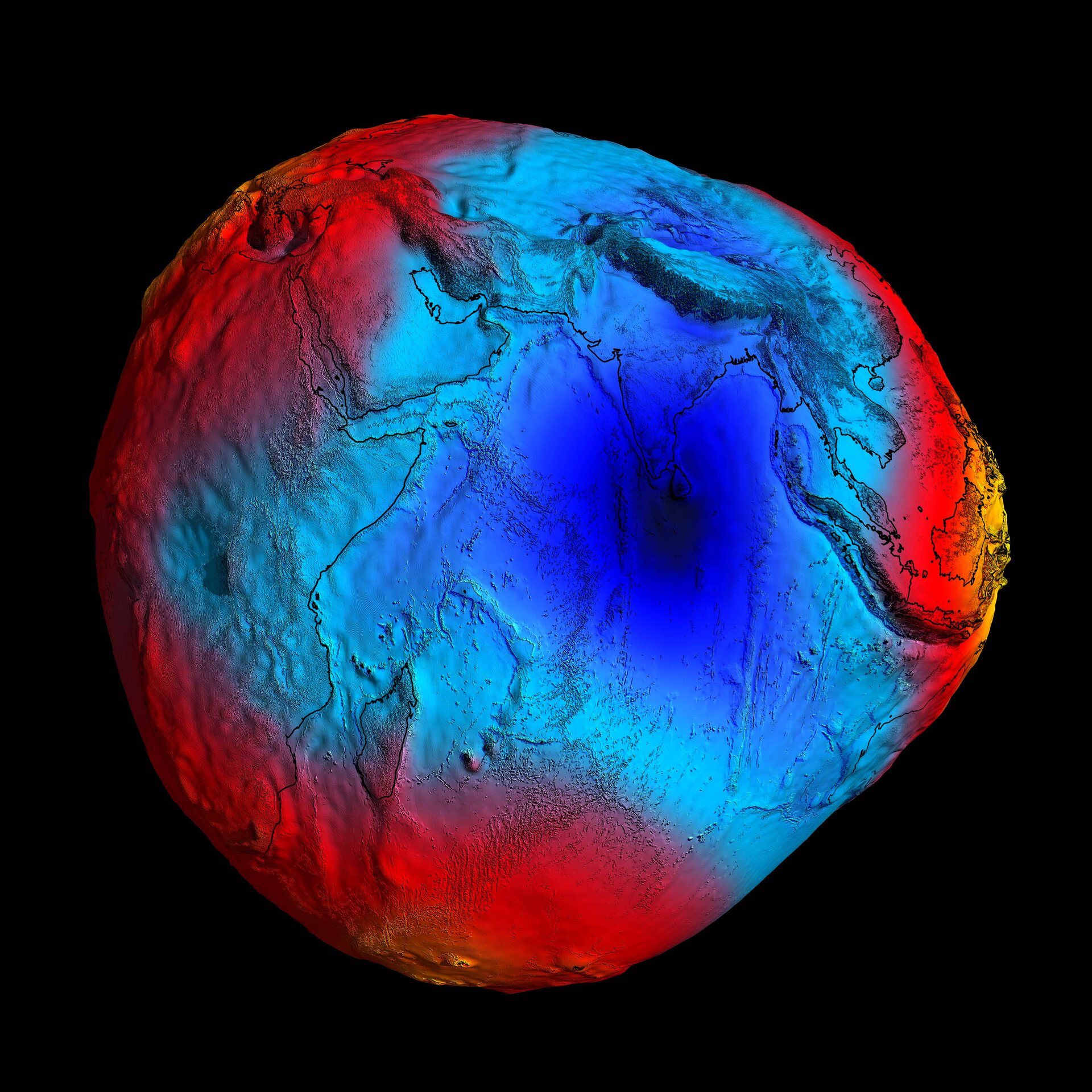
• → European Space Agency

      • Space for Europe
      • Space News
      • Space in Images
      • Space in Videos
    • About Us

      • Welcome to ESA
      • DG's news and views
      • For Member State Delegations
      • Business with ESA
      • Law at ESA
      • ESA Exhibitions
      • ESA Publications
      • Careers at ESA
      • ESAshop
    • Our Activities

      • Space News
      • Observing the Earth
      • Human Spaceflight
      • Space Transportation
      • Navigation
      • Space Science
      • Space Engineering & Technology
      • Operations
      • Telecommunications & Integrated Applications
      • Preparing for the Future
    • Careers at ESA

    • For Media

      • Media
      • ESA TV
      • Videos for professionals
      • Photos
    • For Educators

    • For Kids

    • ESA

    • Space in Images

    ESA > Space in Images > 2014 > 07 > 2011 GOCE geoid

    Free Search (21976 images)

    2011 GOCE geoid

    (1.53 MB)

    Details

    Open/Close
    • Title 2011 GOCE geoid
    • Released 30/07/2014 3:31 pm
    • Copyright ESA/HPF/DLR
    • Description

      In 2011, GOCE delivered a model of the 'geoid' pictured here. At the time, it was the most accurate ever produced. The colours in the image represent deviations in height (–100 m to +100 m) from an ideal geoid. The blue shades represent low values and the reds/yellows represent high values.

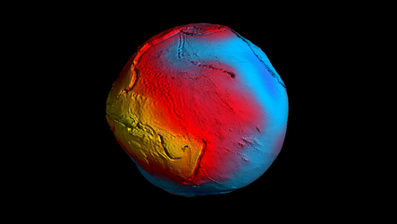
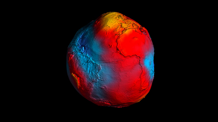
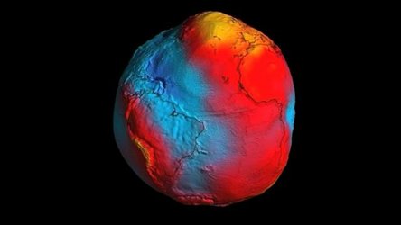
      A precise model of Earth's geoid is essential for deriving accurate measurements of ocean circulation, sea-level change and terrestrial ice dynamics. The geoid is also used as a reference surface from which to map the topographical features on the planet. In addition, a better understanding of variations in the gravity field will lead to a deeper understanding of Earth's interior, such as the physics and dynamics associated with volcanic activity and earthquakes.

      By the middle of 2014, no less than five gravity field models and corresponding geoids had been generated from GOCE's data. Each version more accurate than the last. The fifth gravity model and geoid, includes all of the gravity data collected throughout the lifetime of the mission – right up until November 2013 when the satellite finally stopped working and succumbed to the force it was designed to measure.

    • Id 315440

    TAGS

    Open/Close
    • Click on the tags to find the matching images.
    • Activity Observing the Earth
    • Mission GOCE

    TAGS

    Open/Close

    Details

    Open/Close

    Rate this

    Views

    Comments

    Share

    • Currently 5 out of 5 Stars.
    • 1
    • 2
    • 3
    • 4
    • 5

    Rating: 4.8/5 (40 votes cast)

    Thank you for rating!

    You have already rated this page, you can only rate it once!

    Your rating has been changed, thanks for rating!

    10440 0
    Tweet

    COMMENTS

    Open/Close

    COMMENTS

    Open/Close

    RELATED IMAGES

    • New GOCE geoid 28 March 2011 New GOCE geoid 20621 Votes: 108
    • The geoid 26 October 2004 The Earth's gravity field (geoid) as it will be seen by GOCE 12019 Votes: 54

    USING OUR IMAGES

    Terms and conditions

    Contact us

    Commenting guidelines

    • Connect with us
    • Subscribe
    • mobile version
    • LATEST ARTICLES
    • · Walking on the Moon – underwater
    • · Storm hunter in position
    • · Mars impact crater or supervolcano?
    • · Top tomatoes thanks to Mars missions
    • · Mars Express v2.0
    • FAQ

    • Site Map

    • Contacts

    • Terms and conditions