Sentinel-1 provides new insight into Italy’s earthquake
On 24 August, an earthquake struck central Italy, claiming at least 290 lives and causing widespread damage. Satellite images are being used to help emergency aid organisations, while scientists have begun to analyse ground movement.
The Italian peninsula is prone to earthquakes because of the continuing collision of the African and Eurasian tectonic plates. Under the Apennine mountain chain, the regional collision is causing the African slab to flex and dip under the Tyrrhenian Sea, while at the same time retreating northeastwards.
The slab's retreat is the main process driving the present tectonic extension which causes earthquakes like this one and the 2009 quake that devastated L'Aquila.
Under the coordination of the Italian Department of Civil Protection, scientists from Italy’s National Institute for Geophysics and Volcanology and the Institute for Electromagnetic Sensing of the Environment of the National Research Council are studying data from the Sentinel-1 satellite mission and other spaceborne radar missions to map surface deformations caused by the earthquake.

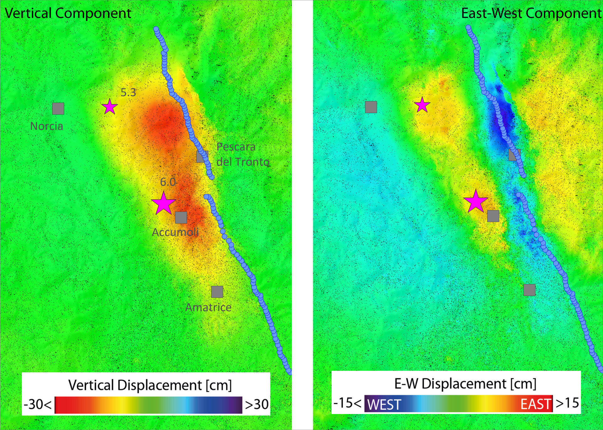
The team found that the main deformation pattern shows subsidence reaching about 20 cm in the Accumoli area, and sideways movement of up to 16 cm.
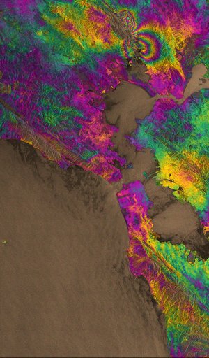
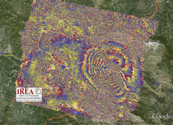
The scientists use a technique that allows them to map surface deformations by comparing radar images over the affected area taken before and after the event.
The team has benefited from the availability of both Sentinel-1A and Sentinel-1B scans. The scientists were able to quantify the ground movement in both vertical and east–west directions by combining the radar scans obtained as the satellites flew both south to north and north to south.
Sentinel-1 is not the only satellite providing information on this recent quake: scientists are also relying on data from the Italian space agency’s Cosmo-SkyMed satellites, as well as satellite imagery from other space agencies.
In addition, data from a multitude of Copernicus contributing missions are being used to produce maps through the Copernicus Emergency Management Service for damage assessment.

Sentinel-1 is a two-satellite mission for Europe’s Copernicus environment monitoring programme, led by the European Commission. The first satellite – Sentinel-1A – was launched in 2014, while its sister Sentinel-1B is still in its commissioning phase following launch just four months ago.
With its 250 km-wide swatch over land surfaces, Sentinel-1 gives scientists a broad view of the displacement, allowing them to examine the ground displacement caused by this earthquake and develop the scientific knowledge of quakes.
Once Sentinel-1B is operational next month, it will be possible to perform routine scans over critical areas like Italy every six days with the two-satellite constellation.