Monitoring Earth’s shifting land
The monitoring of land subsidence is of vital importance for low-lying countries, but also areas which are prone to peculiar ground instability.
Land subsidence is the lowering or sinking of the ground’s surface, owing to changes that take place underground. Subsidence is usually due to a combination of ground water overexploitation, mining, natural consolidation of sediments and rapid urbanisation.
This is a major threat, in both urban and agricultural areas, where the continuous lowering over time can cause damage to buildings, sink houses, crack roads, and can cause severe impacts on the environment and economy. In order to support urban development projects and risk assessment efforts, subsidence monitoring is necessary.
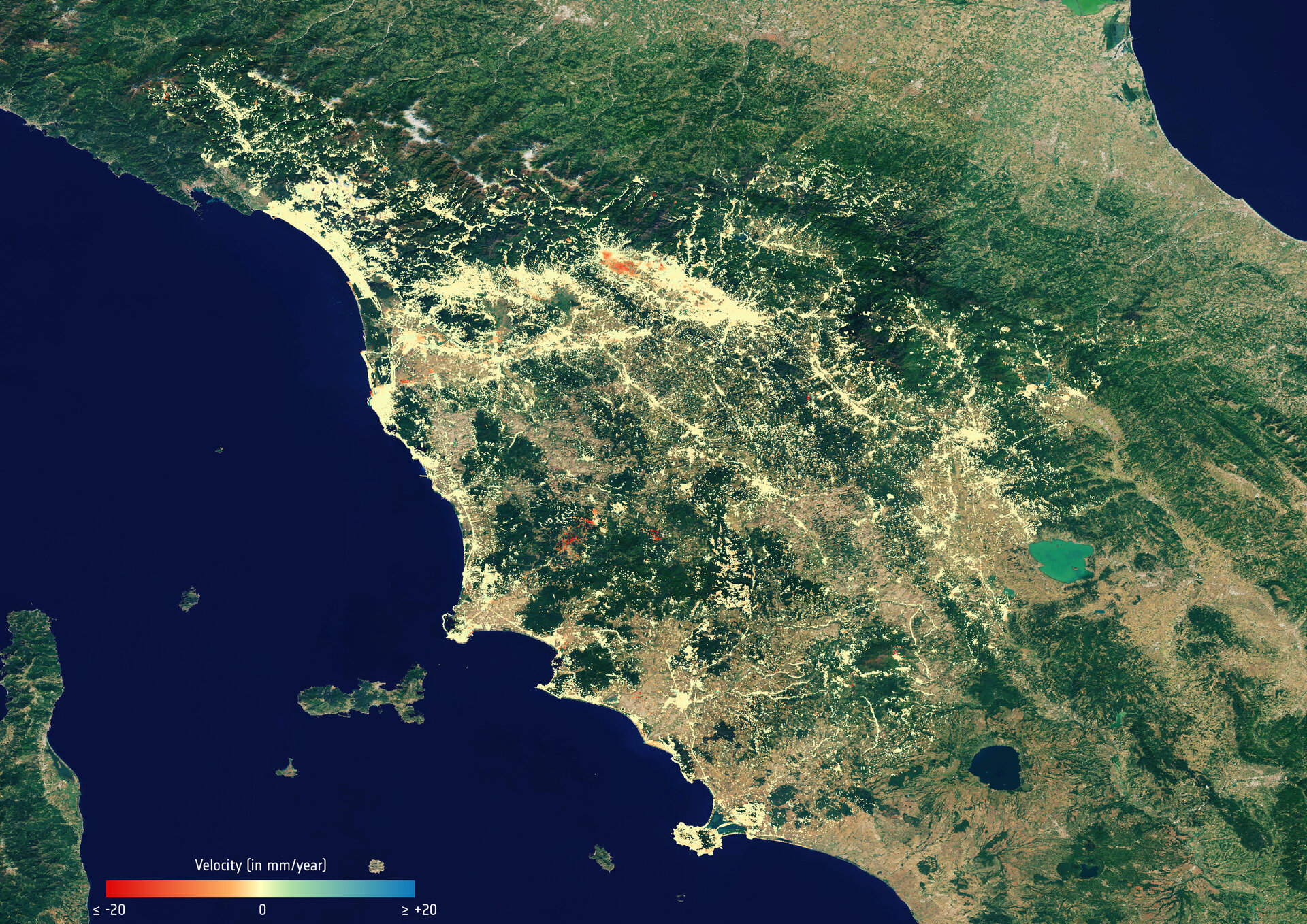
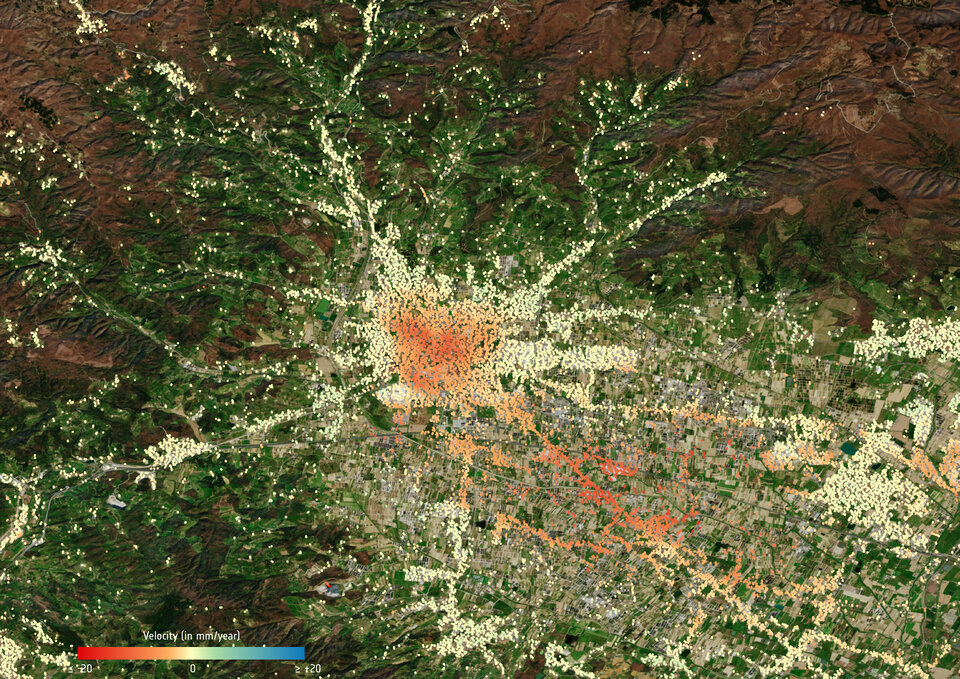
Along with the Veneto and Emilia Romagna regions in Italy, Tuscany is an interesting area to analyse, seeing as several cities such as Pistoia, are affected by land subsidence.
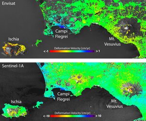
Conventional techniques to track and monitor this silent hazard, including repeat optical levelling and groundwater monitoring, can be difficult to manage in the long-term. By using radar data acquired by the Copernicus Sentinel-1 mission over time, ground deformation maps can be created in order to provide a regional monitoring system.
These maps can be useful to analyse past displacement phenomena of a single point in Tuscany over the last few years, in order to help spot unstable areas. This information is routinely sent to the local authorities in charge of geohazard management practices.
The project was driven by the University of Florence, representing the Italian Civil Protection Department, the Regional Government of Tuscany and TRE ALTAMIRA, a company which provides displacement measurements and mapping solutions from satellite radar data at a global level.
Alessandro Ferretti, CEO of TRE ALTAMIRA, comments, “Thanks to Copernicus Sentinel-1, the SAR industry paradigm has definitely changed from ‘mapping’ to ‘monitoring.’ Tuscany is the first region in Italy to benefit from this.”
Professor Nicola Casagli from the University of Florence adds, “Satellite data, acquired with short revisiting times and promptly processed, can contribute to the detection of changes in ground deformation patterns, and can feed a decision support system for hydrogeological risk mitigation strategies.”
Radar images – such as those provided by Sentinel-1’s C-band synthetic aperture radar at centimetre precision – are the best way of tracking land subsidence and structural damage across wide areas.
In order to have a continuous flow of displacement information on a regional scale, once a new Copernicus Sentinel-1 image is available, it is automatically downloaded and added to the existing archive. This allows new deformation maps to be generated and updated on a regular basis.
We are changing our natural world faster than at any other time in history. Understanding the intricacies of how Earth works as a system and the impact that human activity is having on natural processes are huge environmental challenges. Satellites are vital for taking the pulse of our planet, delivering the information we need to understand and monitor our precious world, and for making decisions to safeguard our future. Earth observation data is also key to a myriad of practical applications to improve everyday life and to boost economies. This week we focus on the world’s biggest conference on Earth observation where thousands of scientists and data users discuss the latest results and look to the future of Earth observation.