Sentinel data enables new system for agricultural monitoring in Poland
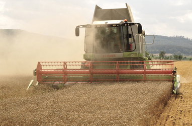
Data from the Copernicus Sentinel satellites are enabling the national monitoring of agricultural activity in Poland – a colossal task that will support the efforts of key national agencies to assess a country’s cropland, productivity, and food security, as well as the implementation of the EU Common Agricultural Policy in years to come.
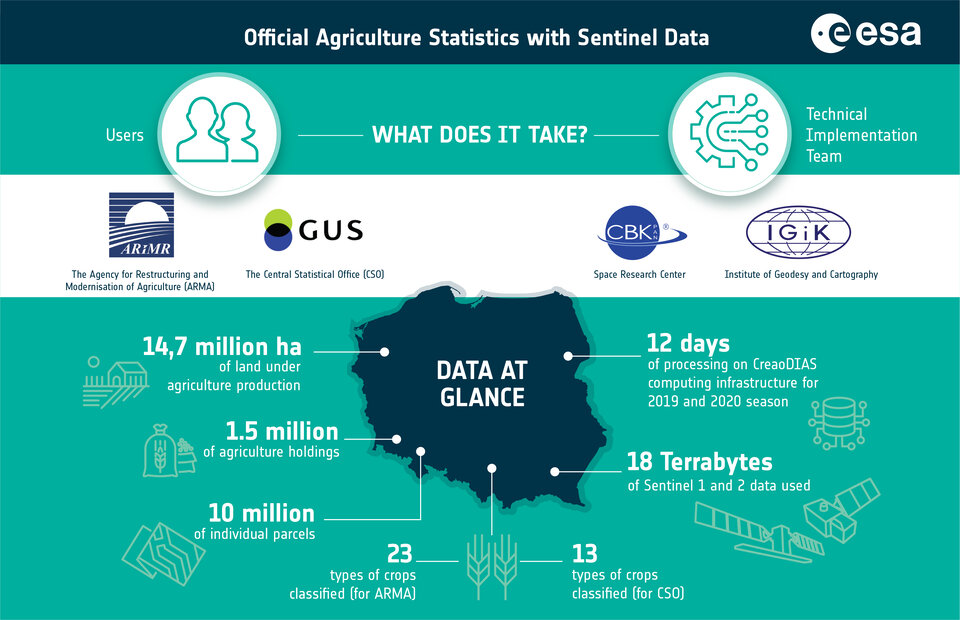
The data, acquired by the Copernicus Sentinel-1 and Sentinel-2 satellites and processed by ESA’s EOStat project, are being used by Statistics Poland, the country’s Central Statistical Office (or GUS – Glowny Urzad Statystyczny).
EOStat aims to bring together ground-based and Earth observation tools to collect agricultural information, with the Sentinels being a key component. Together, these Sentinels image land and sea at a high resolution, identifying characteristics such as vegetation type, soil cover, and waterways from space.
Monitoring and assessing agricultural data is an essential task, and typically performed once a year in Poland via Statistics Poland's agricultural survey. This survey is also scaled up every decade, as it is in 2020, in the form of a Decadal Agricultural Census supported by Eurostat (the EU’s statistical office), which collects some 300 variables covering different aspects of farming such as general farmland characteristics, livestock, the labour force, animal housing, and support measures for rural development.
Therefore, while essential, this task is also immense – especially so given that Poland has some of the most agricultural holdings (over 1.5 million) and arable land (14.7 million hectares) within the EU-27, and is also the fifth-largest beneficiary of the EU Common Agricultural Policy (CAP).
The agricultural statistics traditionally comprise field and household surveys, but, this year, will be able to make the most of Sentinel data to characterise geospatial and crop type characteristics in Poland.
“Implementing large-scale crop identification and monitoring with Copernicus data is a backbone of our strategy to improve the accuracy and effectiveness of agriculture statistics,” says Artur Łączyński, Director of Statistics Poland’s Agriculture department. The data and services developed in the EOStat project will also be used to support the national paying agency – ARiMR – responsible for implementing the EU CAP in Poland.
“The EOStat project is a big step towards country-scale monitoring of agriculture at the field level,” adds Jedrzej Bojanowski of the Institute of Geodesy and Cartography (IGiK), Poland, and EOStat Project Coordinator. “We have developed novel algorithms for classifying crop types, monitoring agricultural activity, and forecasting crop yields for the main administrative units, and optimised these algorithms so they can be applied across the entire country.”
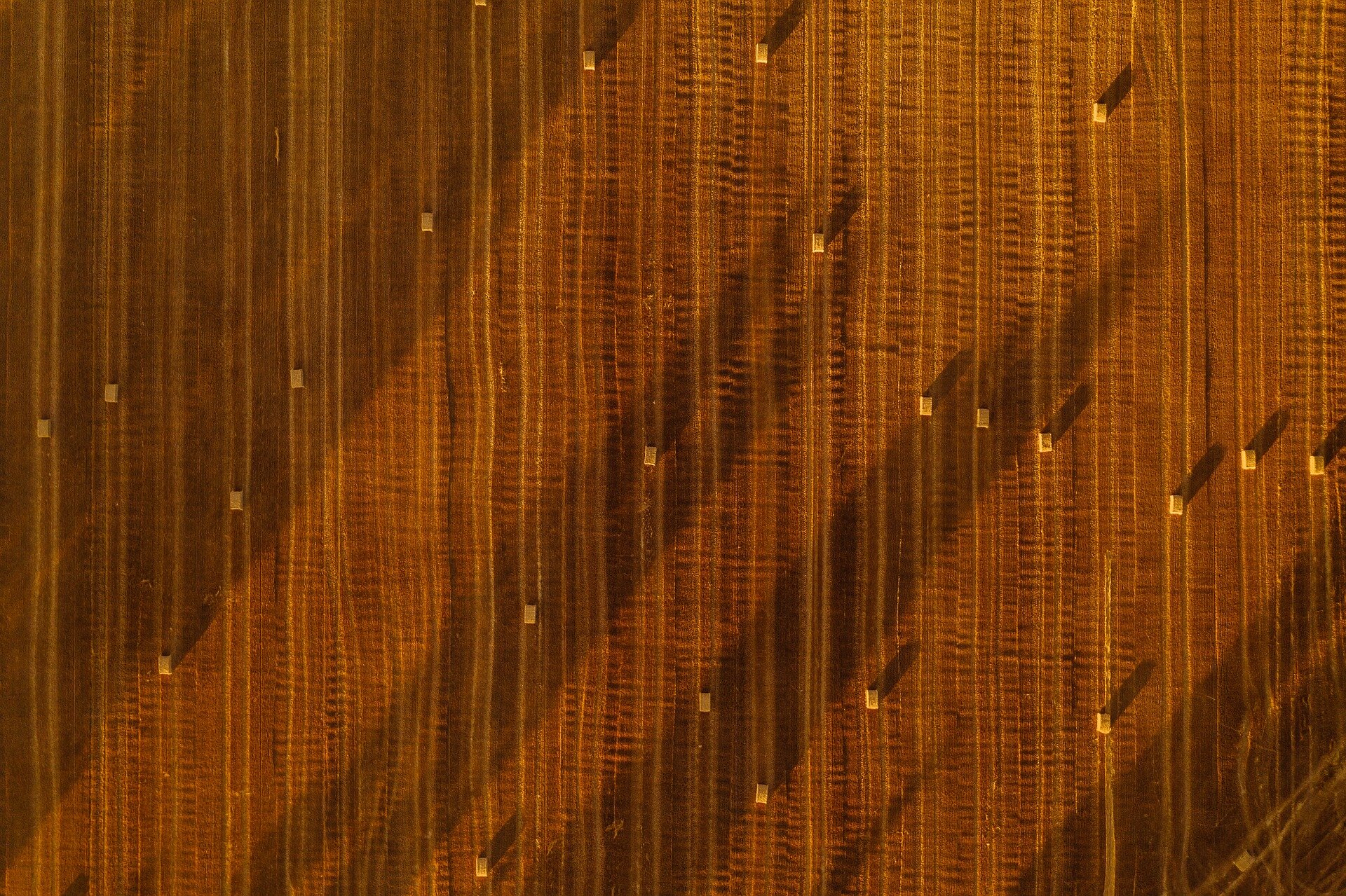
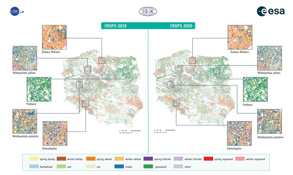
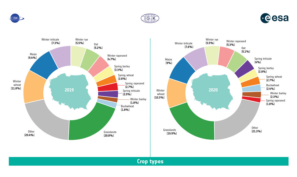
Drawing from Sentinel data, EOStat provides information on the spatial extent of the 13 most popular crops in Poland – eight cereals, winter and spring rapeseed, buckwheat, maize and grasslands – and employs a novel methodology able to monitor small, irregular parcels of agricultural land (a particular issue in Poland, where over half of the country's parcels do not exceed five hectares).
The products generated by EOStat will become a key element of Statistics Poland's new large-scale system for assessing crop condition, type, and potential yield, which will be the basis of Poland’s agricultural statistics reporting process after 2021.
“This project shows just how well Sentinel satellites fit both national and European needs for quality data and information services,” says Anna Burzykowska, ESA Technical Officer. “In the span of only two years we have managed to define and deliver complete end-to-end data processing chains based on the synergistic use of Sentinel and in situ data to support various assessments related to official statistics, national food security and natural capital accounting. EOStat truly demonstrates the tremendous Europe-wide value of the Sentinels.”
Up to 18 terabytes of data were processed for the 2019 and 2020 vegetation seasons using CreoDIAS, a cloud infrastructure designed and adapted to process large amounts of EO data.
“It took just six days to process the data for one season thanks to our direct access to Sentinel data and the large processing power of CreoDIAS," says Edyta Woźniak of the Polish Academy of Sciences’ Space Research Center (CBK PAN), who led the EOStat crop identification effort. “On our local machines it could take as long as five weeks.”
Josef Aschbacher, ESA’s Director of Earth Observation Programmes, added, "Information from the Sentinels is finding a myriad of uses to improve daily lives. I am thrilled that both Sentinel-1 and Sentinel-2 missions are enabling the monitoring of agricultural activity on a national scale. The data is vital to monitoring food security and supporting the implementation of the Common Agricultural Policy.”
Ultimately, EOStat aims to provide Statistics Poland with the ability to regularly acquire, process, and use EO data, and to support ARiMR monitoring of crop diversification, agricultural activity, and Ecological Focus Areas (as ESA also does via Sen4CAP). EOStat is led by a scientific consortium of remote sensing specialists from IGiK and CBK PAN, and financed by ESA’s Polish Industry Incentive Scheme and Earth Observation Envelope Programme-5.