
Earth from Space: Canadian Arctic
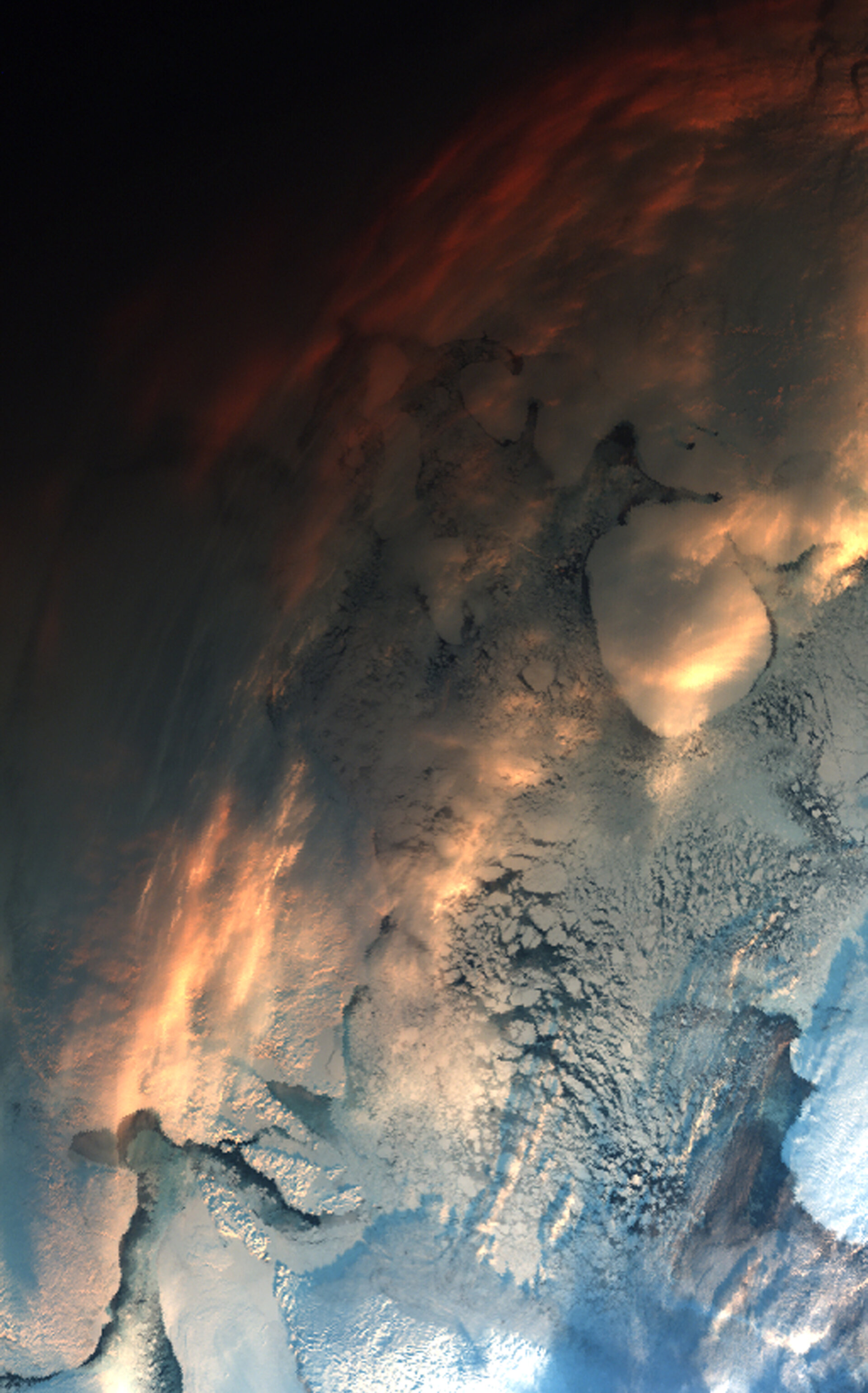
This Envisat image shows the snow-covered Nunavut territory in the Canadian Arctic. The icy body of water is Fox Basin, a shallow extension of the Atlantic Ocean.
The basin remains ice-covered for most of the year, with landfast ice (sea ice that remains attached to the coast) dominating in the shallower northern waters and pack ice (normally broken separate blocs of ice) covering the deeper southern waters.
Baffin Island, the fifth largest island in the world, is visible in the top right, and Melville Peninsula is visible in the lower left. Prince Charles Island (round shaped, west of Baffin Island) is the largest island in the basin. As visible, it appears to be attached to Baffin Island via a temporary ice bridge.
Stretching roughly 500 km across at its widest point, the basin is home to the last large landmasses discovered in North America. Prince Charles Island, Air Force Island (located directly east of Prince Charles Island) and Foley Island (north of Prince Charles Island) were all discovered in 1948 from aerial surveys.
Due to the low elevation of the sun at this time of the year, the top of the image appears very dark. The position of the low sun gives the clouds in the upper part of the image a reddish tint.
The Advanced Along Track Scanning Radiometer (AATSR) acquired this image on 2 December 2009. AATSR, one of the 10 instruments on Envisat, has a visible-light imaging capability for land surfaces and atmospheric clouds and aerosols.
The instrument is an improved version of the ATSR flown on ESA’s first Remote Sensing Satellite (ERS-1) in 1991 and its successor ATSR-2, launched in 1995 on ERS-2.
Working day and night AATSR measures global sea surface temperature (SST) to an accuracy of 0.3º K, constantly extending an 18-year satellite dataset commenced by the predecessor ATSR instruments. The top two metres of the ocean alone contain more energy than the entire atmosphere, and so this long, continuous time-series of SST data provides important information for modelling Earth’s climate.
AATSR is also especially sensitive to anomalous heat sources such as volcanoes or the central cores of forest fires. For more than a decade, ERS-2 and Envisat have been continuously surveying fires burning across Earth’s surface. Worldwide fire maps based on data from ATSR-2 and AATSR are available to users online in near real time through ESA's ATSR World Fire Atlas.
More than 50 million hectares of forest are burnt annually, and these fires have a significant impact on global atmospheric pollution, with biomass burning contributing to the global budgets of greenhouse gases, like carbon dioxide.
Quantifying fire is important for the ongoing study of climate change. The 1998 El Niño, for example, helped encourage fires across Borneo which emitted up to 2.5 billion tonnes of carbon into the atmosphere, equivalent to Europe's entire carbon emissions that year.

