
Earth from Space: Green Granada
The fertile land of southern Spain’s Granada province is shown in this image from the Pleiades satellite.
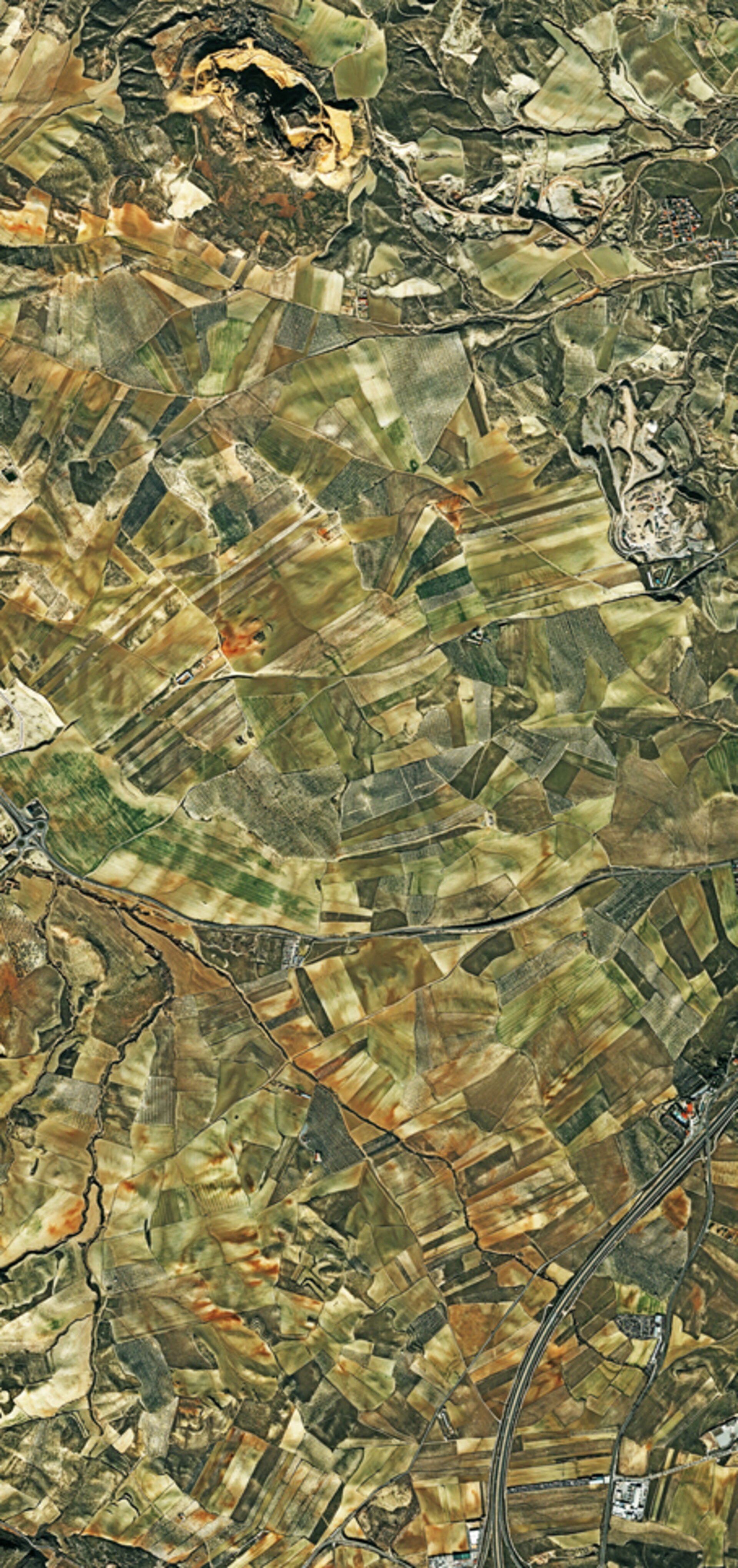
The area pictured is just southwest of the provincial capital, Granada.
Zooming in on the fields, we can see dots of vegetation planted in rows, many of which appear to be olive groves.
Looking at individual olive trees from an altitude of 750 km was not always possible with civil Earth observation satellites. For the last decade, however, high-resolution capabilities have given us a better view than ever before.
In the lower right, we can see a highway that leads north towards the city. Along that road, the red roof and pool of a motel and campground are visible.
Staying in the lower right, what appears to be a large car park is a scrap yard.
At the top of the image is Montevive, a hill that had been a site for mining minerals such as strontium. In ancient times, people would come here to collect medicinal herbs such as oregano, lavender and rosemary.
Below Montevive and on the right side of the image, there appears to be another mining area, possibly also for strontium.
This image was acquired by France’s Pleiades satellite on New Year’s Day of this year.
The Image of the Week is featured on ESA Web-TV, broadcast online every Friday at 10:00 CET.
