
Earth from Space: Reclaimed lands
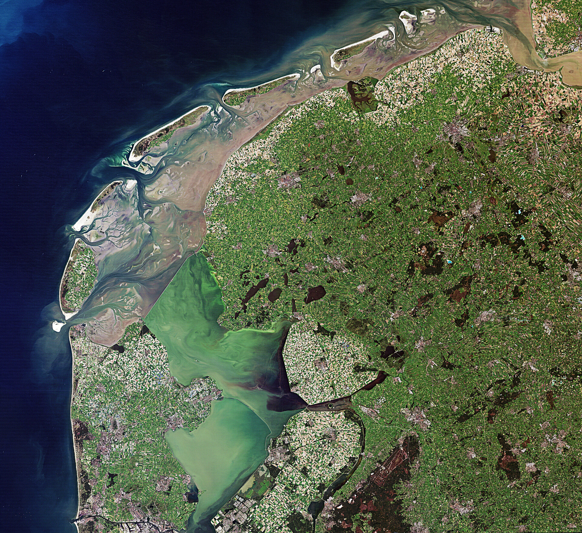
This Landsat image from 6 September 2010 shows the intertidal Wadden Sea and two shallow, artificial lakes in the Netherlands.
The biologically diverse sea was declared a UNESCO World Heritage Site in 2009. This unique region is one of the largest wetlands in the world.
Visible in the image is the Afsluitdijk – a causeway that creates a division between the Wadden Sea to the north and the former Zuiderzee bay to the south. Built between 1927 and 1933, this causeway dammed off what was a salt water inlet of the North Sea and turned into a fresh water lake.
After the dike was built, the Dutch were able to reclaim land from the sea – like the lighter coloured areas in the lower-central part of the image. Zooming in, we can see the patchwork of agricultural land plots.
About a fifth of the entire country is reclaimed from the sea, lakes, marshes and swamps.
The Thematic Mapper on Landsat 5 is jointly managed by NASA and the US Geological Survey. ESA supports the Landsat series as a Third Party Mission, meaning it uses its ground infrastructure and expertise to acquire, process and distribute Landsat data to users.
ESA has recently opened archived Landsat data for use by the scientific community, free of charge.
The Image of the Week is featured on ESA Web-TV, broadcast online every Friday at 10:00 CET.

