Taking the dazzle out of CryoSat yields a first
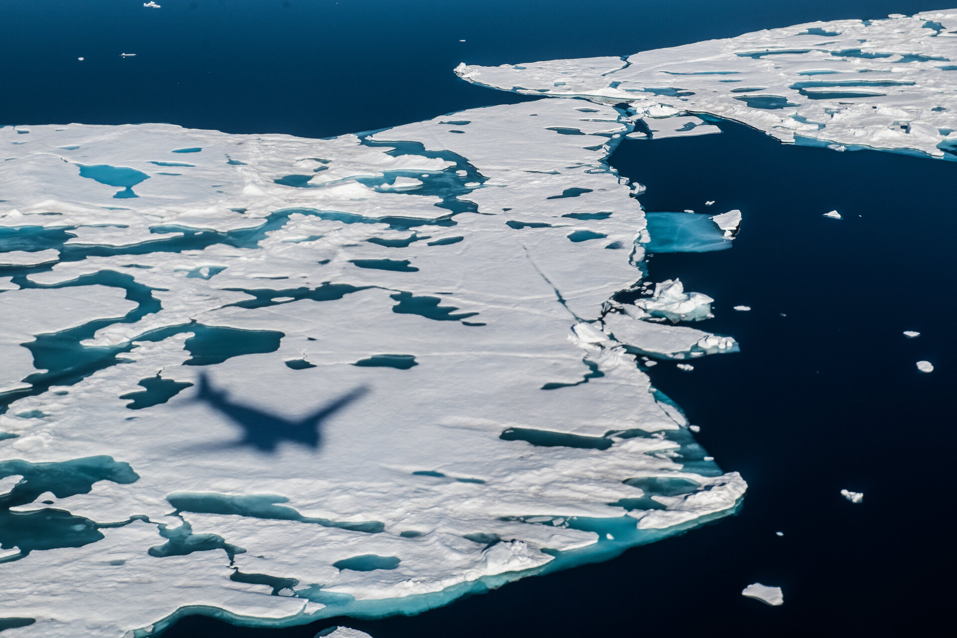
Since it was launched more than 12 years ago, ESA’s CryoSat ice mission has dazzled by way of its sheer technological and scientific excellence. This superb Earth Explorer satellite has returned a wealth of information that has transformed our understanding of Earth’s ice and how it is responding to climate change. In some circumstances, however, being dazzled isn’t a good thing, particularly when it comes to measuring the height of sea ice from space during the summer.
A paper published in Nature describes how scientists have now found an ingenious way of removing the pesky problem of dazzle from surface meltwater to yield the first ever continuous, year-round, altimetry measurements of sea-ice thickness in the Arctic Ocean.
As one of the most dynamic components of Earth's climate system, sea ice naturally waxes and wanes with the seasons, but the overall trend is one of rapid decline as a result of climate warming.
Floating ice not only plays a fundamental role in the polar environment but also in the global climate. For example, its white surface reflects far more sunlight back to space than the dark ocean, it acts as insulation between the ocean waters and the air, and it helps drive global ocean circulation patterns. It also supports native communities and is vital for wildlife above and below the water.
To understand exactly how much ice the Arctic Ocean is losing, measures of both ice extent and ice thickness are needed to work out the actual loss in terms of volume.
Jack Landy, from the UiT Arctic University of Norway, said, “Arctic ice is melting faster than ever. We need knowledge about the thickness of the sea ice, both to reduce safety risks for businesses and shipping, but also to make forecasts for the future climate.”
Satellites have actually been used to estimate ice thickness since the 1980s, but these measures are more reliable during the winter, from October to March, when the ice and snow are cold and dry.
During the summer, a vast area of sea ice in the Arctic melts away and as climate change takes a grip the amount left by September tends to be less as the years go by.
However, it’s the thickness of the summer ice that proves the most challenging to measure from space. This is because ponds of meltwater can accumulate on the surface of the ice which lead to inaccuracies in satellite data.
Dr Landy stated, “In the summer months, satellite instruments can be dazzled by meltwater that pools on the sea-ice surface, meaning that they are unable to distinguish between melting ice and the surface of the open water between sea-ice floes.”
This issue of dazzle also complicates how scientists interpret data from the CryoSat mission.
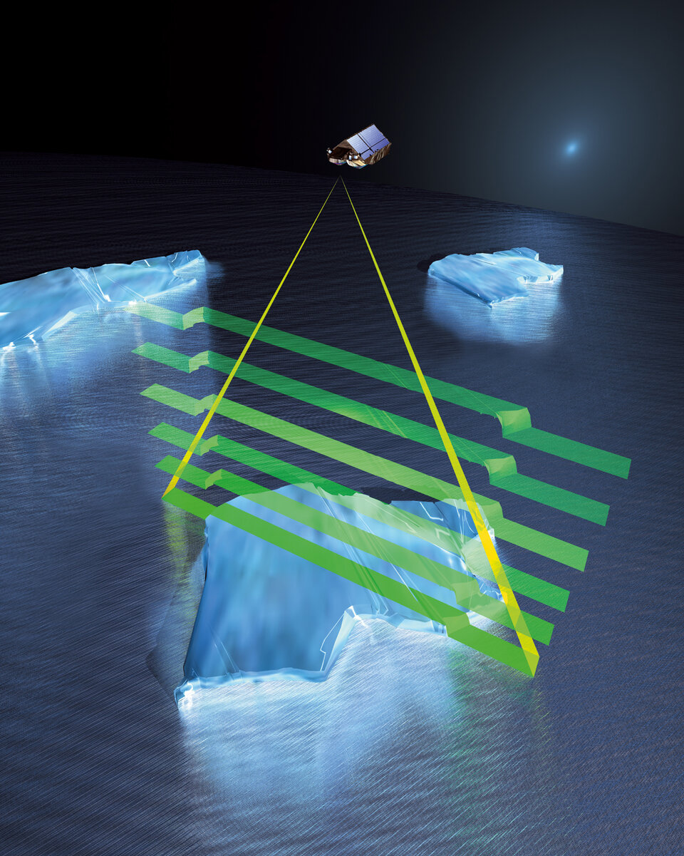
CryoSat carries a specialised radar altimeter that measures the height of ice protruding above the water, and from this ice thickness can be calculated.
Having confidence in satellite data is absolutely key to climate science research so, funded initially by ESA’s Living Planet Fellowship Programme and then by the UK Natural Environment Research Council and the Research Council of Norway, a team lead by Dr Landy looked into how this issue of dazzle could be solved.
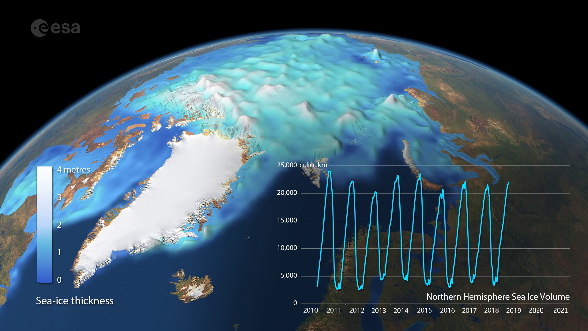
Their results, published today in Nature, describe how they harnessed artificial intelligence and applied it to CryoSat’s data to yield the first pan-Arctic, all-year, decade-long, twice-monthly sea-ice thickness record for 2011–2020.
Dr Landy explained, “Our international team used artificial intelligence techniques to check whether CryoSat was looking at the melting sea-ice floes or the ocean surface between floes, then we used radar model simulations to ensure CryoSat was measuring the thickness of the sea ice correctly.”
“By comparing the new satellite data with in-situ observations from fieldwork campaigns in the Arctic, we discovered that CryoSat could indeed measure the sea-ice thickness accurately during summer. The data have revealed that sea-ice volume shrinks by 80% each summer in the Arctic, from around 23 000 cubic km at the end of winter to around 4000 km at the end of summer.
“Climate models predict that the Arctic Ocean has lost around three-quarters of its summer sea-ice volume since the 1980s. Our new observations confirm that over the past decade, the volume of summer sea-ice has been as low as predicted by the models.”

Access the video
According to Dr Michel Tsamados from University College London the findings are of great importance for our understanding of the weather and the climate. “When we use the new ice-thickness data in advanced numerical prediction models, it will improve both our short-term forecasts for the weather at the mid-latitudes and the long-term forecasts that show what climate we will have in the future.”
As well as advancing climate science, these new findings will also have important practical uses. For example, they lead to safer Arctic passage for maritime traffic, particularly in summer.
Melting summer ice has meant that shipping has increased significantly in recent years, particularly in the Barents Sea and near Svalbard. Nevertheless, before setting course, ships need accurate information on where the ice is and how thick it is.
The Norwegian Meteorological Institute provides sea-ice forecasts for the Arctic but have lacked pan-Arctic observations of sea-ice thickness through the summer months.
“Using the new satellite data, we are finally able to make sea-ice forecasts informed by the ice thickness, not only for the winter, but also for the summer. This increases safety for ships and fishing boats," added Dr Landy.
"We can also predict whether there will be ice or not at a given location in September, by measuring the ice thickness in May.”
This new way of dealing with dazzle from ponds of meltwater also provides a significant step forward for ESA in the development on the future Copernicus Polar Ice and Snow Topography Altimeter, CRISTAL.
Carrying a dual-frequency radar altimeter and microwave radiometer, CRISTAL will measure and monitor sea-ice thickness and overlying snow depth. Together observations of sea-ice extent made by the Copernicus Imaging Microwave Radiometer mission, the CRISTAL measurements will support maritime operations in polar oceans and contribute to a better understanding of Arctic warming on sea-ice volume.
ESA’s mission scientist for CRISTAL, Dr Paolo Cipollini, said, “Now that CryoSat has clearly demonstrated that we can take year-round measurements of sea-ice thickness from space, we have confidence that in the not-so-distant future we will be able to ensure the continuity of those crucial measurements for many years, thanks to the two CRISTAL satellites currently being built.
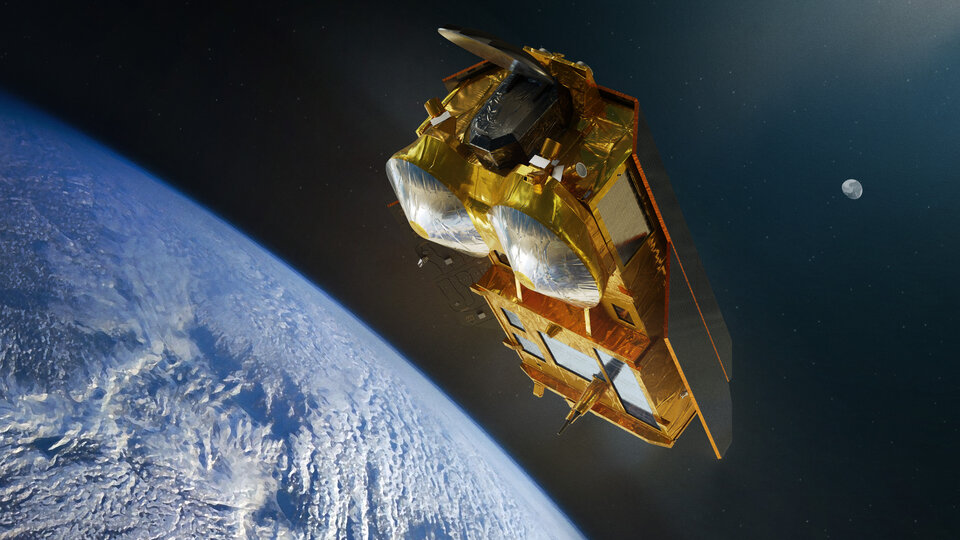
“CRISTAL's two-frequency approach in combination with an enhanced operation mode of the radar will make these measurements even more accurate.
“We ultimately need to make sure that we put in place an operational ground segment to routinely produce year-round data for the Copernicus Services, to the benefit of the many users in climate research and commercial operations.”
In the meantime, ESA’s CryoSat team is further focusing on new ways of getting the best out the mission’s data.
ESA’s CryoSat mission manager, Tommaso Parrinello, noted, “One of our objectives with respect to extending the mission until 2025 is to further improve the CryoSat data and also to add new data products to the mission’s portfolio.
“We are looking at several new methods, including artificial intelligence, to do this.”