
Revealing under water mysteries and saving lives
A smart camera to improve underwater conservation and construction took home first prize in the Galileo Masters while an innovative smart-phone app to help prevent traffic accidents and save lives was awarded the ESA space solutions Prize. For both, Europe's satellite navigation system Galileo plays a key role with its high accuracy.
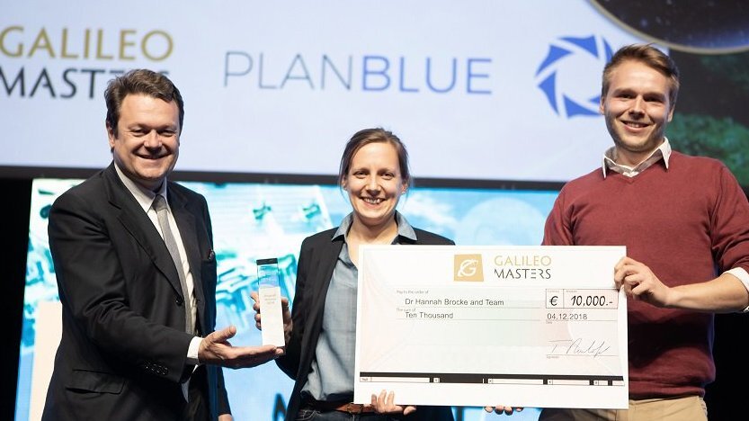
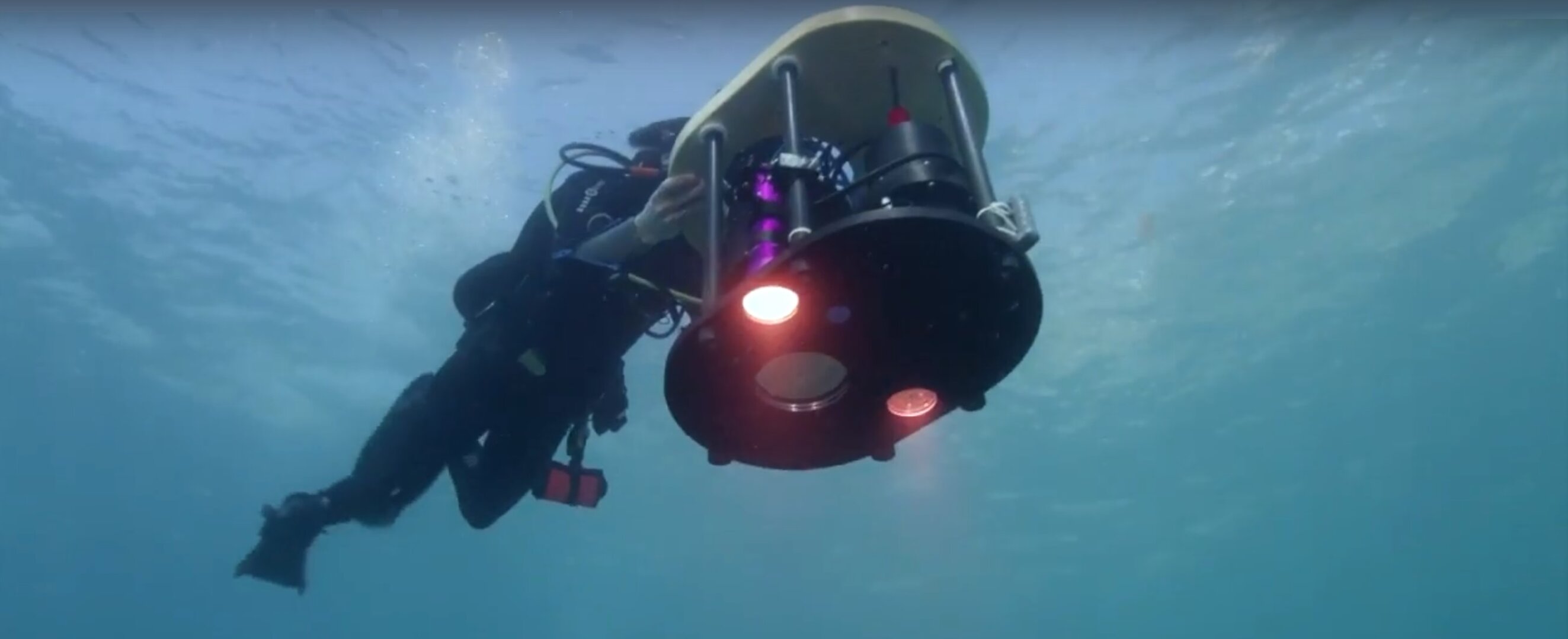
While the Earth’s atmosphere and surfaces are well monitored by satellites, there are no satellites to identify biodiversity or plastics in the oceans. The German start-up company PlanBlue has developed the new seafloor monitoring technology DiveRay to map and assess what under the sea surface and better understand the seafloor. For this, PlanBlue was awarded the Galileo Masters Grand Prize in the European Satellite Navigation Competition 2018, at the award ceremony on 4 December in Marseille, France.

The French start-up company Lycie uses a CNES patent in their Drive Safely and Save Money Lycie mobile app to detect abnormal behaviour both on the road and inside a car during driving to actively prevents traffic accidents and saves lives. After the car starts to drive the smart phone on the dashboard will provide real-time notifications to the driver whenever a dangerous situation is identified. For their innovative solution, Lycie was awarded the ESA space solutions Special Prize.
Get to know the oceans better
PlanBlue uses an intelligent hyperspectral underwater camera to automatically scan seafloor areas, as well as lake bottoms and river beds. The core of system is the machine-learning intelligent algorithm technology for the image analysis.
The DiveRay significantly reduces the time spent both below and above water, and the data obtained is objective and can easily be compared to future studies. The PlanBlue standardised monitoring technology will speed up climate monitoring, thus a help policy-makers for environmental legislation as well as aid underwater construction industries.
Galileo data is incorporated in the seafloor maps, geo-referenced, so the exact same locations of the seafloor bed can easily be revisited to monitor changes. The high-quality data is enriched by the intelligent software algorithm providing a smart tool for the exploration of the almost 95% of the world oceans still unknown.
Reduce accidents and save lives

Lycie uses a machine-learning algorithm originally designed for satellite data to process smartphone data sources like cameras and accelerometers, as well as information from Galileo.
The application learns while driving and warns drivers of potential dangers: obstacles, cars suddenly changing lanes, or tiredness, for example.
In addition to less accidents and less people being injured, the use of Lycie`s innovative Drive Safely and Save Money Lycie mobile app have the potential to reduce the cost of insurance policies as the insurance companies` payouts for accidents will be reduced.
Based on Galileo’s high positioning accuracy, the system brings life changing safety to everyone. It contributes to the road safety objectives of the United Nations’ goals for sustainable development.
“Road accidents are occurring in all countries all the time. A system like the one Lycie has developed provides an innovative and forward thinking approach to reduce accidents and casualties,” says Niels Eldering from ESA Technology Transfer and Business Incubation Office running the 21 ESA BICs and offering the ESA space solutions Prize.
“It is great to see that the Lycie entrepreneurs has come up with a smart and easy-to-use system to help us all in our daily life, to live safer. We welcome them at one of our ESA BICs to turn their ideas into a viable business here in Europe.”
ESA space solutions Prize
The ESA space solutions prize aims at innovative ideas that can be immediately implemented and quickly nurtured into profitable start-ups at one of the 21 ESA Business Incubation Centres – ESA BICs - located in Austria, Belgium, Czech Republic, Estonia, Finland, France, Germany, Greece, Hungary, Ireland, Italy, the Netherlands, Norway, Portugal, Spain, Sweden, Switzerland, the UK.
ESA BICs – world's largest ecosystem for space-related entrepreneurship
The 21 ESA Business Incubation Centres – ESA BICs – are operated under ESA’s Technology Transfer and Business Incubation Programme Office (TTPO) as part of its ‘ESA space solutions’ network of Business Incubation Centres (ESA BICs) and Technology Transfer Brokers offering complete access to all aspects of space-related innovation, technology and intellectual properties and is a gateway to ESA and European space research and developments.
Over 650 start-ups have been fostered and another 160 new start-ups are taken in yearly at the ESA BICs to be supported under the two-years business development boosting programme.
European Satellite Navigation Competition
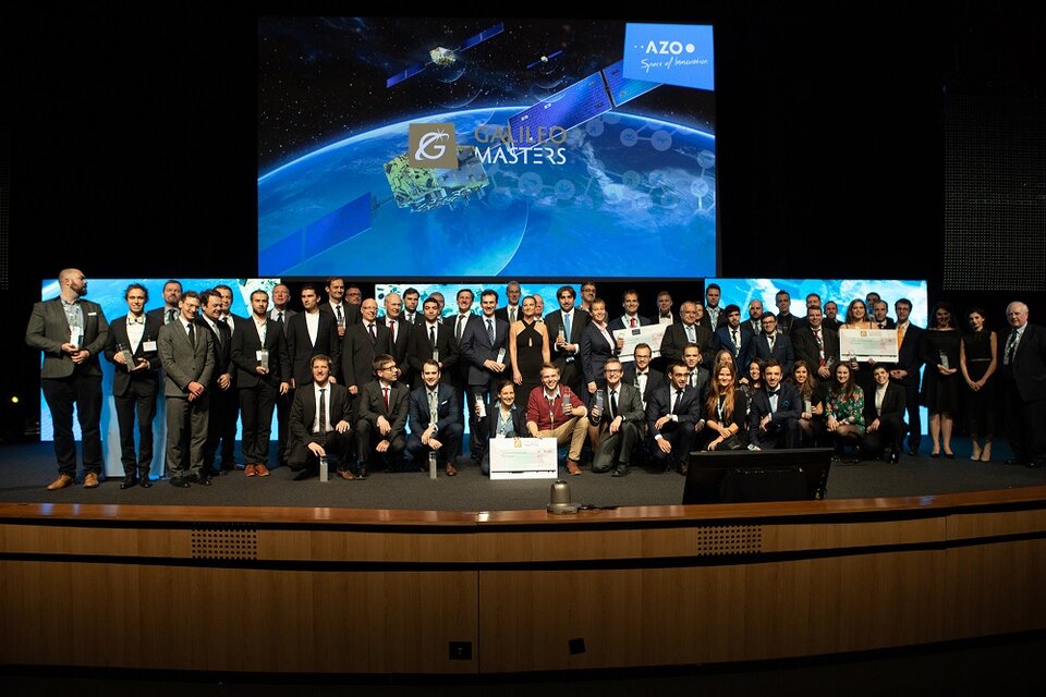
The competition, also named the Galileo Masters, annually rewards the best services, products and business ideas using satellite navigation in everyday life. Its mission is to spur the development of market-driven applications based on satnav technologies.
For 15 years, the competition has shown that satnav technologies are opening the door to myriad applications, with more than 11500 participating developers from global partner regions.
More on ESNC and the other winners here.
More on ESA´s Technology Transfer Programme and its Business Incubation Centres here.
