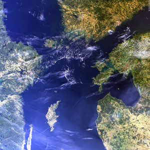
Finland, The Baltic Sea - MERIS - 31 May 2002
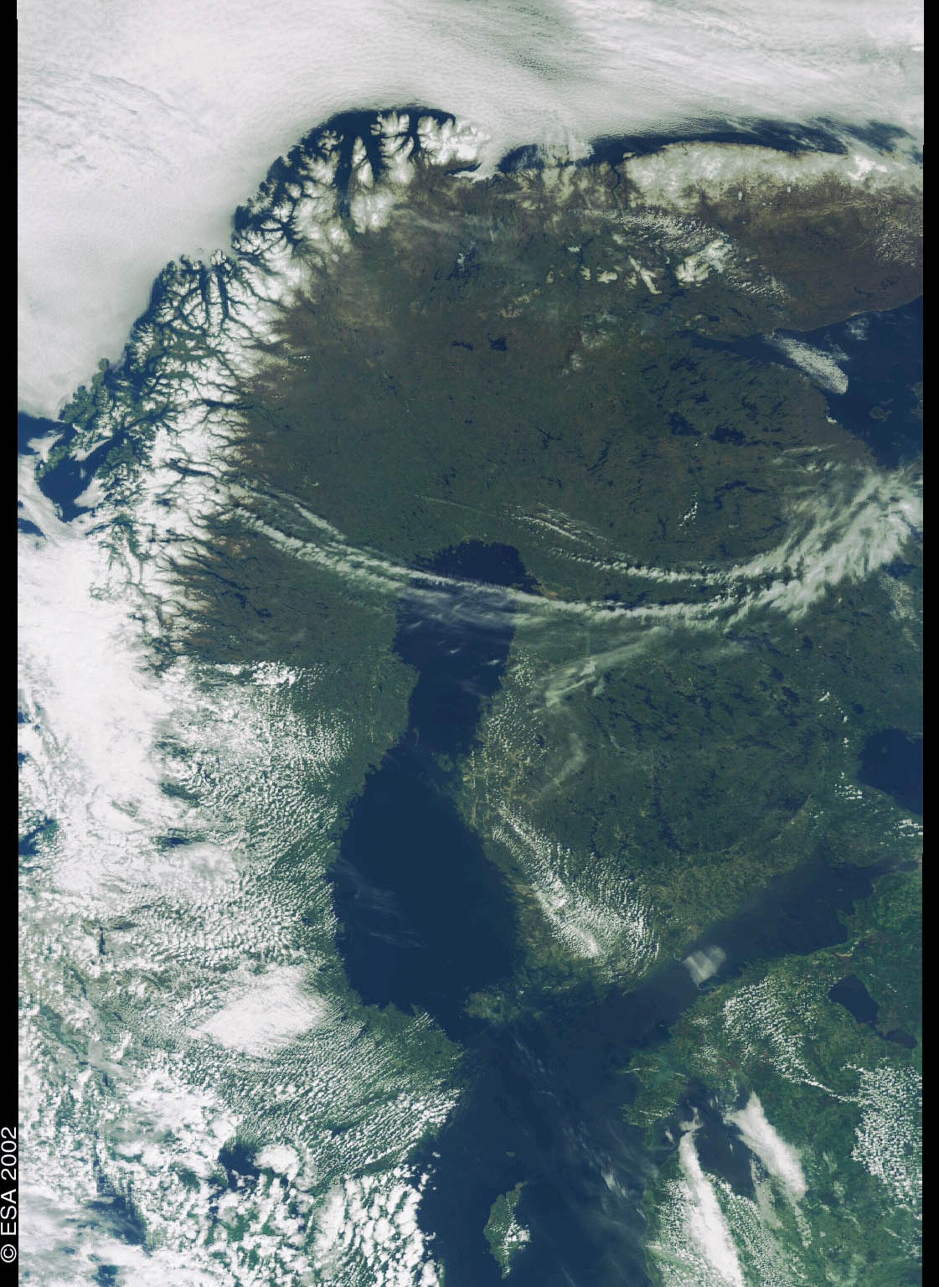
This MEdium Resolution Imaging Spectrometer (MERIS) image shows the northern part of the Baltic Sea and the surrounding Scandinavian countries. On the left, Sweden and Norway can be discerned through an uneven layer of clouds. The eastern arm of the Baltic Sea is the Gulf of Finland. It separates Finland, at the top, from the Estonia, at the bottom. It also provides Russia with an access to Baltic Sea via St. Petersburg, located at the very end of the Gulf, on the right edge of the image.
Each year in the spring, important phytoplankton blooms occur in these biologically active waters with important consequences for the local fisheries. Phytoplankton are at the beginning of the chain food in the world’s oceans and their presence is crucial for fish growth and survival.
Operational services routinely provide fishery companies with chlorophyll concentration maps. These maps indicate the presence of phytoplankton and are used in area like the Indian Ocean for tuna fishing, resulting in better identification of auspicious fishing areas and a better natural-resource management. MERIS will provide three important water quality indicators on a global scale: the concentration of chlorophyll pigments, yellow-substance absorption (characterizing the optical properties of decaying biological matter in the water), and suspended sediments concentration (particles mainly originating from rivers runoff, terrain erosion and tide motions).
Technical Information:
Instrument: MEdium Resolution Imaging Spectrometer (MERIS)
Date of Acquisition: 31 May 2002
Orbit number: 01307
Instrument features: Reduced Resolution image (1200-meter resolution)