Agency
SAC-C imagery helps assess flood damage in Santa Fe city
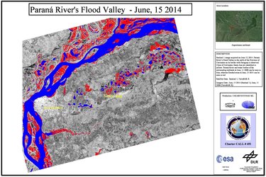
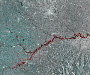
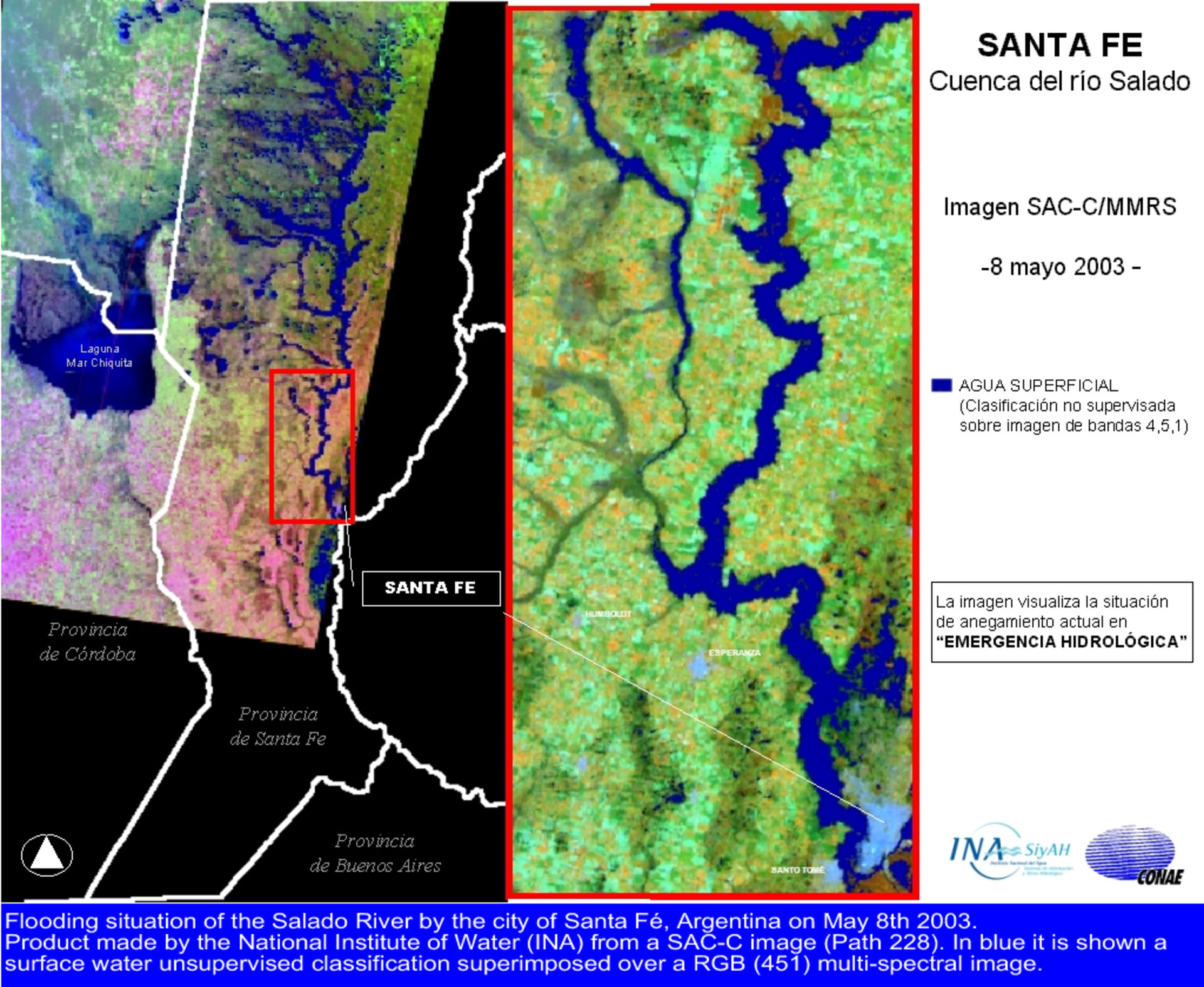
When Argentina's River Salado Norte flooded its banks in May 2003, the nearby city of Sante Fe was badly affected. SAC-C imagery was quickly processed to provide accurate spatial information on the disaster area to civil protection decision makers along with the country's National Water Institute. Surface water is shown in blue. Now Argentina's CONAE space agency has signed up to the International Charter on Space and Major Disasters, SAC-C will join other Earth Observation spacecraft that can assist in emergency situations worldwide.