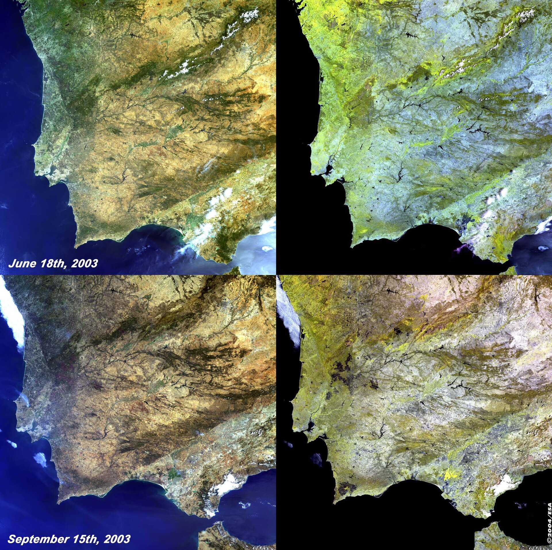
Algarve Fires - MERIS, 18 June and 15 September 2003
This series of MERIS (MEdium Resolution Imaging Spectrometer) images taken from the start and end of the summer last year clearly shows the effect that the numerous fires had on the country's landscape.
Two images are shown from two dates. The top two images from June first show a simulated true colour image, and then a false colour image using bands in the Near Infrared (NIR) to highlight differences in land cover. The true colour images shows much greenery as what would be expected at this time of year. Healthy vegetation is displayed in the more yellow tones on the false colour image.
Then compare these two images with those below taken in September after a number of fires had destroyed acres of land. After the long summer the land has dried out and appears much less green. In the Algarve fires continue to burn, as seen by the blue/white plumes, these also exist just north of Lisbon. Now if we look at the false colour NIR image we can see the effect that the fires have had on the landscape. The brighter yellow tones are less apparent, but more importantly we see these dark "burn scars" particularly notable is the one in the Algarve, but also to the north east of Lisbon. Smaller scars are visible all over the country.
Technical Information:
Instrument: MEdium Resolution Imaging Spectrometer (MERIS)
Dates of Acquisition: 18 th June and 15 th September 2003
Orbit number: 06790
Instrument features: Full Resolution image (300 - metre resolution)
Coordinates:
NE Lat/Long: N 41.30 / 2.52 W
NW Lat/Long: N 42.55 / 9.34 W
SW Lat/Long: N 36.74 / 10.86 W
SE Lat/Long: N 35.54 / 4.56 W