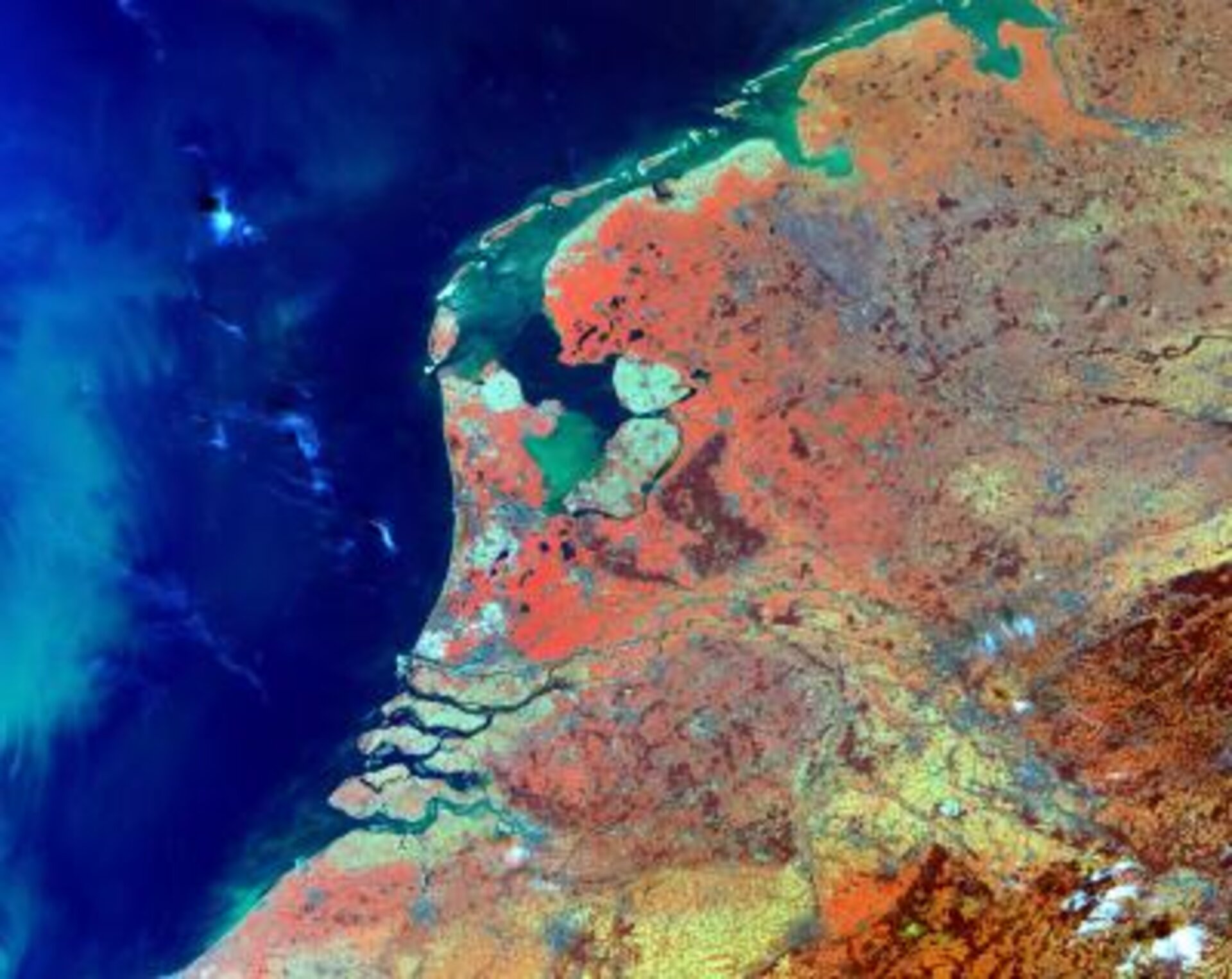
View of the Netherlands from the MERIS instrument on-board ENVISAT
A 300-metre resolution view of the Netherlands from the MEdium Resolution Imaging Spectrometer (MERIS) on-board ENVISAT. Vegetated area can be identified in the red hue. Amsterdam, Rotterdam and The Hague are clearly visible in grey. On the left of the image, in the North Sea, in green, suspended sediments carried by the Thames can be distinguished. MERIS covers the Earth in 3 days, in 15 spectral bands spanning from 400 to 1000 nanometres. Through its observation of water colour, MERIS makes a major contribution to scientific projects that seek to understand the role of the oceans and ocean productivity in the climate system, and further increases our ability to forecast changes through modelling. Secondary objectives are directed towards improving our understanding of vegetative processes as well as atmospheric phenomena associated with clouds, water vapour and aerosols.