Applications
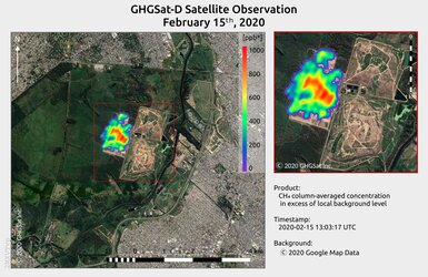
Methane plume from oil & gas infrastructure in the Caspian Sea region
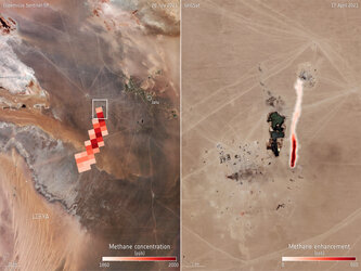
Captured by GHGSat’s Claire mission on 21 May 2020, this image shows methane emissions from an onshore oil & gas facility in the Caspian Sea Region. GHGSat is a New Space initiative that draws on Copernicus Sentinel-5P data for mapping methane hotspots. Its Claire satellite has now collected more than 60 000 methane measurements of industrial facilities around the world.