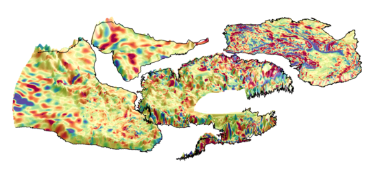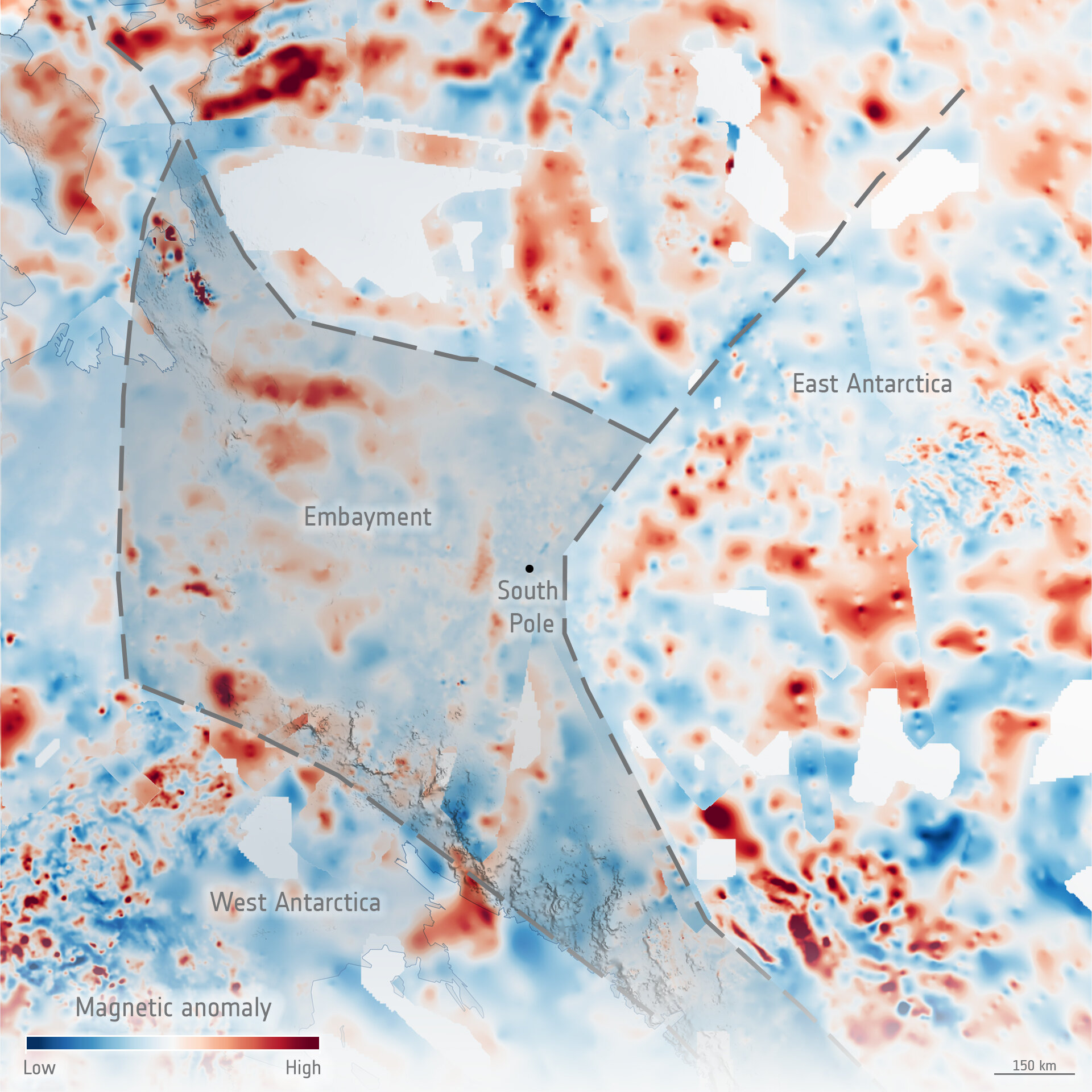
Patterns of magnetic rocks and embayment under the ice in East Antarctica
It’s very difficult to know what lies beneath a blanket of kilometres-thick ice, so it is hardly surprising that scientists have long contested the shape and geology of the ancient supercontinent from which East Antarctica formed over a billion years ago. An ESA-funded study called PolarGAP can now lay some of this conjecture to rest. Using sensors on aircraft to measure changes in the gravity and magnetic signatures of the different rocks under the ice, scientists have discovered a huge bay the size of the UK formed part of the edge of East Antarctica. The newly revealed patterns of highly magnetic rocks (shades of red), and areas where these rocks appear to be missing, led PolarGAP researchers to determine that a large embayment fringes the ancient rocks of East Antarctica. The embayment may have first formed when a huge supercontinent called Rodinia was breaking apart and the vast Pacific Ocean forming.
Read full story: Filling the GOCE data gap unearths South Pole’s geological past