

Harnessing satellite data for sustainable development in Africa
Earth observation data open up a world of possibilities to strive towards the United Nations' Sustainable Development Goals (SDGs). But global goals require local action, and it can be difficult for smaller organisations and government agencies – especially those in the global south – to access such data.
The NGO Global Partnership for Sustainable Development Data (GPSDD) is a global network dedicated to expanding the availability of information, including Earth observation data from the Copernicus Sentinel satellites. Their aim is to achieve social impact by ensuring that data can be used to their fullest potential by nations, businesses, civil society groups, and citizens.
GPSDD recently won a Group on Earth Observations Sustainable Development Goals (GEO SDG) award that recognised their efforts to promote collaboration around an open-source platform embedding the use of Earth observation data for better decision making on sustainable development.
Looking to meet demand for analysis-ready Earth observation data, GPSDD brought together a coalition of expert partners to establish the Africa Regional Data Cube (ARDC*). This open platform comprises 17 years of satellite data, available along with problem solving support, capacity building and peer learning activities.

Access the video
Developing the ARDC involved translating satellite data into ready-made information to help Ghana, Kenya, Sierra Leone, Senegal and Tanzania address issues related to agriculture, food security, deforestation, urbanisation, water access and much more. In doing this, GPSDD bridges a key gap: although space agencies and organisations offer Earth observation data freely and openly, the expertise and platforms required to access them present a challenge.
Since its launch in 2018, the ARDC has been making it easier to include satellite data in a variety of projects. While data from NASA's LANDSAT programme formed the basis for the ARDC, the more recent incorporation of Copernicus Sentinel-1 data was a significant development.
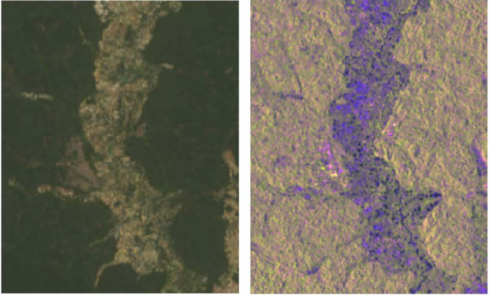
"Including data from Copernicus Sentinel-1 was more than just adding more of the same information. It complements the LANDSAT data from NASA, and can look through clouds, allowing for more consistent observations under any weather conditions," says Ken Mubea, User Engagement Manager at Digital Earth Africa, an evolution of the ARDC.
Adding this data from the ESA-developed satellite mission to the already-integrated data from NASA improved the ability of the ARDC to capture deforestation and land degradation. It both reinforced the strengths and compensated for limitations in the data already in use.
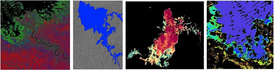
Two of the many diverse projects in which the Copernicus Sentinel-1 data have been used are monitoring illegal mining and crop development. Illegal mines in Ghana were previously difficult to identify, but the data in the ARDC, particularly the ability to compare land changes over time, are now helping detect areas where mining is taking place. Meanwhile, climate change and other external forces are threatening the livelihoods of large pastoral communities in Senegal that rely on agricultural production and crop yields for survival; with the ARDC, communities can better monitor vegetation cover and evaluate how it changes over time.
"We've really empowered these institutions we've been working with — some of them never expected to have access to this kind of data,” adds Ken. "Beyond providing the data, our role is to help institutions and governments talk to each another in a way they haven't before. The data provide the connecting point that wasn’t previously there."
While the Africa Regional Data Cube's successes are already exciting, there is much more to come. The lessons learned from it are currently being incorporated into Digital Earth Africa – an evolution to a fully operational, continent-wide service. Digital Earth Africa will use space data, including from Copernicus Sentinel-1 and -2, to support all of Africa to tackle national development priorities and global challenges.
*The ARDC supports open data cube (ODC) access and capacity building. The ODC seeks to increase the value and impact of global Earth observation satellite data by providing an open and freely accessible exploitation architecture. It is an Open Source Geospatial Data Management and Analysis Software project that helps users harness the power of satellite data. At its core, it is a set of Python libraries and PostgreSQL database that helps users work with geospatial raster data.