ESA Navigation projects
Satellite navigation systems are changing the way in which we travel from place to place whether by land, sea or air and whether in remote areas or through congested city streets. Within a few years, mobile phones will incorporate global positioning receivers as standard. The combination of being able to send a text message by mobile phone together with your precise location will have far reaching implications.
The European Space Agency supports the development of many of the innovations in satellite navigation technology. The various projects span a wide range of applications:
- Location Based Services (LBS) and Personal Mobility
- Road
- Rail
- Maritime
- Aviation
- Multi-modal Transport and Remote Asset Tracking
- Emergency Management and Law Enforcement
- In-door Positioning
- Technology and Facilities Development
Location Based Services (LBS) and Personal Mobility
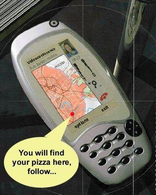
The day is almost here, for example, when you will be able to use your mobile phone equipped with satellite navigation receiver to find your way when entering an unfamiliar city. You will be able to send your requirements (for example, nearest parking space, pizza restaurant or whatever) via text message to a service provider, who will use your position to determine the nearest facility to you. The service provider will check on availability – perhaps even book a table or parking space for you – before automatically sending a map for display on your phone which shows your position and how to get to what you want.
Road
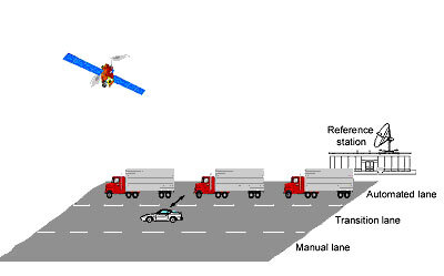
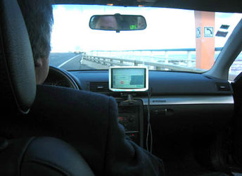
Satellite navigation will help regulate road use and minimise traffic jams. If all vehicles are fitted with a navigation satellite receiver and a data transmitter, their position can be relayed automatically every few seconds to a central station. This information can then be used in a number of ways to control road usage. It could, for example, be used to charge motorists for using a stretch of road, to restrict access to congested roads, or to inform drivers of congestion and suggest alternative, quieter routes.
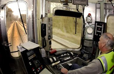
Rail
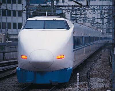
Due to ongoing developments (EGNOS, GALILEO), satellite navigation is about to become an interesting innovation for all fields of transport. One of them is the railway domain, which could considerably profit from the implementation of autonomous on-board positioning systems. Especially for local and regional railway lines, there are various possible applications which could enable a cost-effective modernisation and increase of efficiency.
However, train control poses high demands on positioning with respect to availability, reliability and integrity. These requirements can only be fulfilled by means of integrated positioning systems which combine GNSS with other sensors.
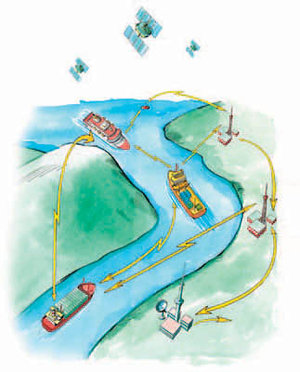
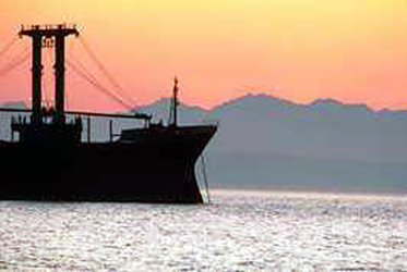
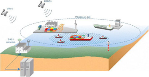
Maritime

The sea and waterways are the most widely used mode for transporting goods worldwide. A wide variety of vessels moves around the world each day. The efficiency, safety and optimization of marine transportation are key issues. EGNOS and Galileo will be a fundamental tool for bringing innovation and progress in navigation and many other marine activities such as fishing, oceanography and oil and gas exploitation. Satellite navigation benefits all maritime applications, including leisure boats, commercial vessels, and unregulated and Safety of Life at Sea (SOLAS) regulated ships. Each application will take advantage of the new characteristics offered by EGNOS and Galileo: increased accuracy and integrity, certified services and high availability.
EGNOS and Galileo will be used in every phase of marine navigation: ocean, coastal, port approach and port maneuvers, under all weather conditions.
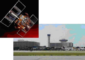
Aviation

When planning aircraft routes and landing schedules at busy airports, it is essential to ensure that aircraft are always a safe distance from each other. "The trouble is you don’t always know where the planes are, so you have to leave a very large safety margin," says Hans Fromm, former Deputy Head of the Navigation Department at the European Space Agency (ESA). "But if you could be confident of knowing precisely where the planes are, you could reduce the margins safely and increase capacity," he adds. EGNOS and Galileo, the satellite navigation system under development in Europe, will provide a guaranteed service with sufficient accuracy to allow airlines and pilots to know their position reliably and precisely enough to make substantial efficiency savings.
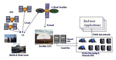
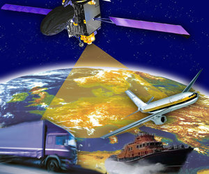
Multi-modal Transport and Remote Asset Tracking
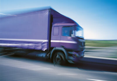
Applications concerned with multi-modal transport and remote asset tracking deal with the possibility of managing fleets or keep track of dangerous goods in many different domains (aviation, road, maritime, rail…). The key advantage of the Fleet Management Solution is that the end user reduces costs and improves customers' service.
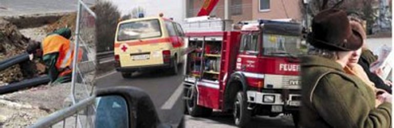
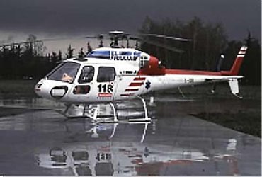
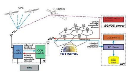
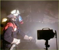
Emergency Management and Law Enforcement

Satellite navigation is already widely used to locate life rafts lost at sea or to keep tabs on explorers heading for isolated and little-known parts. A mobile phone equipped with standard navigation satellite receiver, however, could soon become an everyday item for the elderly or disabled. The knowledge that their precise location will be relayed automatically with a SOS phone message will increase their confidence to get out and about.
Crisis and emergency situations require a joint, coordinated effort by several teams, sometimes in particularly severe environments. In major disasters like earthquakes, floods, landslides and forest fires, the transport and communications infrastructures are probably unavailable, while roads, power lines and water distribution may be damaged or even destroyed. The basic infrastructure itself often has to be restored before aid can be brought to the victims.
Successful relief operations rely on the co-ordination of real-time information on topography, hazard maps, and alternative sources of power, water and any other urgent need. This co-ordination would be provided by a relief organisation control centre, based on pre-disaster information, integrated with updates coming from position data and satellite images.
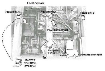
In-door Positioning
GPS has become an emerging and important positioning source for a wide range of applications, many of which going much beyond the traditional transport sector, i.e. personal mobility including dense urban, indoor, and outdoor applications. Practically all of the current applications rely on the GPS signals, sometimes also exploiting regional or local augmentations to increase accuracy. As applications also move into safety-critical areas where service reliability is of concern, users and services providers alike are becoming aware of the importance of service qualities and ultimately service guarantees.
Although GNSS is capable of providing accurate location in areas where the satellite signals are available, this is unlikely to be the case inside buildings, hence, if exploited, indoor navigation is not only a promising market but also seen as an essential local area augmentation for GPS, EGNOS, and Galileo.
Technology and Facilities Development

Applications regarding technology and facilities development are concerned with the broad concept of providing aid and exploiting tools to other applications. For example, data collections can be performed and broadcasted in various formats to make it available to different positioning technologies.