
Navipedia celebrates 200 000th visit
Navipedia, the web’s leading resource on satellite navigation, passed more than 200 000 visits this summer.
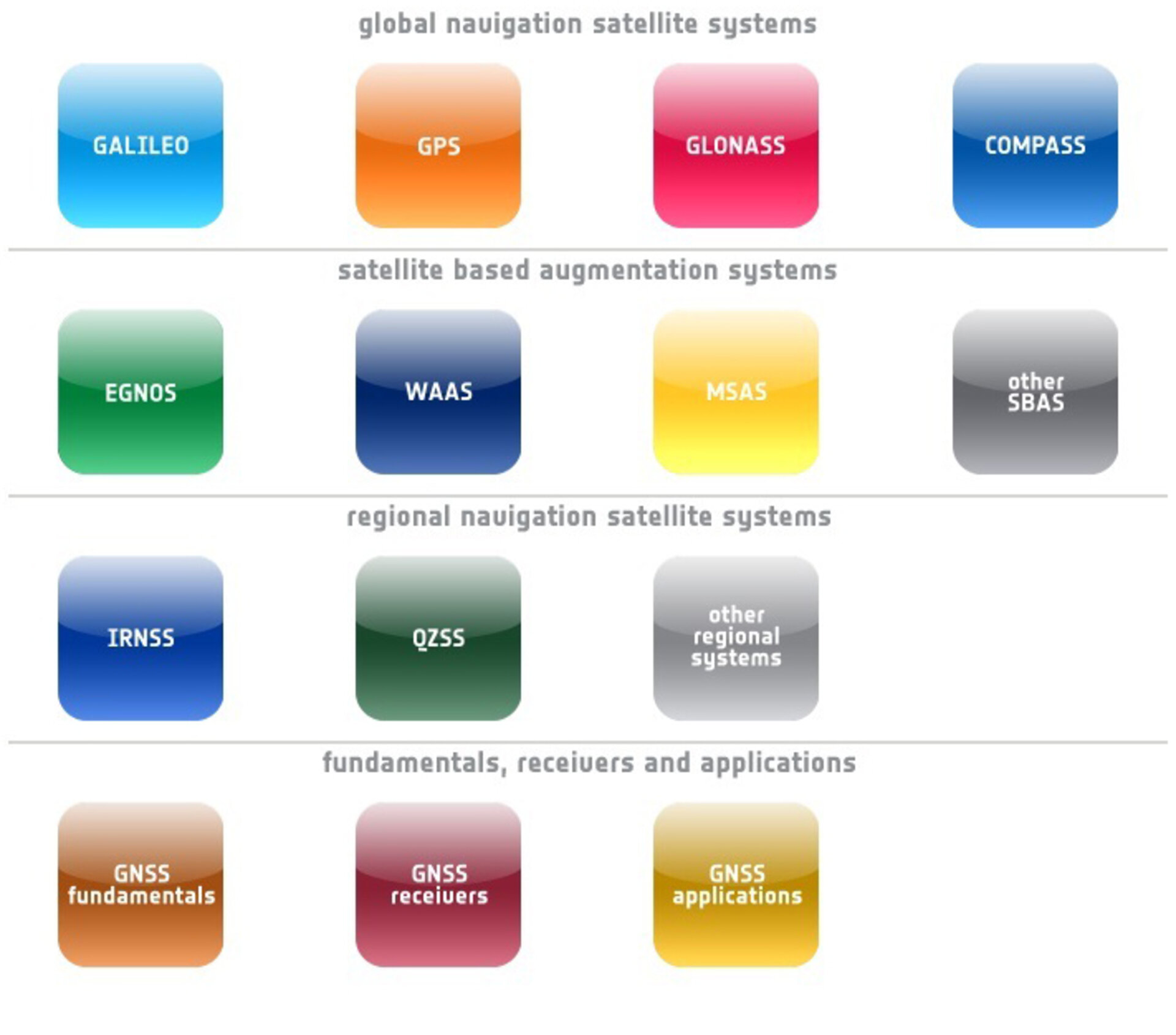
The wiki-based website was set up by ESA last year as a one-stop shop for satnav information, ranging from fundamental principles to practical applications and details of the various satnav systems in operation – including ESA’s own Galileo constellation.
The site has grown to encompass more than 400 separate articles, with new texts added and updated regularly.
The site’s dynamic nature reflects the constantly evolving domain of Global Navigation Satellite Systems (GNSS), with various constellations under construction and new applications being unveiled all the time.

Following the Wiki (‘What I know Is’) template, the website can be contributed to by knowledgeable members of the external public, with an ESA technical editorial board to ensure the information is accurate and reliable. Visitors can also register to join discussions, or post requests for articles to be drafted.
“Our 200 000th visit came earlier this summer,” explained Javier Ventura-Traveset, responsible for the development of Navipedia and in charge of managing GNSS education activities for ESA.
“Navipedia was already developed to provide a single online source of reliable and current GNSS information, in place of quickly outdated text books or scattered websites. The aim is to serve a wide range of users, from GNSS institutions and industry to academia and the public interested in knowing more.
“Navipedia articles have therefore been classified into three categories: basic, medium and advanced. It’s an approach that seems to be working – the site has established a solid community around it, and the demand for knowledge keeps on growing.
“We are pleased to see that Navipedia has become a true and reliable reference for GNSS knowledge on the Internet, being extensively used by Universities and GNSS industry.”
Ten facts about satellite navigation:
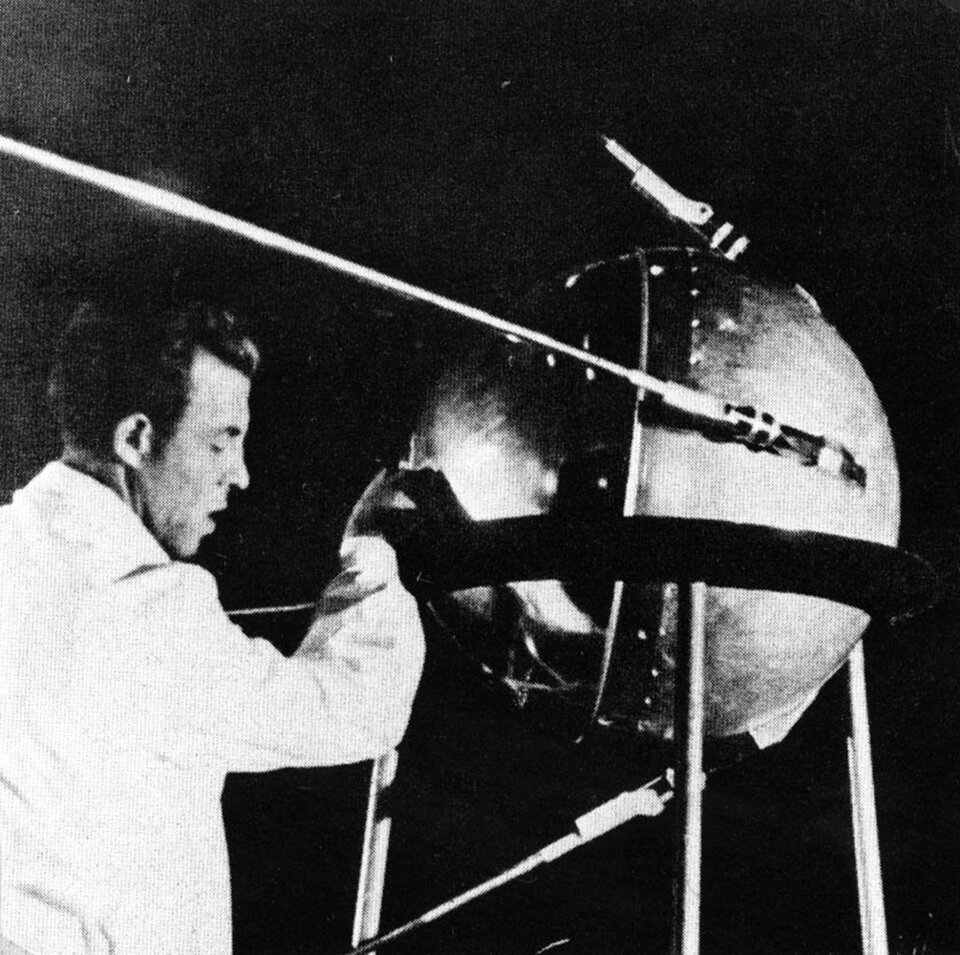
1. The US Transit military satellite, launched in 1960, was the first operational navigation satellite, based on Doppler-based ranging. Its operating concept came from Sputnik: when scientists managed to deduce the satellite’s orbit from the Doppler-shifting of its signal, they realised the same principle would work in reverse on the ground if the satellite’s orbit was already known.
2. Modern GNSS satellites are based on the principle of ranging: each satellite emits a signal containing the time it was transmitted – accurate to 1000 millionths of a second, using atomic clocks – and the satellite’s orbital position. Because the speed of light is known, the time it takes for the signal to reach a receiver can be used to calculate the distance from the satellite. Combining signals from a minimum of four satellites pinpoints the user’s horizontal and vertical location.
3. The first US GPS satellite was launched in 1978. The first flight tests of Russia’s Glonass system began in 1982, with both the GPS and Glonass constellations being completed in the mid-1990s.
4. During the 1990s civil GPS readings were intentionally degraded, and could be incorrect by as much as a football field (100 m). In May 2000 this ‘Selective Availability’ was turned off: civil GPS accuracy improved tenfold, benefiting civil and commercial users worldwide.
5. Europe’s first navigation satellite was ESA’s GIOVE-A, launched in 2005. It tested key hardware for the Galileo constellation, measure the radiation environment in medium-Earth orbit and secure frequency bands for the upcoming Galileo.

6. ESA’s second test satellite, GIOVE-B, launched in 2008, had the distinction of flying what was the most accurate atomic clock ever for satellite navigation: its Passive Hydrogen Maser design is accurate to one second in three million years. The same clocks are flown, along with rubidium clocks for redundancy, on the initial four Galileo satellites launched in 2011 and 2012.
7. Galileo, GPS and GNSS aim to be fully interoperable – they can be used in combination by user receivers to provide better performance than any single system. Interoperability should be particularly important in ‘urban canyons’ and other locations when much of the sky is obscured, meaning fewer satellites are available at any point. Technical discussions began some 15 years ago to achieve interoperability.
8. Each GNSS employs its own coordinate reference frame for Earth’s surface. Two GNSS are said to be interoperable from a reference frame perspective if the difference between the frames they employ is below the target accuracy. As an example, the GPS coordinate reference frame is WGS84 whereas Galileo uses Galileo Terrestrial Reference Frame; their difference is expected to be within 3 cm, hence guaranteeing interoperability for most applications.
9. Each GNSS also has its own time standard, independent of the international civilian time standard: Universal Time Coordinated/ Atomic Time (UTC/ TAI). Although GPS Time and Galileo System Time are expected to be within the nanoseconds order of magnitude, the service providers have agreed to broadcast the GPS/ Galileo time offset which can then be used by the receiver.
10. This year is predicted to be the last that personal navigation devices within cars for road navigation remain the single most popular product with embedded GNSS technology. Although this market continues to grow, it is set to be eclipsed by GNSS-equipped smartphones.
