
Humanitarian Aid
The GSE Humanitarian Aid (Respond) is an alliance of European and International organisations working with the humanitarian community to improve access to maps, satellite imagery and geographic information.
The users of the consortia’s products and services represent a diverse ‘family’ of charities, international organisations, and government institutions. While there is a real requirement for geographic information these users have little or no interest in satellites, raw imagery or processing methods.
Respond aims to provide geographic information in an easily understandable and useable format for these users.
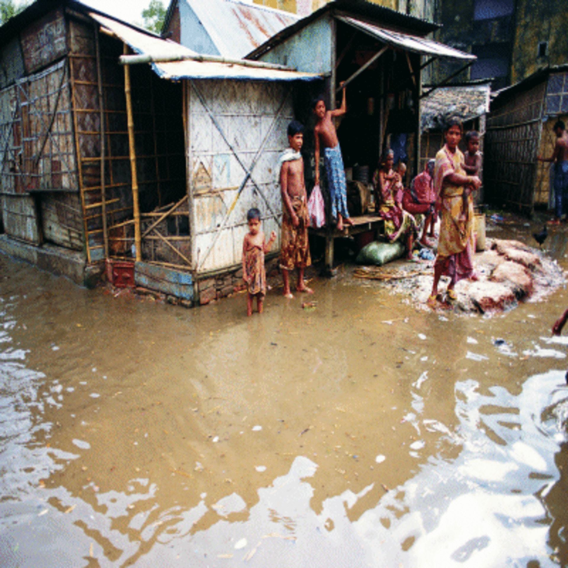
Geographical information, such as that provided by Respond helps aid agencies get aid to people that need it as quickly as possible
By June 2005 the Respond consortium has already achieved the following (at June 2005):
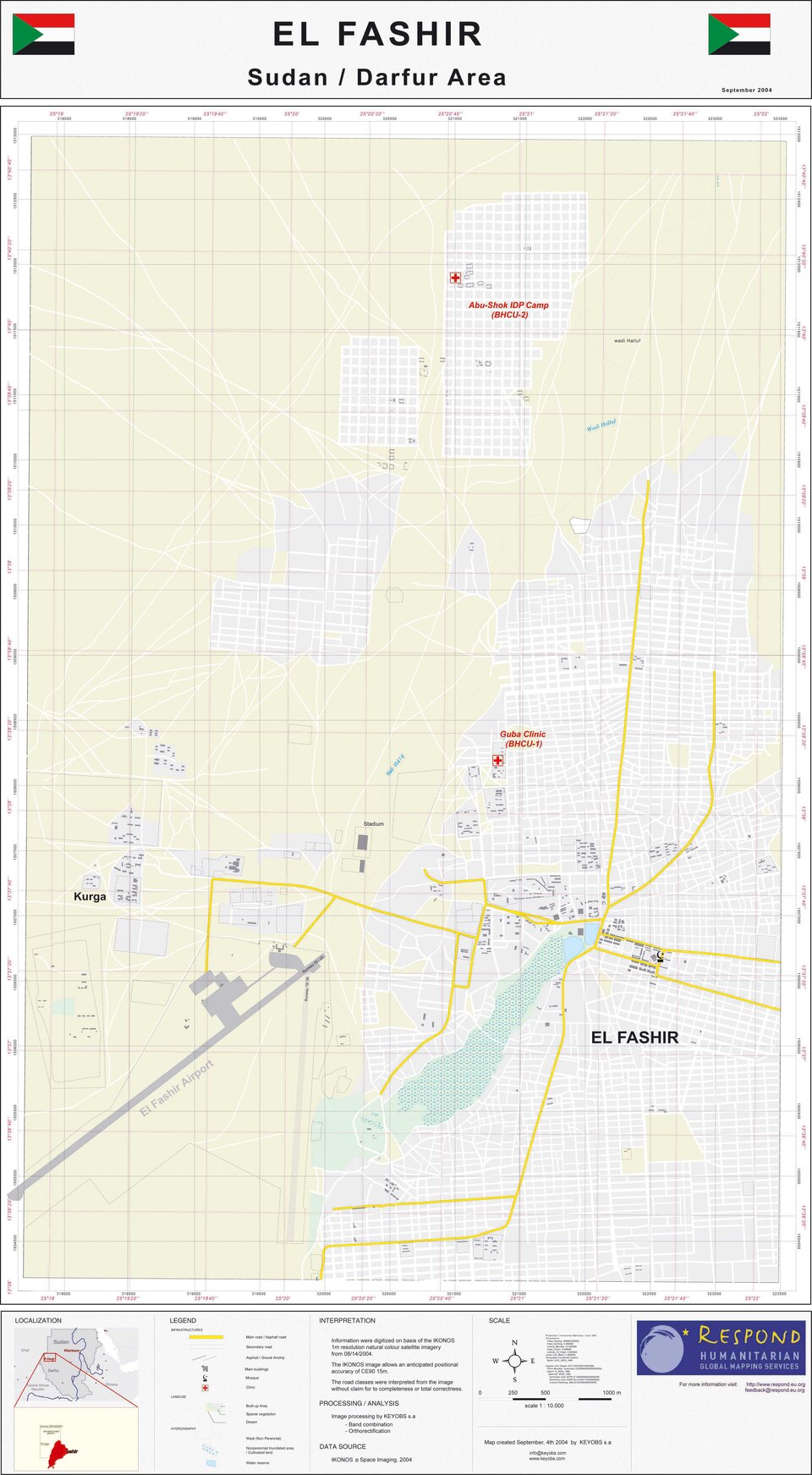
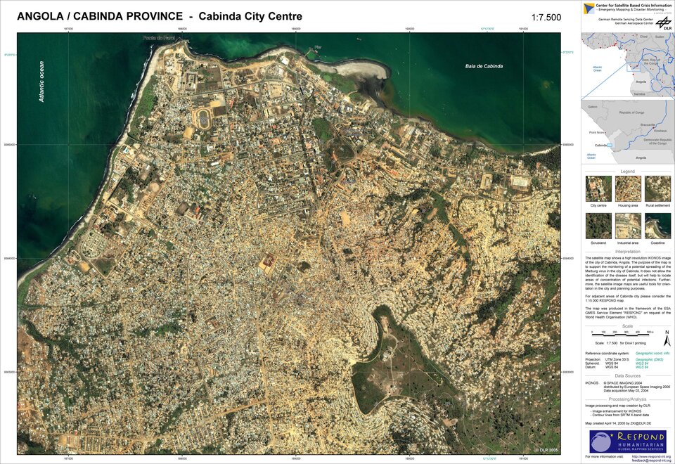
Some 130 discrete mapping products have been produced funded or associated with Respond. The majority of products have been produced in response to Darfur and the Tsunami, along with products related to specific fast onset crises;
214 Products were produced by Respond partners in the 4 weeks following the Asian Tsunami of December 26 2004, 49 with a Respond logo. This shows the capacity of the consortium to proved a high volume of service at times of crisis;
- Respond partners have produced nearly 400 crisis mapping products in around 25 charter activations.
Services
1. Basic maps (digital, paper, using both EO (earth observation) and non-EO sources.
The products within this service consist of core information, standard mapping, population density, infrastructure, logistical information etc. Also included here is the production of high resolution maps for crisis situations and pro-active mapping of hotspots/areas likely to suffer from natural disasters/crises
2. Crisis and damage mapping
The products within this service include Emergency mapping and general damage assessment and value added products from the international Charter ‘space and major disasters’, also included in this service are post disaster recovery maps, and rapid mapping for crises (non-charter).
3. Situation maps
This service includes products such as peacekeeping GIS and maps, security maps, planning of contingency operations and operations coordination maps.
4. Refugee/IDP support maps
Products included in this service are used for Refugee/IDP camp siting, Refugee/IDP camp GIS and maps, needs assessment and environmental impact maps which include information such as availability of resources such as fuel.
5. Thematic maps
-
Prevention/ Reconstruction
Planning purposes – products include hotspot risk mapping, vulnerability mapping, general coping capacity, resilience, natural and man-made crisis planning maps, food aid planning maps, reconstruction planning maps. -
Health Maps
Products include health GIS and maps, online health mapping, and epidemic vector control mapping. -
Environmental impact assessment maps
Products include identification of easy to reach hydro-geological water sources and other resources, and post-conflict environmental assessment.
6. Communication reporting includes information for reporting and communication
Post crisis and graphics to illustrate the situation. The atlas of forgotten crises is also included in this service.
7. Alert Services
Including hazard forecasts and global disaster alert systems
Field Services/Training service (Additional service)
This includes in field mapping where humanitarian crises occur, data collection and mapping of roads, settlements etc and training of Humanitarian aid workers in the use of maps and GIS.
User feedback & Involvement
A total of 32 service utility reports have been received over the first 10 months of the Respond project. These reports form the core of the formal feedback regarding Respond products and services. The project consortium has also received a large amount of positive informal feedback. Of the 32 service utility reports 29 described Respond products as “A key input”, “very useful” or “useful”.
“We had reports of bombardment some 15km from our position. Using the only map that was not taken from us at Sudanese customs, we verified our staff evacuation plans – saving expensive helicopter time and keeping us working”. THW
“It enabled us to make contingency planning for possible relocations of our Health facilities. It also enabled us to better plan outreach health services in town areas of high risk and home visits for Primary Health Care services. Excellent document!”. DRK
“Until then we had no map of the operational area whatsoever! It showed the area vital for us since the sub-delegation was located in Abeche and regular travel between both locations was necessary in very difficult climatic conditions. The map enabled us to pre-plan supply routes, access routes and logistics ex airport”. DRK
“50+ maps were produced during the exercise that depicted relevant phases of the exercise play. These maps played an important role in central briefings, individual briefings, Exercise Control, and for use as navigation aids for exercise players.” UK DfID (CHAD) following the Triple04 Exercise
“The vegetation imagery and processing provided by UNOSAT and Respond was essential to conduct spatial analysis and assign cooking fuel priorities to settlements and IDP camps.” United Nations Joint Logistics Centre.
The target users are European and international organizations involved with Humanitarian Aid, Peace Keeping, Disaster Reduction and International Development, for activities concerning areas outside Europe.
Complementary projects – EC/National
The EC Framework 6 Network of Excellence GMOSS is establishing many of the research issues associated with the use of EO for Security and Humanitarian Aid. The EC have recently Tendered for a full Integrated Project in this area and Respond members are heavily involved with LIMES consortium, managing the humanitarian aid theme.
The EC FP6 IP Preview is related in that it is dealing with flood and fire monitoring in the European arena. The British National Space Centre have also funded the "Raising In-sector Awareness of Geo-information Applications for Humanitarian Aid", which has allowed the Respond team to produce promotional materials and to federate new users, especially the Asian Development Bank and the World Bank.
Organisations working in the Humanitarian Aid sector:
European:
DG RELEX - the Directorate General for External Relations of theEuropean Commission plays a pivotal role in the development of an effective and coherent policy for external relations policy for the European Union. DG RELEX is responsible for the development and follow-up of a range of policies, some of which are linked to emergency instruments such as civilian crisis management and rapid reaction mechanism.
DG ECHO - the Commission's Office for Humanitarian Aid delivers humanitarian assistance and relief to the victims of natural disasters or armed conflict outside the European Union
DG ENV/ MIC - the Monitoring Information Centre of the Directorate General for Environment in charge of facilitating emergency rescue and relief activities at European level through the mobilisation of civil protection assets in the Member States for disasters and crises occurring within and outside the European Union territory.
United Nations :
UN Office for Coordination of Humanitarian Affairs (OCHA)
The UN High Commissioner for Refugees (UNHCR)
UN Department of Peace Keeping Operations (UNDPKO)
United Nations Development Programme (UNDP)
United Nations Joint Logistics Centre (UNJLC)
United Nations Office of Project Services (UNOPS)
United Nations Institute for Training and Research (UNITAR)
United Nations Children Fund (UNICEF)
UN Organization for Education and Science (UNESCO)
United Nations World Food Programme (WFP)
International:
International Federation of Red Cross and Red Crescent Societies (IFRC)
World Health Organisation (WHO)
World Bank
Asian Development Bank
Donor organisations
National:
Civil Protection Agencies
Ministries of Internal Affairs/ Civil Protection Department
Development and Aid agencies (e.g. Germany’s Techniches Hilfswerk THW)
International / National / Local:
Non Governmental Organisations (e.g. German Red Cross)
The users connected directly with the project are:
The Directorate General for External Relations (DG RELEX) of the European Commission;
The Humanitarian Office of the European Commission (ECHO);
The Directorate General for Environment / Monitoring Information Center of the European Commission (DG ENV/MIC);
The Office for the Coordination of Humanitarian Affairs (OCHA) – is the branch of the United Nations which aims to mobilse and coordinate effective and principled humanitarian action in partnership with national and international actors;
The United Nations High Comissioner for Refugees (UNHCR) - the UN agency mandated to lead and co-ordinate international action to protect refugees and resolve refugee problems worldwide;
World Food Programme (WFP) – the food aid arm of the UN, WFP uses its food to meet emergency needs and support economic and social development;
The United Nations Office for Project Services (UNOPS) – manages project resources to help developing countries and countries in transition;
International Strategy for Disaster Reduction (ISDR) – aims to build disaster resilient communities by promoting increased awareness of the importance of disaster reduction;
Technisches Hilfswerk (THW) the governmental disaster relief organisation of the Federal Republic of Germany;
Deutsches Rotes Kreuz (DRK) – DRK is the German arm of the International Red Cross organisation
Asian Development Bank (ADB) – a multilateral development finance institution dedicateed to reducing poverty in Asia and the Pacific;
- The AlertNet NGO community (300+ NGOs).
RESPOND products are also distributed via the UN HICs (Humanitarian information centres) and via the Internet (e.g. via www.respond-int.org) hence the total number of users is unknown as any interested party can access these maps.
Future Visions
In the future Respond aims to move towards operational funding mechanisms and self-governence. Full realisation of the service portfolio and expansion of this portfolio according to user requirements and the addition of more proactive mapping to the services are also goals for the near future.
