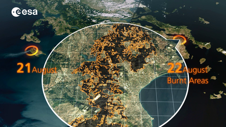
Emergency response
The Copernicus Emergency Management Service aims to reinforce Europe’s capacity to respond to emergency situations, be they caused by extreme weather, geophysical hazards such as earthquakes, or manmade disasters such as oil spills and humanitarian crises.
The C-band synthetic aperture radar on Sentinel-1 can provide images with a resolution of 10 m and within hours of acquisition to aid emergency response.
This imagery can be used for precise terrain deformation monitoring over landslide, seismic or subsidence areas by providing regular and frequent interferometric observations.
It can also support impact assessment for many types of hazard including hydrometeorological and geological events.
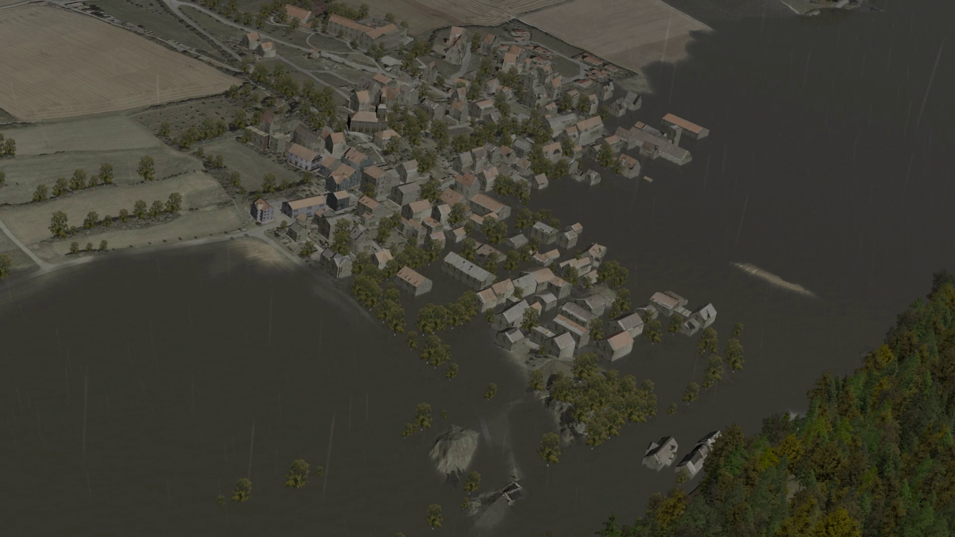
Sentinel-1’s radar ability to ‘see’ through clouds, rain and in darkness makes it particularly useful for monitoring floods. Images acquired before and after a flood offer immediate information on the extent of inundation and support assessments of property and environmental damage.
The mission also provides information on wind and waves, which can be used to track the paths of oil slicks and other pollutants.