
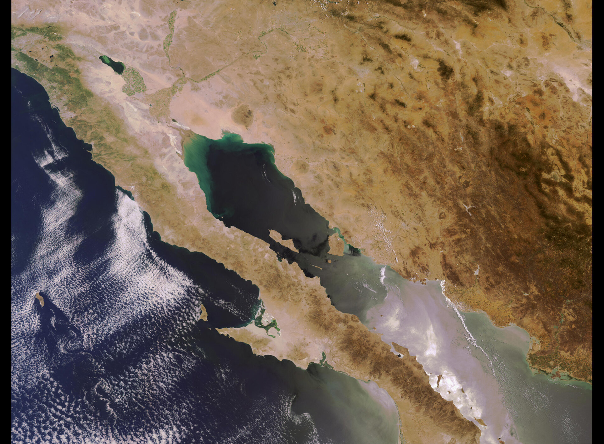
Earth from Space: Baja California Peninsula
Mexico’s Baja California Peninsula, highlighted in this Envisat image, lies at the southern tip of North America and is surrounded by water with the Gulf of California, also referred to as the Sea of Cortés, to the east and the Pacific Ocean to the West.
Baja California, which rides on the eastern edge of the Pacific Plate, was torn away from mainland Mexico by the San Andreas Fault. Tectonic plate movements lifted the eastern edges and sea water filled the lower areas, creating the Gulf of California. Geologists estimate the peninsula has slid north westerly about 300 kilometres over the last four to six million years.
The peninsula, the second-longest on Earth spanning over 1 220 kilometres, is situated in close proximity to the Pacific and North American tectonic plate boundaries, which go up the Gulf of California toward the Salton Sea and the San Andreas Fault. Two other faults, the San Miguel and the Aqua Blanco, run obliquely to the main plate boundary in the northern Baja Peninsula. Geologists say the motion along the faults in northern Baja is between 6 and 8 millimetres per year.
As a result of the close proximity to plate boundaries, Baja has a diversity of landforms, including mountains, canyons and volcanic areas (on land and under the sea), creating a variety of habitats for terrestrial and marine species.
According to the WWF, the Gulf of California hosts 34 species of marine mammals, nearly 900 species of fishes, five species of marine turtles, 4 839 species of marine macro-invertebrates and 626 forms of macro algae. The Gulf is also home to about 530 bird species and serves as a stopover for birds migrating between North and South America.
California Gray Whales also use the area in their migratory travels. Swimming roughly 9 656 kilometres from the Bering Sea beginning in mid-October, they arrive at the warm lagoons of Baja California in December and January. The whales give birth to their young and remain in the lagoons until between February and May when the calves are strong enough to travel. There are three major whale breeding grounds in Baja: Laguna Ojo de Liebre, Laguna de San Ignacio and Bahia Magdalena.
Other marine mammals found in the area include finback whales, humpback whales, bottle-nosed dolphins, California Sea Lions, elephant seals, Guadalupe fur seals and harbour seals.
The mountainous areas of the peninsula are rich in prehistoric cave paintings left behind by native people. The large colourful murals of figures, spirits and animals are so impressive that UNESCO included them on The World Heritage List in 1993.
ESA has been supporting UNESCO in its activities to conserve World Heritage sites since 1993 by providing satellite images over the sites acquired by Envisat. UNESCO uses these images to detect possible risks and to identify ‘safety belts’ around the protected areas.
This image was acquired on 28 May 2006 by Envisat’s Medium Resolution Imaging Spectrometer (MERIS) working in Full Resolution Mode to offer a pixel size of 300 x 300 metres. Full Resolution Mode is used mainly for land cover, agriculture and coastal acquisitions.

