
Earth from Space: Planted patchwork
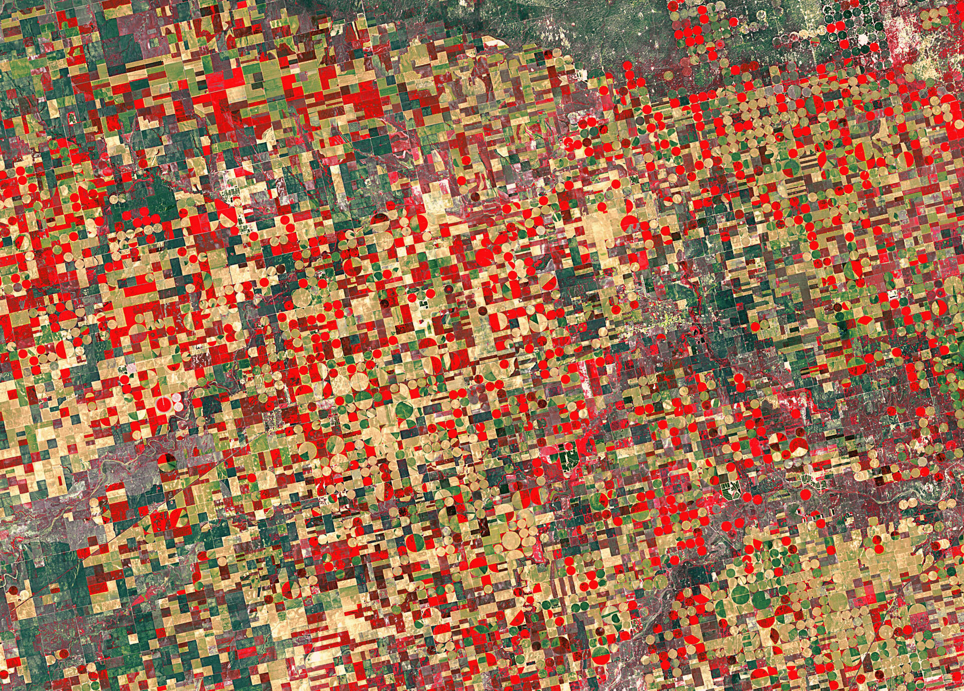
This false-colour Landsat image from 4 May shows agricultural structures in the US state of Kansas.
The Midwestern state’s agricultural outputs include cattle, sheep, wheat, soybeans, cotton, corn and salt. Kansas is also one of the top ten states in US oil production.
The cropland is divided into circles and rectangles due to the different types of irrigation systems.
Circles come from a central-pivot system, where the long water pipe rotates around a well at the centre, while rectangles are made when the pipes are rolled in straight lines across the fields.
The false colour makes vegetation look mostly red and brown in this image, allowing for better discrimination between different vegetation types.
This is helpful when satellite data are used in agricultural monitoring for mapping and classifying land use, crop type, crop health, change detection, irrigated landscape mapping and crop area mapping.
In the bottom right corner, the agricultural patchwork breaks for the Cimarron River. Sometimes, the water in this river disappears entirely under the sand in the river bed.
In the central right portion of the image is the city of Ulysses. Home to about 6000, it sits 65 km north of Kansas’s border with Oklahoma, and 65 km east of the border with Colorado.
The Thematic Mapper on Landsat-5 is jointly managed by NASA and the US Geological Survey. ESA supports the Landsat series as a Third Party Mission, meaning it uses its ground infrastructure and expertise to acquire, process and distribute Landsat data to users.
The Image of the Week is featured on ESA Web-TV, broadcast online every Friday at 10:00 CEST.

