
Earth from Space: Southern Europe
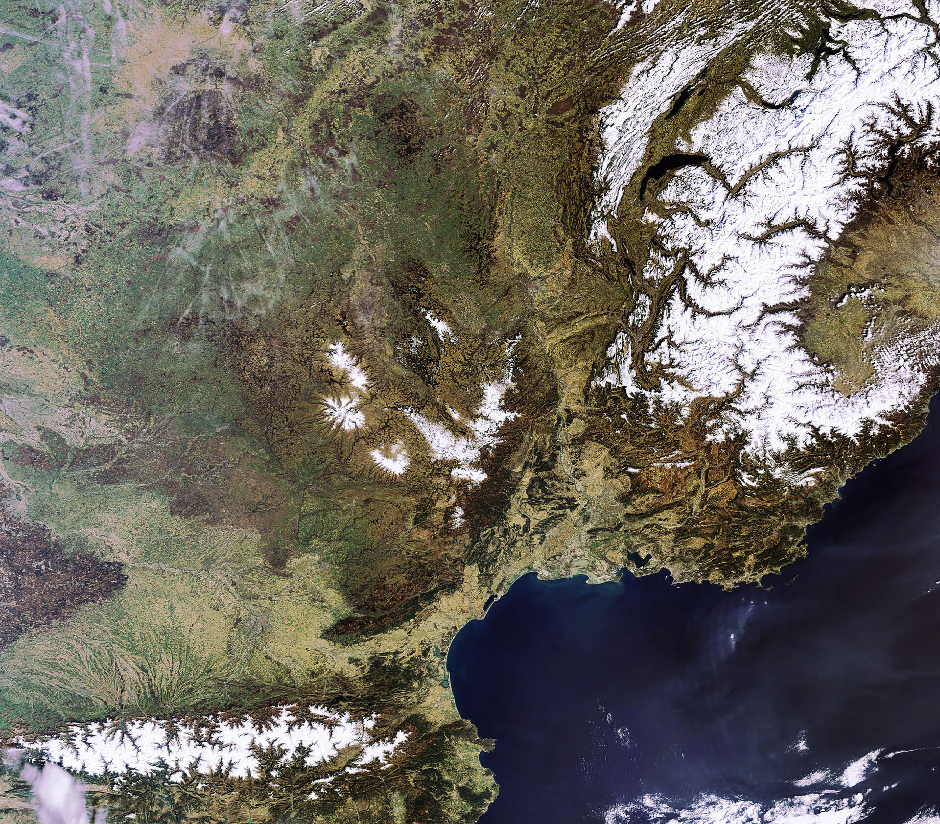
This Envisat image highlights a cloud-free southern Europe, with Spain (lower left), France (centre), Switzerland (upper right) and Italy (lower right) all visible.
Four mountain chains are clearly distinguishable in the image owing to their snow-capped tips – the Alps, Jura, Pyrenees and Massif Central.
The Alps extend some 1200 km through France, Switzerland, Italy and Austria and occupy an area of about 200 000 sq km. The western portion of the mountain range is visible (bottom right) on the border of France and Italy. The Jura Mountains, northwest of the Alps, are also snow covered.
The Pyrenees (bottom left) form the natural border between France and Spain (with the country of Andorra in between). Massif Central (centre, northeast of Pyrenees) is France’s third largest mountain range after the Alps and Pyrenees.
The dark blue crescent-shaped lake located between the Alps and Jura mountains is Lake Geneva. With an area of 581 sq km, it is the largest Alpine lake in Europe. The northern part of the lake, about 347
Lake Neuchâtel (visible above Lake Geneva) is the largest lake located entirely in Switzerland. It is some 38 km long, ranges from 6 km to 8 km wide and has a surface of 218 sq km.
Also visible is the Mediterranean – the world's largest inland sea. The large, irregularly-shaped body of water adjacent to the sea is the Étang de Berre, which was created at the end of the last ice age by rising water levels.
Marseilles, France’s second-largest city, is located on the coast southeast of the Étang de Berre. Other cities visible in the image are Lyon, in the Rhone Valley between the Alps and Massif Central, and Toulouse, the famous French aerospace city, on the Garonne River, between the Massif Central and the Pyrenees.
This image was acquired by Envisat's Medium Resolution Imaging Spectrometer (MERIS) instrument on 16 March 2009, working in Full Resolution mode to provide a spatial resolution of 300 m.

