Envisat celebrates first anniversary in space
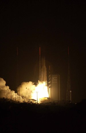
One year ago tonight, the largest and most sophisticated Earth observation satellite ever built blazed a fiery trail into the night skies above French Guiana and became another bright star in the constellation of spacecraft in ESA’s Earth observation programme.
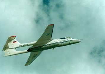
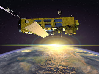
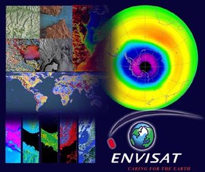
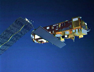
The spacecraft, dubbed Envisat for Environmental satellite, carried with it a suite of 10 advanced sensors designed to provide scientists on the ground with the most comprehensive look ever offered by a remote-sensing satellite of the Earth’s oceans, land, atmosphere and ice caps.
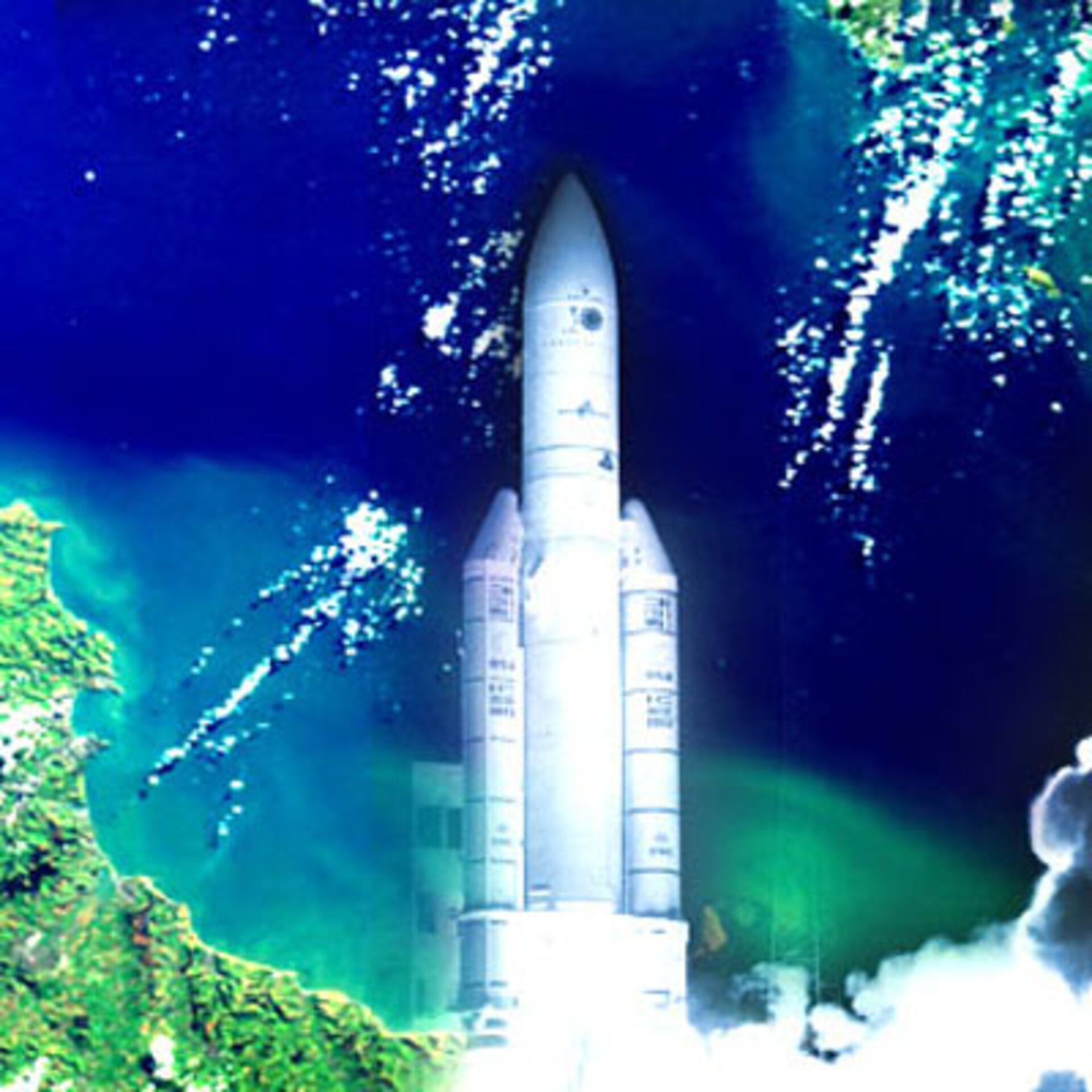
Borne aloft by an Ariane-5 launcher, the picture-perfect launch of Envisat from the Europe's spaceport in Kourou was followed by a flawless insertion into a sun-synchronous polar orbit. Since reaching its final orbital position on 3 April, Envisat has circled the globe approximately 5000 times in an endless circle that allows it to fly over the same area on Earth every 35 days.
All instruments fully operational

Following the successful launch and insertion into orbit of Envisat, the proudest accomplishment of the Envisat team is that all 10 instruments are operating as planned.
This assessment came after a long and complex commissioning phase of the satellite, centred on ensuring that all ten instruments onboard Envisat were working properly. This task was complicated by multiple operating modes for many of the sensors. For example, the imaging radar, ASAR, works in five different modes and 37 different sub-modes.
As part of this process, the instruments also need to be calibrated, with the measurements and other observations recorded by Envisat’s sensors matched against the results from other satellite, airborne and ground-based instruments. Well worth the effort, the calibration work sees to it that the Envisat mission returns the highest quality of reliable, accurate data possible back to researchers on Earth.
These calibration and validation procedures for each of the Envisat instruments occupied the Envisat team and outside researchers brought in to assist for most of last year. Several updates to the onboard instrument software were installed to correct for a few anomalies that were encountered. A calibration review in September confirmed that the satellite and instruments were operating nominally, with stable performances seen from all of them.
The late arrival of Artemis to its proper orbital slot (see related articles) forced Envisat to rely exclusively on the earth station in Kiruna, Sweden. This produced an extremely high workload, and slowed the pre-processing and distribution of Envisat data. To compensate, at least partially, ad hoc transmit and receive equipment was installed in November at another earth station at Svalbard, the Norwegian archipelago close to the North Pole. This improved the performance of the ground segment while the Envisat team has started the testing activities with Artemis that are now underway and expected to be completed this spring.
ESA technicians encountered a related difficulty with Envisat’s Payload Data Segment (PDS), the ground data delivery network for data. Initial performance of the PDS was not reliable enough to maintain the original schedule for delivering data products to the instrument teams involved in the calibration and validation activities. A number of corrective actions were taken, including new releases of the PDS subsystems and new operational procedures, which allowed the gradual opening of the Envisat data services to users during the fourth quarter of last year.
Envisat enters initial operational phase

Once Earth imagery and other data acquired by Envisat’s sensors is transmitted to ground stations, it is still a long way away from being usable by scientists and other researchers studying various aspects of the Earth’s environment. The data still must be turned into either calibrated engineering values, and then into validated geophysical products. This was the task of the calibration/validation teams which, despite the initial ground segment difficulties, received enough data to provide results for the formal instrument and product reviews conducted in September and December.
"This confirmed the enthusiasm of the Earth science community for the initial results of the Envisat instruments," said Prof. José Achache, ESA Director of Earth Observation.
Based on the results of the calibration/validation reviews of Envisat, the commissioning phase of the mission was closed at the end of 2002, and ESA formally authorised the transition of Envisat into the initial operations phase.
Of the more than 800 potential Envisat scientific projects worldwide, 500 can now request ASAR or MERIS products, a significant milestone for two major Envisat instruments. A total of 73 products have been released gradually since September 2002 and made available in a variety of technical “flavours” and distributed via different media such as the Internet, satellite link, CD-ROM, Exabyte data packs, and soon, DVD.
Ten eyes on natural and man-made events

Throughout the past 12 months, Envisat has captured people's imaginations and media headlines all over the world by returning striking images and valuable scientific data of the events, both natural and man-made, that have helped to shape our world. Some of the most notable of these include:
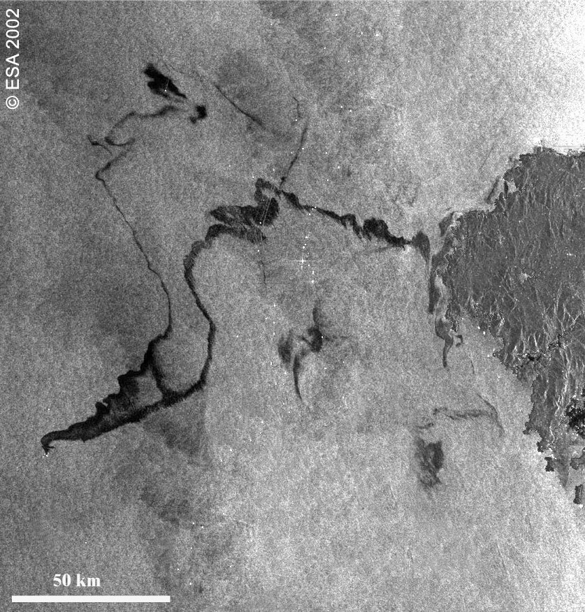
the 150-km-long oil slick from the sinking oil tanker, Prestige, captured by Envisat’s ASAR sensor in November, which vividly captured the extent of the spill off the Spanish coast;
ASAR images of the August floods along the Elbe River valley in Germany, Austria and the Czech Republic, provided to governmental authorities and civil relief agencies under the International Charter on Space and Major Disasters;
the birth of a new iceberg in the Antarctic through a series of images captured by Envisat from May through October;
- spectacular MERIS images showing the October eruptions of Mount Etna in Sicily, and phytoplankton blooms in the oceans near Canada, Norway and Senegal.
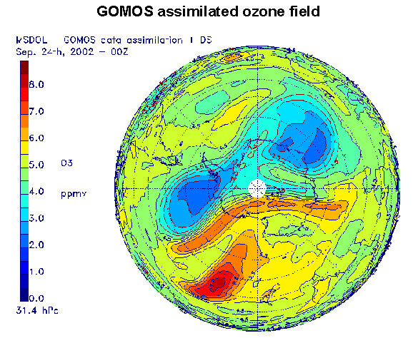
Other imagery and measurements from the spacecraft’s sensors may not have been as visually striking, but were of great interest to the Envisat research community. Not only were the eruptions of Mount Etna, for instance, recorded by the MERIS optical and infrared spectrometer, follow-on analysis of data from the SCIAMACHY instrument showed the levels of sulphur dioxide gases thrown up by the volcano and carried by winds towards Africa and the eastern Mediterranean. In another example, data from Envisat's GOMOS sensor was used in conjunction with data from other ESA satellites to predict accurately the premature breakup of the ozone hole in September, months earlier than normal.
Sensor synergy
The combination of data from various Envisat sensors also is allowing scientists to gain new insights into natural phenomena that were difficult to obtain previously. Data from three Envisat sensors – radar altimeter, microwave radiometer, and the DORIS tracking instrument - have been combined to produce a global chart of the current El Niño that is affecting weather patterns in many parts of the world.
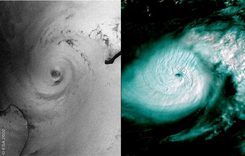
The combination of sensor data also allows scientists a simultaneous look at different parts of events taking place below the satellite. A combined ASAR/MERIS image of Hurricane Isidore that passed through the Gulf of Mexico in September afforded a rare opportunity for researchers to view, literally, the top and bottom of a hurricane for a clearer understanding of the principle dynamics of this type of storm. A similar merged image of a weather front off the Italian coast allowed the clouds patterns observed by the MERIS instrument to be correlated with the front’s structure captured in a simultaneous ASAR radar image.
The synergies among the Envisat sensors and their potential to unlock further secrets of our world have only begun to be explored. As ESA commemorates the first anniversary of Envisat’s launch, however, it is evident that the spacecraft’s suite of sensors offers both exciting research possibilities and practical contributions to solving our most pressing human problems.
Political impact in Johannesburg
The first year of Envisat was also the year of the World Summit on Sustainable Development (WSSD), held in late August and early September in Johannesburg. As the cornerstone of ESA’s Earth observation programme, Envisat played a key role in creating a greater awareness among world leaders that information from space-based sensors is vital to the success of global initiatives for sustainable development.
"There can be no sustainable development without adequate information about the state of the Earth and its environment," ESA’s Achache told WSSD delegates during his plenary address.
After the meeting, the ESA executive noted that WSSD's 54-page Plan of Implementation contains more than 10 specific references to Earth observation, clearly demonstrating that the Summit recognised the importance of space technology for sustainable development.
A look ahead
One year ago, Envisat was launched with the promise of providing the European space programme with another highly capable, advanced space platform. Since then, all Envisat instruments have been verified, some obstacles have been overcome, and the years of effort needed to design, build, launch and, finally, verify normal operations have started to show substantial returns.
Today, the satellite stands at the threshold of a new phase – the routine delivery of Earth observation information. This will give scientists a better understanding of fundamental Earth processes, offer political leaders and other decision-makers another set of tools for addressing critically important social and economic issues, and give us all profound, new insights into the world around us.
That will certainly keep Envisat one of the brightest stars in the European skies for years to come.