Looking at the seas
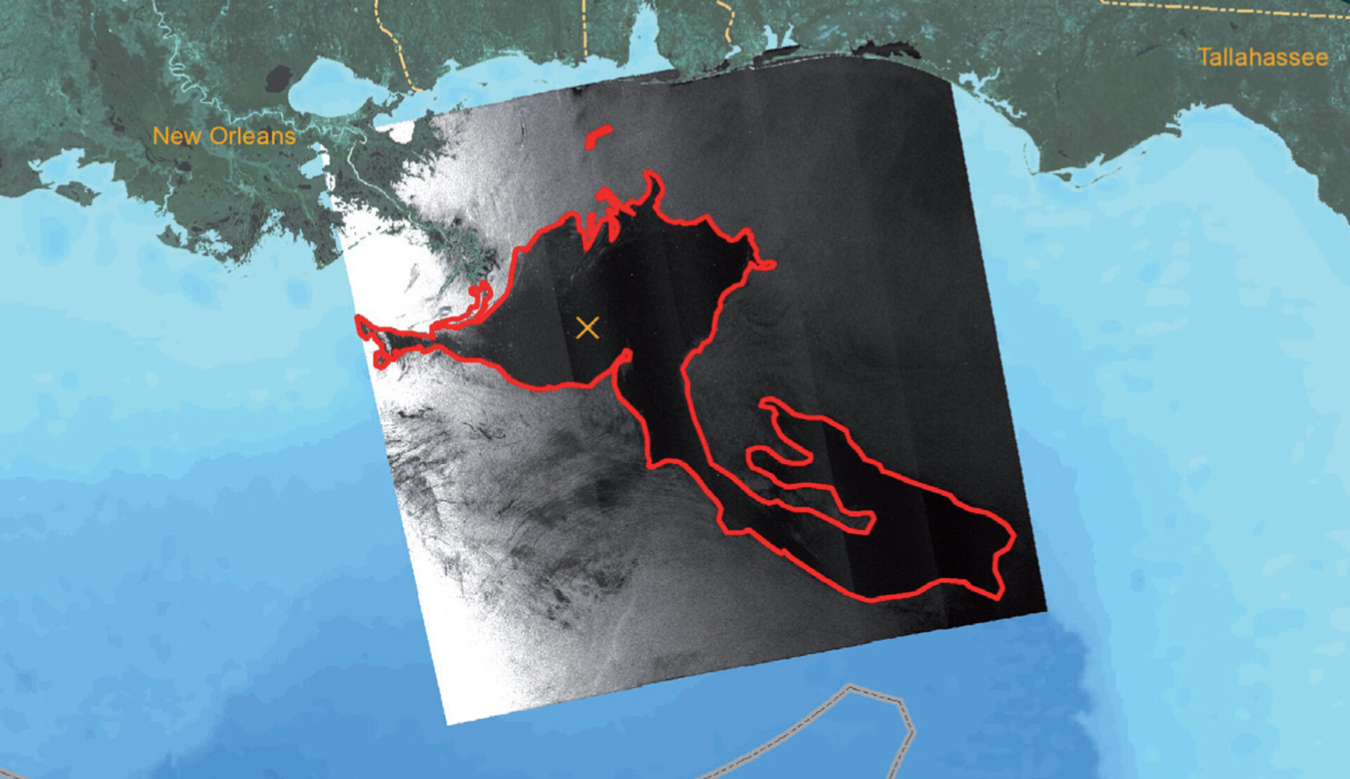
Looking at oil spills in the global ocea
During the 2010 Deepwater Horizion oil spill in the Gulf of Mexico, scientists used Envisat data to monitor the spill as it inched towards the Loop Current – raising concerns that it could reach the current and be carried south towards coral reefs in the Florida Keys. Radar data from ESA’s Envisat and other European and international satellites were transformed into weekly maps showing the location, shape and size of the spill.
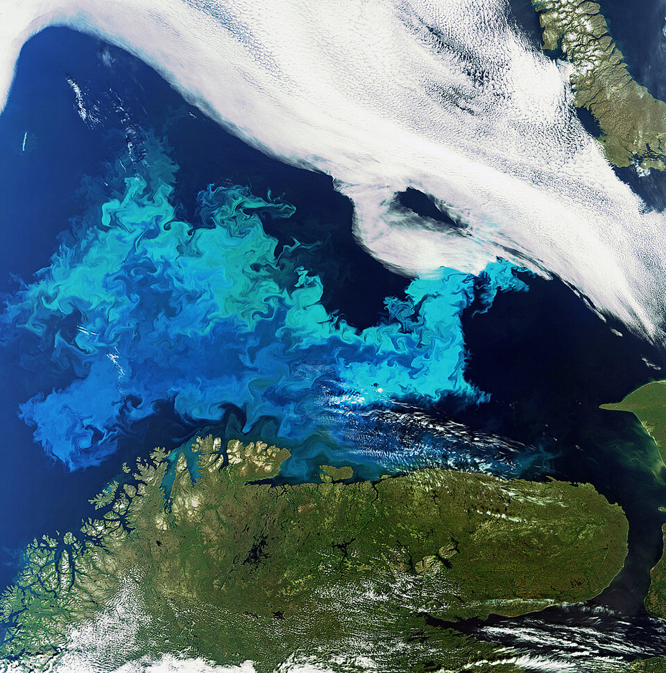
Algal Blooms
Phytoplankton are the base of the marine food chain, and play a huge role in the removal of carbon dioxide from the atmosphere and the production of oxygen in the oceans. By helping to regulate the carbon cycle, phytoplankton are important to the global climate system. Different types and quantities of phytoplankton exhibit different colours. Earth-observing satellites like Envisat can monitor these algal blooms. Once a bloom begins, an ocean colour sensor can make an initial identification of its chlorophyll pigment, and therefore its species and toxicity. Since the phytoplankton are sensitive to environmental changes, it is important to monitor and model them for climate change calculations and to identify potentially harmful blooms.
Waves height and propagation
Waves reaching up to 11 metres devastated France’s Reunion Island in the Indian Ocean when it slammed into the southern port of Saint Pierre in May 2007. Waves then created from the same storm measuring as high as seven metres began crashing into Indonesia coastlines from Sumatra to Bali, killing at least one person and causing some 1200 people to flee their homes. The Advanced Synthetic Aperture Radar (ASAR) aboard Envisat was used to follow these waves in order to refine their propagation paths and determine their arrival times and intensities.
Rising seas in the Arctic
The Beaufort Gyre is a great clockwise ocean circulation in the western Arctic Ocean. Accelerated by strong Arctic winds, the sea surface bulges upwards. Measurements from ESA’s ERS and Envisat missions show that, since 2002, the surface has risen by about 15 cm and the volume of fresh water has swollen by approximately 8000 cubic km – around 10% of all the fresh water in the Arctic Ocean. A change in the direction of the wind would cause the fresh water to spill into the rest of the Arctic Ocean and even reach the north Atlantic. This could slow a key ocean current, stemming from the Gulf Stream, and subsequently cool Europe. This current keeps the continent relatively mild compared to other areas at similar latitudes.