

Protecting the heart of Borneo
In Southeast Asia, the island of Borneo is home to one of the world’s most diverse rainforests, but its natural resources are under threat. Information from satellites is being used to evaluate the impact of the island’s future development.
The mountainous island is the third largest in the world. It is an area of exceptional biological diversity and its natural resources have tremendous social and economic value at local, national and global levels.
While still of great importance, these resources have diminished in recent years due to logging, plantation development, mining and forest fires.
“The ecosystems in the heart of Borneo provide many local, regional and global services and benefits,” said Anna van Paddenburg, Sustainable Financing and Policy Strategy Leader for the World Wildlife Fund (WWF) Indonesia.
“The mountainous forests form the headwaters of most of Borneo’s 20 major rivers, providing water for agriculture, human consumption, and industry.
“The forests provide timber and non-timber forest products, and store huge amounts of carbon.
“The diverse ecosystems support endemic plants and animals, which supports eco-tourism and pharmaceutical research.”
While it is widely recognised that healthy ecosystems provide services that play a critical role in maintaining individual and societal welfare, the benefits that flow from them are not always accounted for in government and private sector decision-making.
In an effort to protect the environment and develop the area in a sustainable way, the Heart of Borneo conservation agreement was initiated by WWF and signed by the governments of Indonesia, Malaysia and Brunei in 2007.
In December 2010, WWF initiated an assessment of Borneo’s natural capital to quantify and understand the value of ecosystem services and benefits.
ESA provided technical assistance through Hatfield Consultants, a Canadian environmental and geomatics consulting company that has been working in Indonesia for 20 years, and NEO BV, a value-adding data provider.
The consortium closely collaborated with WWF and scientists from the Natural Capital Project and the consulting agency Witteveen+Bos.
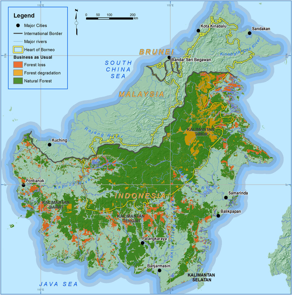
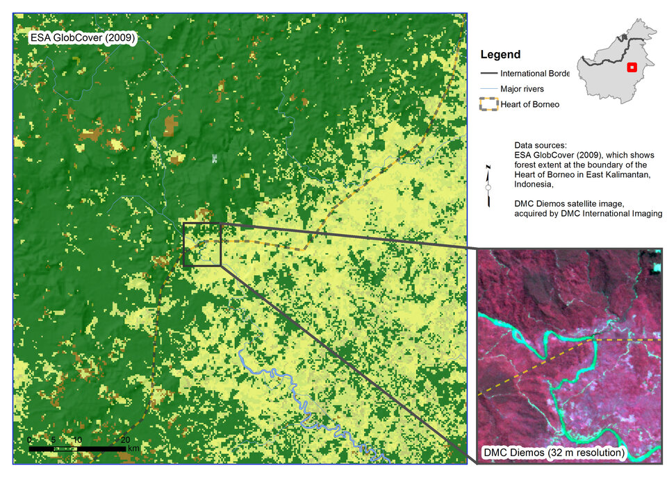
Satellite data from different ESA projects were used to build development scenarios. Among the sources were global land cover data, which show changes in land use in Borneo.
Plans and permits for plantation, forestry and mining were used along with historical trends in land use to map contrasting Business-as-Usual and Green Economy scenarios.
The Business-as-Usual scenario for forest cover projects a loss of 3.2 million hectares of primary and secondary forest cover on the island between 2009 and 2020. This is primarily due to palm oil expansion, mining and unsustainable forestry practices.
Implementing the Green Economy projection would reduce the loss of forest cover to an estimated 0.1 million hectares.
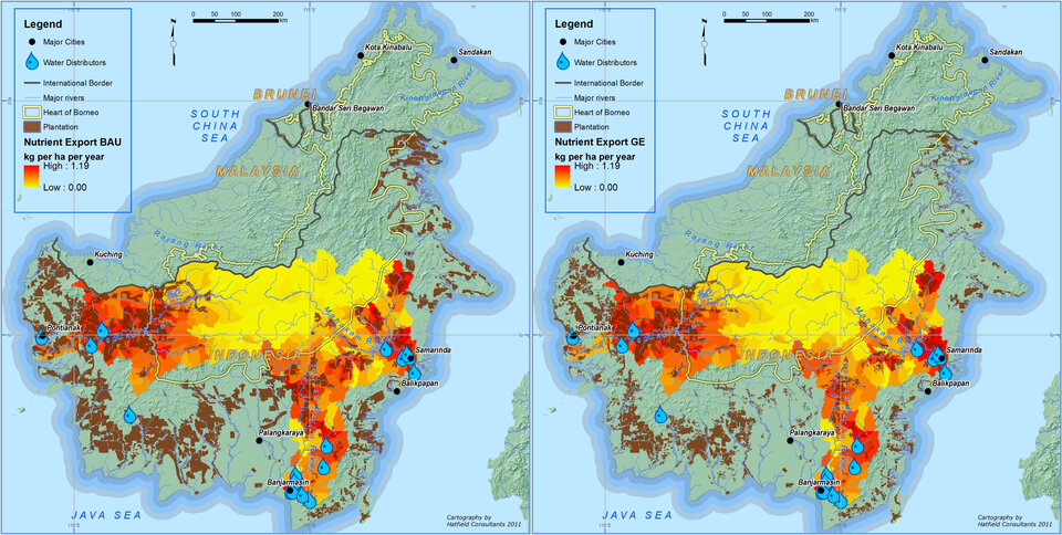
The scenarios were derived from the assessment of gains or losses of ecosystem services using the Integrated Valuation of Ecosystem System Services and Tradeoffs (InVEST) models, which were developed by Natural Capital Project.
InVEST models include water yield, water purification, sediment retention, carbon sequestration, habitat quality and biodiversity.
The team used several InVEST models, for example to demonstrate that central Borneo provides water to 70% of the island’s population.
InVEST models were also used to demonstrate how water quality is affected by large-scale palm oil development, since there is increased nitrogen export due to extensive fertiliser use.
