
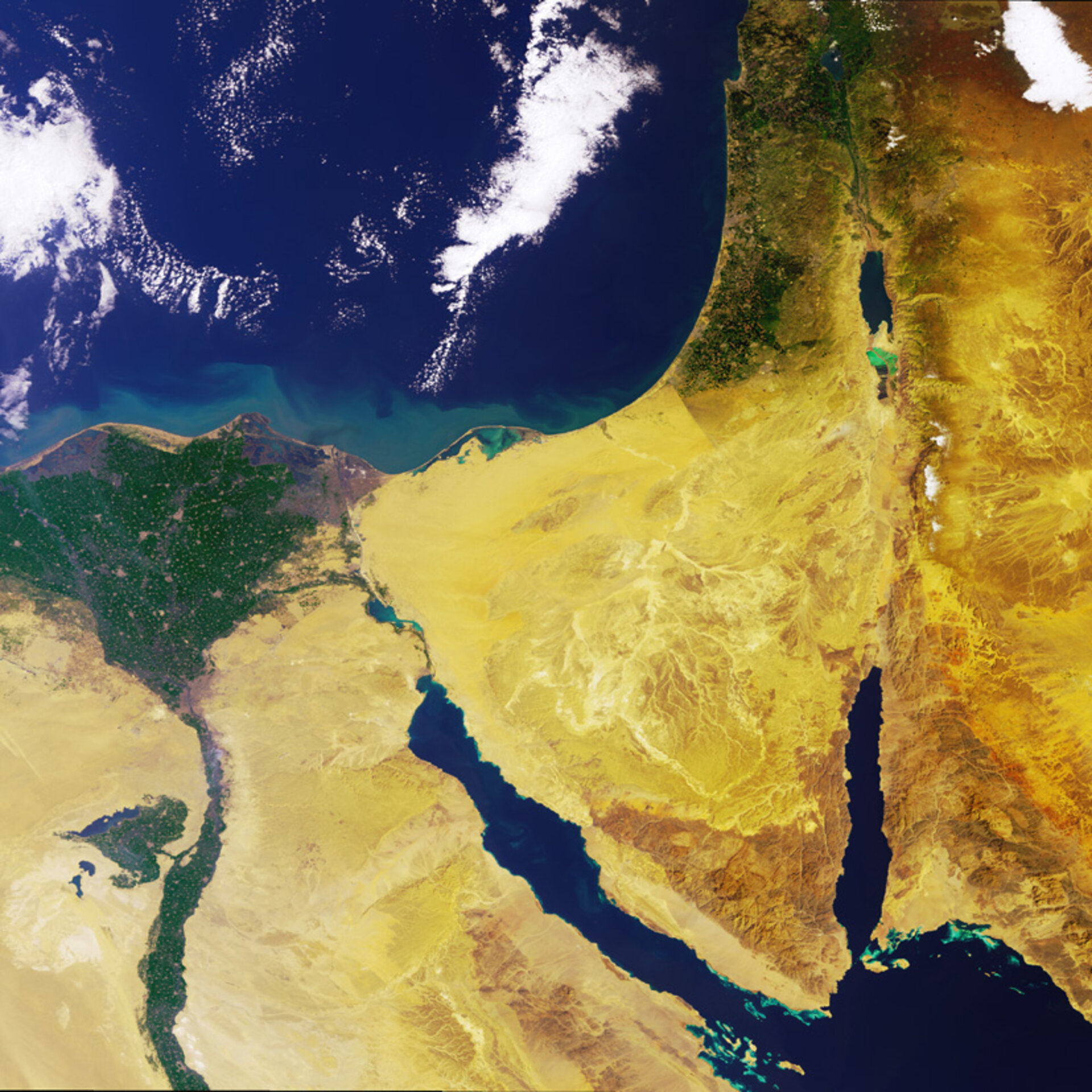
The Nile Delta and the Sinai Peninsula
The fertile green territory of Egypt's Nile Delta provides a notable contrast to the bare desert of the Sinai Peninsula in this Envisat view.
Only 2.5% of Egypt's land area is suitable for agriculture, corresponding to the Nile Valley and Delta. These low-lying floodplains are some of the oldest intensively cultivated areas on Earth, supporting up to 1600 inhabitants per square kilometre.
The triangular shape of the Delta comes from the divergence of the branches of the Rosetta and Damietta branches of the Nile. The branches split at the base of the Delta and are separated by around 140 kilometres by the time they reach the Mediterranean coast 160 km north.
In 969 AD the city of Cairo was founded as a military camp at this strategic point of divergence, on the eastern side of the Nile. Its name was originally Al-Qahira, meaning 'the victorious'. By the 13th century it was one of the world's largest urban settlements, although its relative ranking declined in later centuries.
Today Cairo is a sprawling metropolitan settlement of 15 million inhabitants. It is the largest city in Africa and the thirteenth largest city in the world. It extends across the western side of the Nile. Against the green of the Delta it appears brown-grey in colour.
The city of Port Said is also visible to the northeast of Cairo, on the Mediterranean coast beside the Suez Canal. With half a million inhabitants, it is an important location for industry, trade and fishing.
Bounded by the Gulf of Suez to its west and a geological fault zone extending from Africa's Great Rift Valley along the Gulf of Aqaba to its east, the arid Sinai Peninsula is almost entirely uninhabited except for some coastal settlements.
Much contested throughout the 20th Century, the majority of the Peninsula is today under Egyptian rule. Egypt's border with Israel is visible in the image, with the Egyptian side appearing lighter south from the Mediterranean. This is apparently due to higher grazing pressure on the Egyptian side.
This 14 February 2005 image was acquired by Envisat's Medium Resolution Imaging Spectrometer (MERIS), working in Full Resolution Mode with a spatial resolution of 300 metres and width of 670 km.
Envisat's radar view
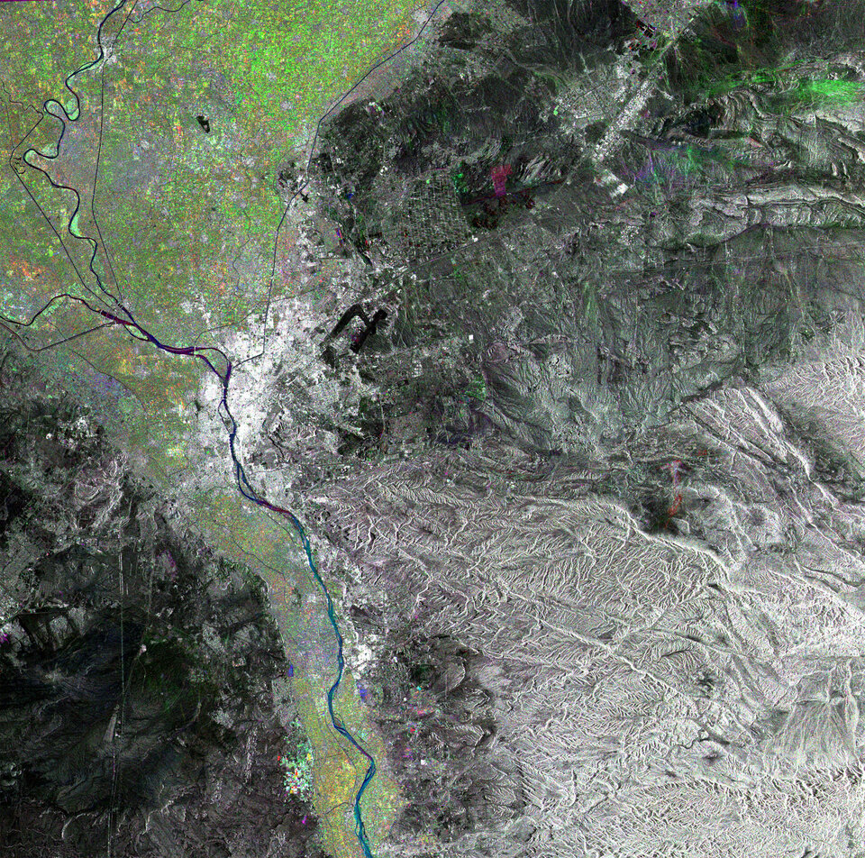
For an alternative Envisat view of the Nile Delta, check this Advanced Synthetic Aperture Radar (ASAR) multi-temporal composite. Radar picks out Cairo's urban expanse brightly.
Radar measures surface roughness rather than reflected light. The colour in the image comes form the fact that this is actually a combination of three ASAR Wide Swath Mode precision images. A colour is assigned to each date of acquisition to highlight changes occurring between them: red for 7 June 2004, green for 20 November 2004 and blue for 8 April 2004, with pixel sampling of 12.5 metres.

