Sentinels
Copernicus programme mission operations
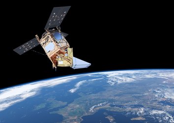
ESA is developing a new family of missions called the Sentinels specifically for the operational needs of the Copernicus programme. Each Sentinel mission is based on a constellation of two satellites to fulfil revisit and coverage requirements, providing robust datasets for Copernicus Services. These missions carry a range of technologies, such as radar and multi-spectral imaging instruments for land, ocean and atmospheric monitoring.

- Sentinel-1 is a polar-orbiting, all-weather, day-and-night radar imaging mission for land and ocean services
- Sentinel-2 is a polar-orbiting, multispectral high-resolution imaging mission for land monitoring to provide, for example, imagery of vegetation, soil and water cover, inland waterways and coastal areas
- Sentinel-3 is a multi-instrument mission to measure sea-surface topography, sea- and land-surface temperature, ocean colour and land colour with high-end accuracy and reliability
- Sentinel-4 is a payload devoted to atmospheric monitoring that will be embarked upon a Meteosat Third Generation-Sounder (MTG-S) satellite in geostationary orbit
- Sentinel-5 is a payload that will monitor the atmosphere from polar orbit aboard a MetOp Second Generation satellite
- Sentinel-5P (for precursor) is a missions being developed to reduce data gaps between Envisat, in particular the Sciamachy instrument, and the launch of Sentinel-5
- Sentinel-6 carries a radar altimeter to measure global sea-surface height, primarily for operational oceanography and for climate studies