

Making way for autonomous ships
As our local waterways are becoming increasingly filled with more and bigger ships, it makes navigating them a challenge at the best of times. The size and capacity of most ports has not increased accordingly, which has led to a rise in marine accidents both in terms of number and cost as a consequence of the expansion in maritime traffic. Some of these incidences could have been prevented by adequate decision making supported by accurate and timely navigation information.
Most errors occur in the busy waters around ports where critical manoeuvres are carried out. For this reason, human pilotage is often required in harbours. Although pilots have extensive knowledge of the local waterways and they are generally expert ship-handlers, the sheer amount of traffic they have to handle on a daily basis, combined with an increasing number of often unforeseen circumstances, can lead to extra pressure and sometimes poor decision making.
A new activity under ESA's GSP (General Studies Programme) framework called "Using GNSS and Big Data Techniques to improve safety in critical maritime operations" has been launched to address the safety issues in maritime and riverine traffic. Detailed information of a vessel's position and foreseen path are key to ensuring safe passage through local waterways. This requires extensive knowledge from the pilot's perspective and an exchange of information between all vessels in the same area.
The objective of the activity is, therefore, to come up with a set of reliable, safe paths to be used by all vessels approaching or leaving to specified ports. There is already a wealth on available AIS (Automated (vessel) Identification System) and GNSS (Global Navigation Satellite Systems) data to support this project. By combining the knowledge of the maritime community and ship manufacturers with GNSS and AIS data, it will be possible to identify certified paths that can then be put to the test.
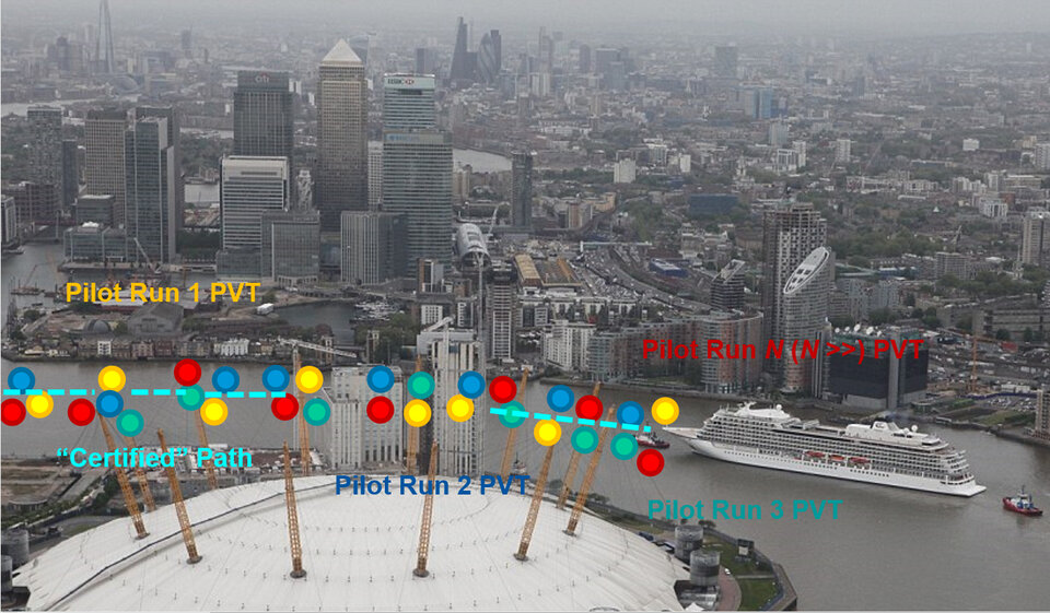
The system will be put through its paces by feeding a certified path into the ship's navigation system. More in detail, the certified path is obtained by previous observations of the paths followed by similar vessels under the same environmental conditions (such as sea-state, weather conditions, and tide levels).
The certified path can be then displayed on the vessel's EDCIS (Electronic Chart Display and Information System) and support the pilot in the execution of an identical operation (e.g. docking or port approach). Together with vessel tracking information, the certified path can also be used by traffic surveillance operators for conformance monitoring purposes. For all these reasons, this concept is expected to ultimately lead to (semi-) autonomous systems that will significantly reduce the pilots' workload and will enhance the safety of critical maritime and riverine operations.
The study will also focus on creating a new roadmap for future European satellite navigation and communication systems, which will include the possibility of two-way communication between vessels and with the port or the local waterways authorities.