Space technology for life on Earth
The abundance of data that satellites collect about our planet can help solve a myriad of problems on Earth. For example, remote sensing technology can be used to detect environmental changes, satellite communication can assist with remote services and natural disaster management, and human spaceflight has advanced our understanding of medicine.
The Discovery element of ESA’s Basic Activities has supported many investigations into how space technology can be applied to Earth-based challenges. This article focuses on three such applications – forecasting natural disasters, monitoring plastic marine litter, and enabling autonomous shipping.
Forecasting natural disasters
According to Our World in Data, each year natural disasters kill an average of 45 000 people worldwide. They impact the quality of life of many more people, and cost billions in economic damage. And worryingly, the impacts of disasters may become worse due to growing urbanisation and increasing numbers of extreme weather events.
Timely forecasting of natural disasters could help save lives and reduce the impact on the economy. In the past, it has been difficult to predict such disasters, but satellites are able to provide new information to make it much easier to act in a quick and coordinated manner.
To achieve this, ESA Discovery has supported studies that explore how exactly we can predict natural disasters using satellite data.
One of the first studies ran under a working group consisting of representatives of space agencies around the world, set up by ESA to research global disaster hotspots. The long-term vision of this group is for space agencies to coordinate their resources so that Earth observation data can be used to forecast all types of natural disasters. The study investigated which space technologies should be developed to achieve this.
Following this investigation, another study explored how Earth observation data could be combined with advancements in computing technologies to improve natural disaster forecasting. The ideas proposed within the study focused on cloud-based infrastructure, particularly the semi-automatic processing of large amounts of data.
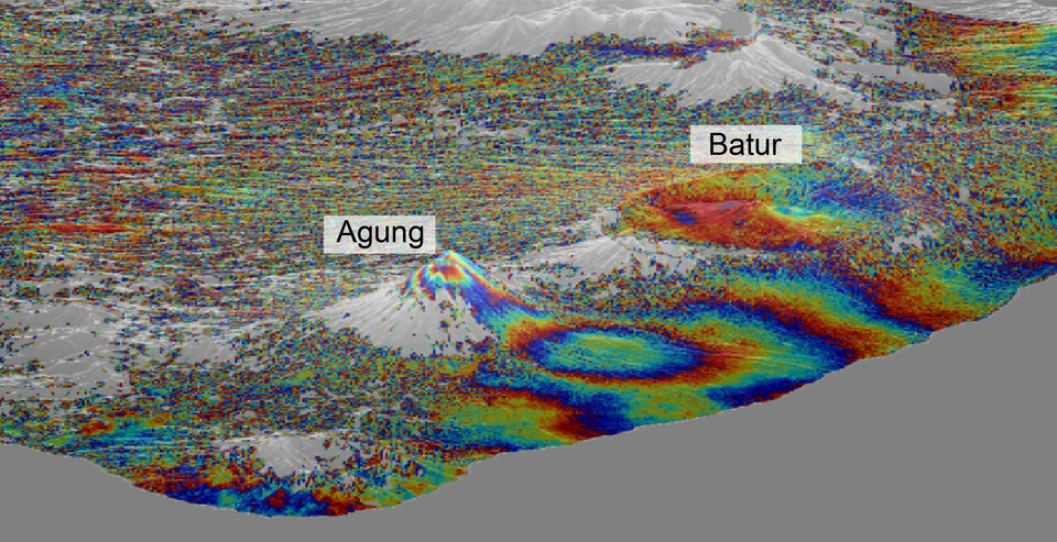
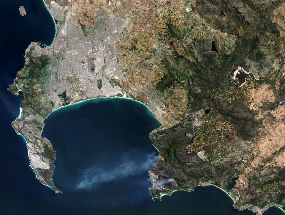
More specific studies looked into how existing satellite data could be used to analyse drought in southern Africa and to study tectonic processes in Indonesia. Indonesia often experiences volcanic eruptions and earthquakes. In the case of one volcano – Mount Marapi – a large-scale eruption that could potentially put 1.1 million people at risk is long overdue, highlighting the need for natural disaster forecasting. By combining SAR interferometry – a technique based on radar – with global navigation systems, space technology can be used to monitor ground movement over time.
As well as helping to forecast disasters, satellites can also support response efforts. One Discovery study proposed a constellation of satellites that combine Earth observation and satellite communications to provide responsive real-time service when a disaster occurs. Another brought together public and private capabilities to agree on consensus mechanisms to reduce confusion and augment trust in key decision-making information around natural disasters.
Monitoring marine litter
Approximately 13 million tonnes of plastic finds its way into the ocean every single year. Most of this sinks to the sea floor, but some remains floating on the surface. From there, it can wash up on coastlines, affecting not just wildlife but also coastal communities, tourism and the food chain.
Monitoring this plastic can be very difficult from Earth’s surface, as it is impossible to see much of the surface at once. But remote sensing, including satellite remote sensing, could change our ability to monitor plastic waste, and Discovery & Preparation is supporting studies that investigate the best way of doing so.
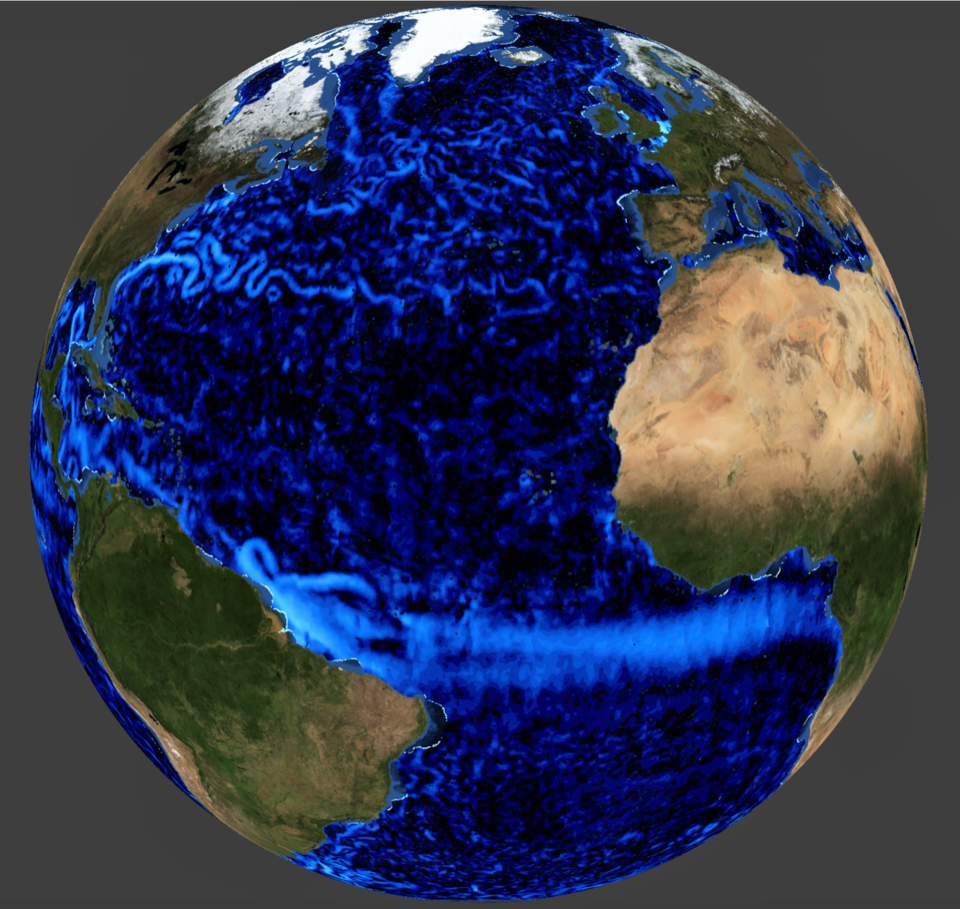
Measurements from space are already used indirectly to get to grips with the problem of marine litter, for example maps of ocean currents can inform us where plastic is likely to move to, so we can work out approximate large-scale plastic concentrations around the world, such as the Great Pacific Garbage Patch.

But there is room to go much further. In 2019 ESA’s Discovery programme launched a call for ideas through the Open Space Innovation Platform (OSIP) that resulted in a large number of innovative ideas to use remote sensing to detect and monitor marine litter pollution.
The activities that were funded following this call for ideas explored how remote sensing, in particular with satellites, could help us detect and monitor marine plastic. The full list can be found here. All elements that feed into this complex problem were analysed, ranging from monitoring platforms (aircraft, drones, satellites) to specific sensors, through simulations to forecast the movement of litter through the ocean.
The activities laid the groundwork for a thriving community that advances European capability in this novel field of research, showing what can be done with current technologies in different observational scenarios and what needs to be done to go even further.
To help primary school students get to grips with how satellites can help detect and reduce plastic pollution in the ocean, ESA Discovery produced an animation that follows three pieces of plastic left on the beach.


Access the video
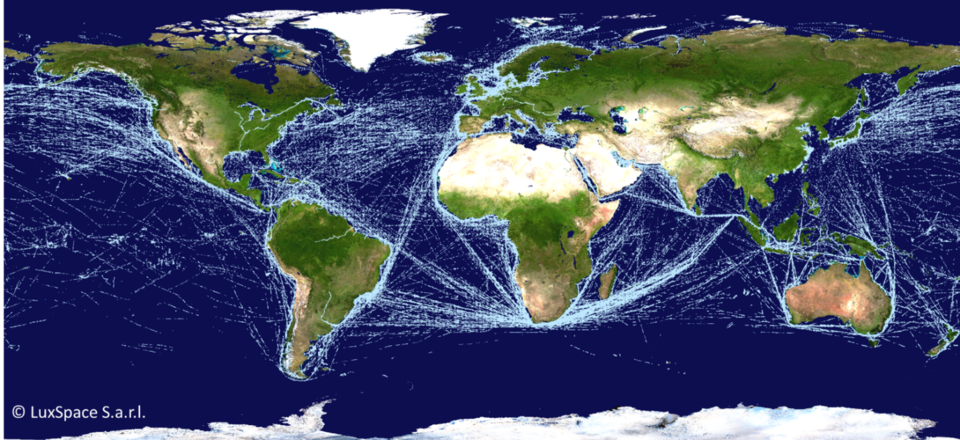
Enabling autonomous shipping
Just as driverless cars could be the future of the automotive industry, captain-less ships could be the future of the shipping industry. Autonomous shipping has the potential to significantly lower costs, increase safety, solve anticipated crew shortages, and improve working conditions.
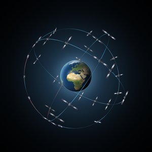
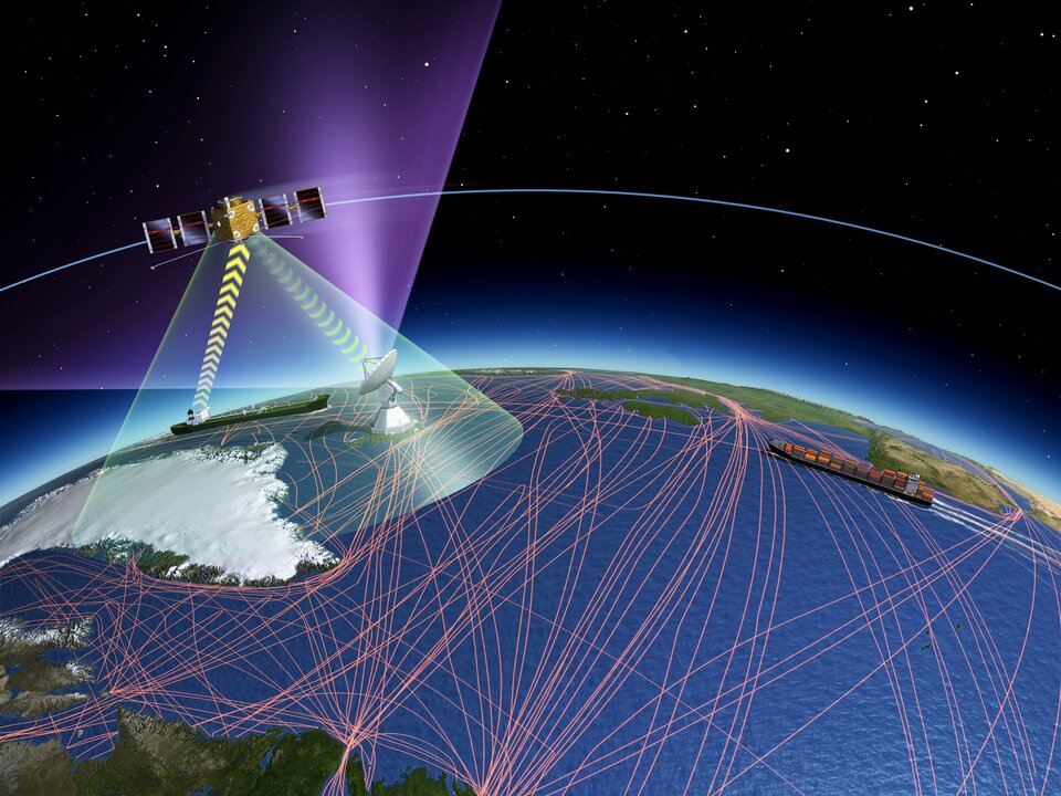
But autonomous shipping relies on an accurate and continuously available navigation system. Discovery has supported studies into how to enhance existing satellite navigation systems to enable autonomous shipping, for example by combining them with land-based systems to improve positioning accuracy.
One of the most difficult times for the captain of a ship is entering or leaving a harbour. A Discovery study evaluated the feasibility of creating a system that would monitor all ships in the harbour to avoid collisions. The system would make use of ESA’s Galileo and EGNOS systems to calculate new routes for ships. A similar study focused on the development of a Maritime Adaptive GNSS Safety Concept to support mariners, especially within the vicinity of ports. Ships worldwide use satellites to navigate; one discovery study explored the impact of space weather on navigation in the Arctic.
The International Maritime Organization runs an anti-collision system for ships which uses data from ground-based sensors. Another ESA-supported study looked into how satellite data could be included in the system to fill gaps in the terrestrial data and ensure worldwide coverage.
An OSIP call for ideas launched in 2019 sought solutions to enable harbour to harbour autonomous shipping. Five ideas were selected for further research, including one project investigating autonomous shipping in sea ice conditions, one looking into enhancing a vessel’s awareness of its surroundings, one combining Earth observation and navigation data to improve navigation safety assessment, and one developing a secure communication link between an autonomous ship and a space navigation system.