
World Refugee Day: ESA helps displaced people to rebuild their lives at home and abroad
Humans are on the move more than ever before. While international travel and work-related migration due to globalisation have increased the voluntary movement of people, millions are compelled to leave their homelands each year to escape war and persecution. Every minute, about 20 people are forcibly displaced for various reasons, entitling many of them to refugee status in host countries under international law.

World Refugee Day is commemorated on 20 June each year to promote awareness and action on their behalf. Refugees’ rights to protection are enshrined in the 1951 Refugee Convention. This document defines a refugee as someone who has fled his or her home and country due to “a well-founded fear of persecution because of his/her race, religion, nationality, membership in a particular social group, or political opinion.” In 2017, there were an unprecedented 70 million forcibly displaced people worldwide, of whom about 25.4 million were refugees, according to the United Nations (UN).
Like the UN, ESA recognises that large-scale human population movements are not always caused by war and persecution, but also by natural disasters, famine or inadequate living conditions. These push factors may reflect or result in a lack of essential infrastructure, poor sanitation, weak educational standards and other development-related issues. By making its satellite data and space applications accessible to government bodies, international organisations and development banks, ESA provides tools to help alleviate the root causes of involuntary migration.

ESA’s online database of projects that contribute to achieving the UN’s 17 Sustainable Development Goals (SDGs) provides a wealth of information. Many projects that support refugees are related to poverty (SDG1), clean water (SDG 6) and telecommunications infrastructure (SDG9), as well as electronic health and education services (SDGs 3/4) which can be useful in refugee camps or on migration routes. Through the Agency’s satellite imagery of large areas, some projects can even help identify the routes themselves.
One Class! is an ongoing project that uses satellite communications to provide an open education network for unaccompanied minors accommodated in immigrant centres in Europe. The pilot e-learning programme enabled children in Sicily to receive social integration services, while being taught via daily videoconferences with their corresponding classes in selected African schools. Supported by ESA, the project aims to bring education to immigrant children, even in emergency situations and makeshift centres, while fostering social inclusion in their host countries.

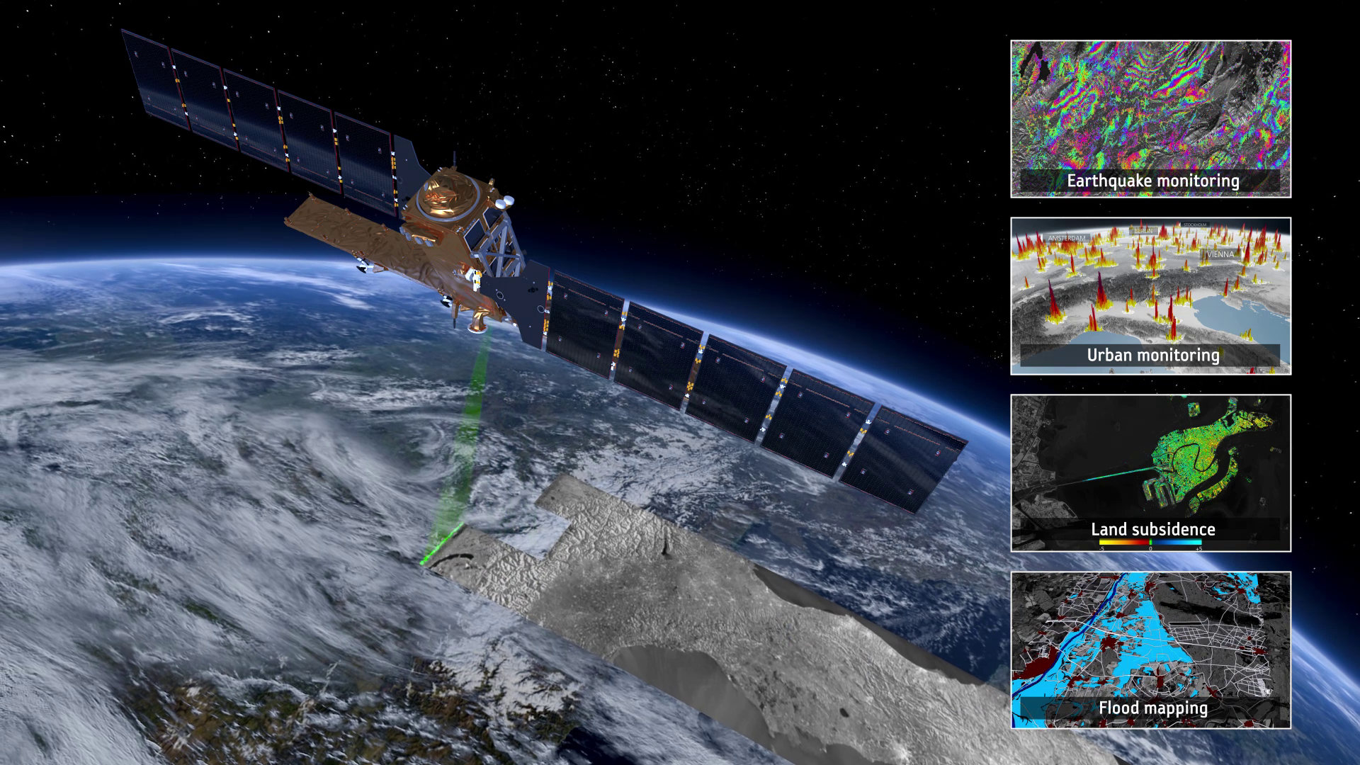
ESA is also involved in projects that harness Earth observation data to monitor disaster areas and migration routes. This year, the Agency looked into big data for migration to help mitigate the causes of forced migration and provide an early warning system to humanitarian and civil organisations preparing for the onset of migrant flows. Data from the Copernicus Sentinel-1 and Sentinel-2 satellites can help assess border areas and conflict zones, providing information on migration hotspots and crossing points. One part of the study explored tracking the movement of people through their mobile phone and social media data using satellite navigation systems.
Information from the Copernicus Sentinel satellites and ESA's SMOS mission can also identify migration push factors linked to environmental conditions, such as vegetation, crops and water levels. Furthermore, satellite imagery is vital for monitoring Himalayan ice fields that contain the largest reservoir of freshwater outside the polar regions and provide water to more than 1.3 billion people in Asia.
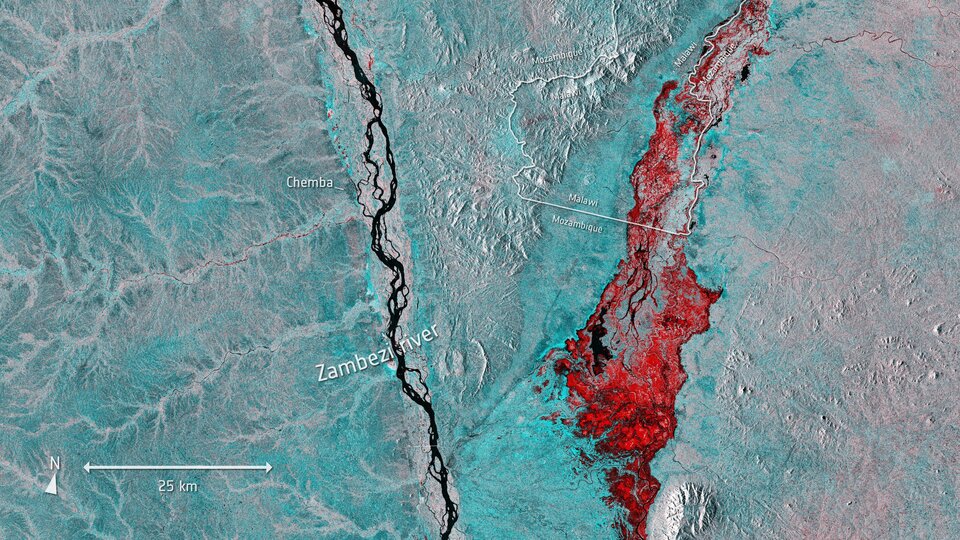
Satellite imagery recently played a key role in managing relief for specific disasters. Last year, it provided evidence of major flood risk on an island that the Bangladeshi government had proposed as a relocation site for thousands of Rohingya refugees from Myanmar. Then in Mozambique this year, Copernicus Sentinel-1 data was used by the Copernicus Emergency Management Service to track flooding after Cyclone Idai – one of the worst storms in the region’s history – caused a major humanitarian crisis.
ESA also supports SmartCare, a collaborative healthcare platform that is especially useful to people living in remote areas. SmartCare enables home-care patients to access rehabilitation services without on-site medical staff through a virtual workspace that involves a physician, a caregiver and the patient. Initially tested in Italy, the service can be deployed anywhere in the world and is provided by satellite and terrestrial telecommunications networks. In the future, it could prove vital for refugees unable to access more traditional healthcare.
Using space applications and satellite imagery to help achieve the SDGs can address the causes of forced migration. ESA contributes to providing people with sound living conditions, an adequate education and easy access to healthcare to help citizens live without civil strife and persecution.