
|
Erstellen Sie einen Katastrophenschutzplan! 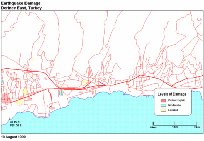 Earthquake damage, 18 August 1999. Derince East, Turkey . Aufnahmen 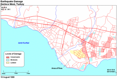 Earthquake damage, 18 August 1999. Derince West, Turkey . Technische Informationen zu den Satellitenbildern  Image with radar interferometric fringes. Each colour cycle corresponds to 28 mm of surface movement towards the satellite (23 degrees to the vertical). Assuming a tectonic movement in the east-west direction and the satellite heading south, calculate the horizontal component of the movement. |