
|
Oefening 1: Spiraalvorming van orkaan Katrina van de wolkentoppen tot de oceaangolven 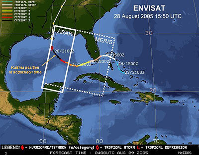 Chart showing acquisition locations for Envisat's MERIS and ASAR images. The MERIS image covers approximately 1200 by 1200 km, while the ASAR Wide Swath mode image covers approximately 415 by 1200 km. |