ESAEducationHomeMeteorologia e ClimaMudança GlobalDesastres Naturais
   
Cheias
Cheias repentinas em Tessalónica
Furacões
Ondas de tempestadeFuracão Katrina
Terramotos
IntroduçãoTerramoto de Izmit
Vulcões
IntroduçãoCadeia vulcânica dos AndesEtnaNyiragongo e Nyamuragira


Article Images
Exercício 1: Explorar o vulcão - Continuação


Download:
 HI-RES JPEG (Size: 833 kb)
The 4-5-3 combination with two IR bands highlights details not seen with previous combinations. Vegetation types can be distinguished and are displayed in shades of orange/brown/green, urban areas in shades of light purple, water is dark and can be delineated from land very well, and the volcanic plume disappears.

Credits: USGS
 
 
Download:
 HI-RES JPEG (Size: 841 kb)
The 7-4-2 FCC band provides a natural appearance: healthy vegetation is bright green, grassland is green, soils have multiple colours, bare soil is pink and sparse vegetation is orange. Fires would appear red.

Credits: USGS


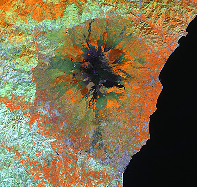
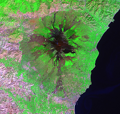
EtnaIntrodução
Detecção de alterações e avaliação de riscos
Exercício 1: Explorar o vulcãoExercício 2 : Interpretação visual através de fotografias terrestresExercício 3: Detecção de lava: imagens e mapas de criseExercício 4: Avaliação de riscos: O GIS consegue ajudar!
Eduspace - Download
Etna_Landsat_GIS.zip
Eduspace - Software
LEOWorks 3LEOWorks 3 Tutorial


   Copyright 2000 - 2014 © European Space Agency. All rights reserved.